Kleiner Leppleskofel
lys
Vandring
Navigere
Navigere
Få denne turen på mobiltelefonen din
Kart
Kleiner Leppleskofel
lys
Vandring
2,28 km
Skann QR-koden og start navigasjonen i bergfex -appen
QR Code
Vandring og sporing
Vandring og sporing

Kleiner Leppleskofel

Avstand
2,28 km
Varighet
00:34 h
Oppstigning
96 hm
Havnivå
2 367 - 2 474 m
Nedlasting av spor
Kart
Kleiner Leppleskofel
lys
Vandring
2,28 km

Take the 6-seater gondola lift from the valley floor to the Brunnalm middle station (2055 m). Change there to the second section of the 3-seater chairlift, the Mooserberglift. This lift takes us across...


Beskrivelse av

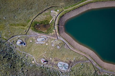
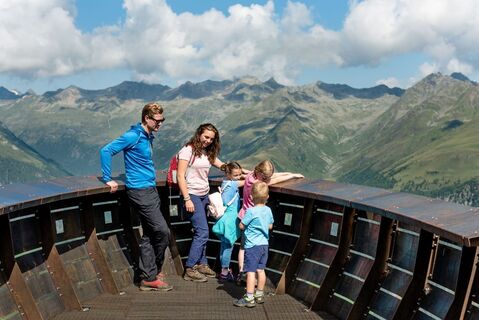
Take the 6-seater gondola lift from the valley floor to the Brunnalm middle station (2055 m). Change there to the second section of the 3-seater chairlift, the Mooserberglift. This lift takes us across the alpine region north of the Weißspitzgruppe to the mountain station near Ochsenlacke (2363 m). Now the hike begins. Via a well-marked path, past a few benches, to the east, you reach the Steinmandl on the summit after approx. 25 minutes on foot. Beautiful view of around 30 "three-thousand metre peaks" and a wide view of the valley. The circular hike continues to the Leppetallenke and the marked hiking trail back to the Ochsenlacke.

Rute
Kleiner Leppleskofel
(2 469 m)
Toppmøte
0,5 km
Cinni (Wasseramsel)
(2 382 m)
Lekeplass
1,7 km
Uro (Bergmolch)
(2 376 m)
Lekeplass
1,7 km
Rute
Kleiner Leppleskofel
(2 469 m)
Toppmøte
0,5 km
Salmo (Bachforelle)
(2 375 m)
Lekeplass
1,7 km
Cinni (Wasseramsel)
(2 382 m)
Lekeplass
1,7 km
Anura (Frosch)
(2 378 m)
Lekeplass
1,7 km
Uro (Bergmolch)
(2 376 m)
Lekeplass
1,7 km
Udo (Libelle)
(2 382 m)
Lekeplass
1,7 km
Beskrivelse av
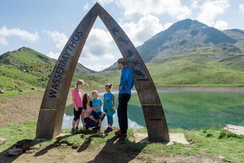
Family-friendly summit tour – discover the magic of the mountains
Teknologi
1 / 6
Tilstand
1 / 6
Landskap
n.a.
Erfaring
n.a.
Beste tid på året
Jan
Feb
Mar
Apr
Mai
Jun
Jul
Aug
Sep
Okt
Nov
Des
Forfatter
Levert av TVB Osttirol
Logo
Del tur
Kart
Kleiner Leppleskofel
lys
Vandring
2,28 km
Feil
Det har oppstått en feil. Vennligst prøv på nytt.
Ingen anmeldelser ennå
Skriv en anmeldelse

Anmeldelser hjelper andre brukere med å velge sitt neste eventyr. Vennligst gi kun vurdering av turen, ikke været eller snacksen din.

Velg en av stjernene for å rangere turen
Dårlig tur
Svak tur
Middelmådig tur
God tur
Utmerket tur
bergfex logo Få innsikten Alltid live på stedet med over 9 500 webkameraer. bergfex Som Pro-bruker kan du nå se de tilhørende webkameraene for mange turer i turappen fra. Dette gjør at du kan se de aktuelle forholdene direkte.
Vandring og sporing

Vandring og sporing

Vandring og sporing
Over 550.000 turforslag, detaljerte kart og en intuitiv ruteplanlegger gjør appen til et must for alle naturentusiaster.
Vandring og sporing