


Bilder av brukerne våre
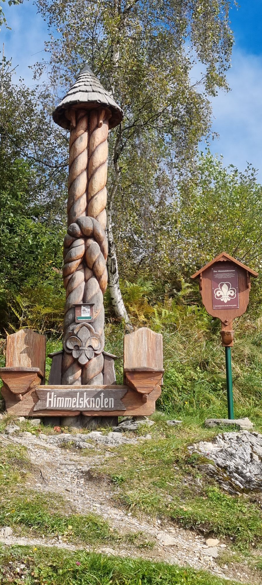
You reach the starting point of this route by cycling from the center of Großarl along the valley bike path towards St. Johann (approx. 3.7 km) and then turning left towards Himmelsknoten. The "Himmelsknoten"...
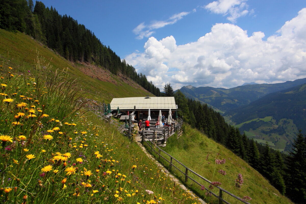
You reach the starting point of this route by cycling from the center of Großarl along the valley bike path towards St. Johann (approx. 3.7 km) and then turning left towards Himmelsknoten. The "Himmelsknoten" is a monument from the old scout guild, which has been holding its forum with us in the Großarl Valley for over 40 years. A forest road leads to the Mooslehenalm. The scent of fresh blueberry dumplings already wafts in the air.
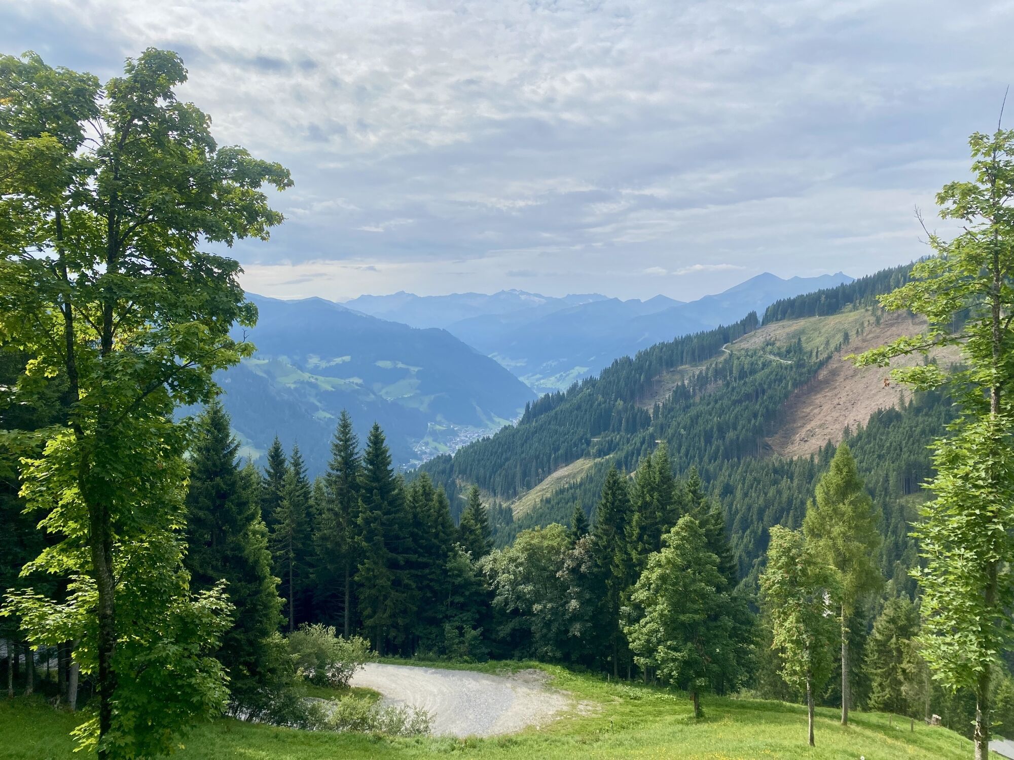
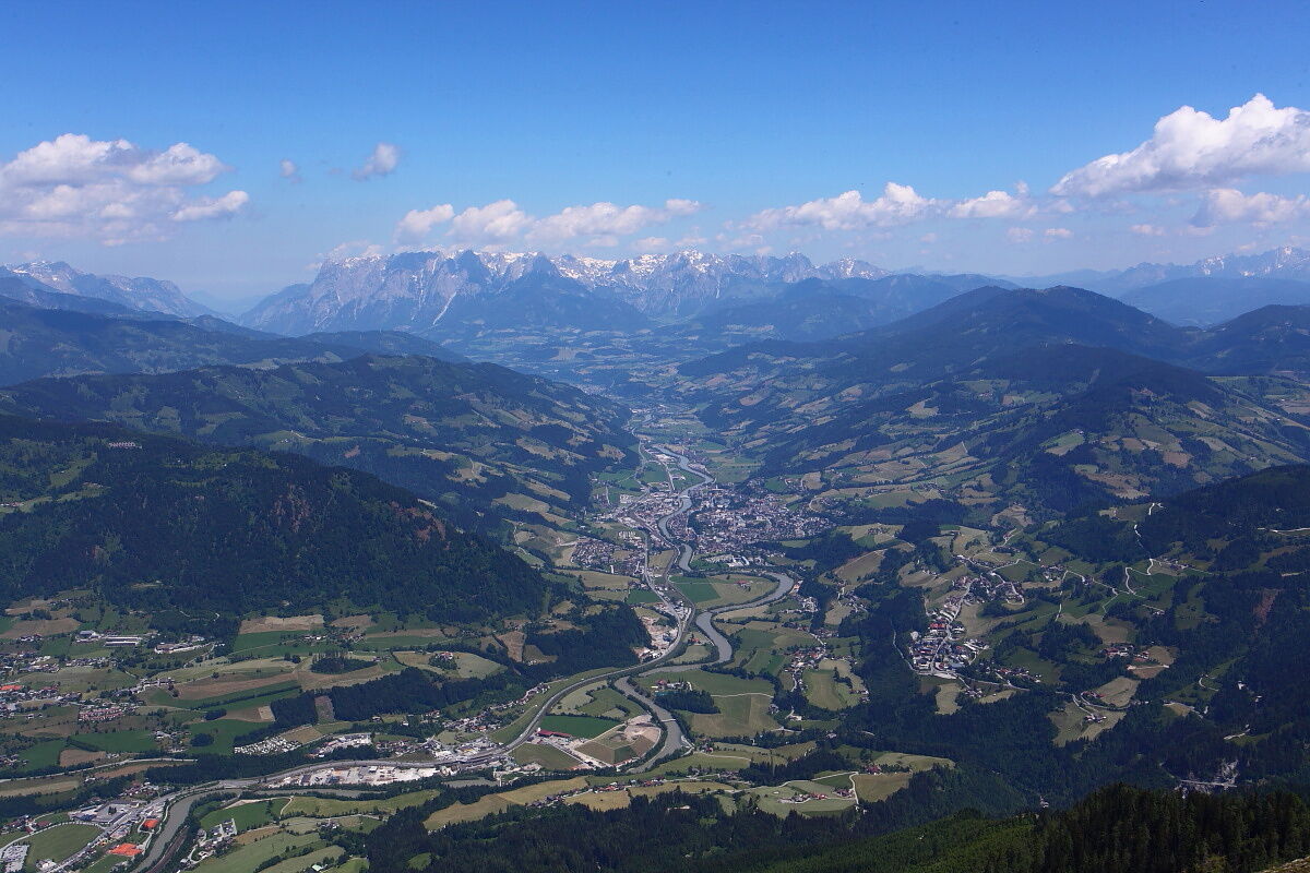
After a refreshment, the path continues to the Viehhausalm - a wonderful view over the Großarl Valley opens up. The alpine farmers pamper all hungry hikers with homemade delicacies. Here children will have their fun.
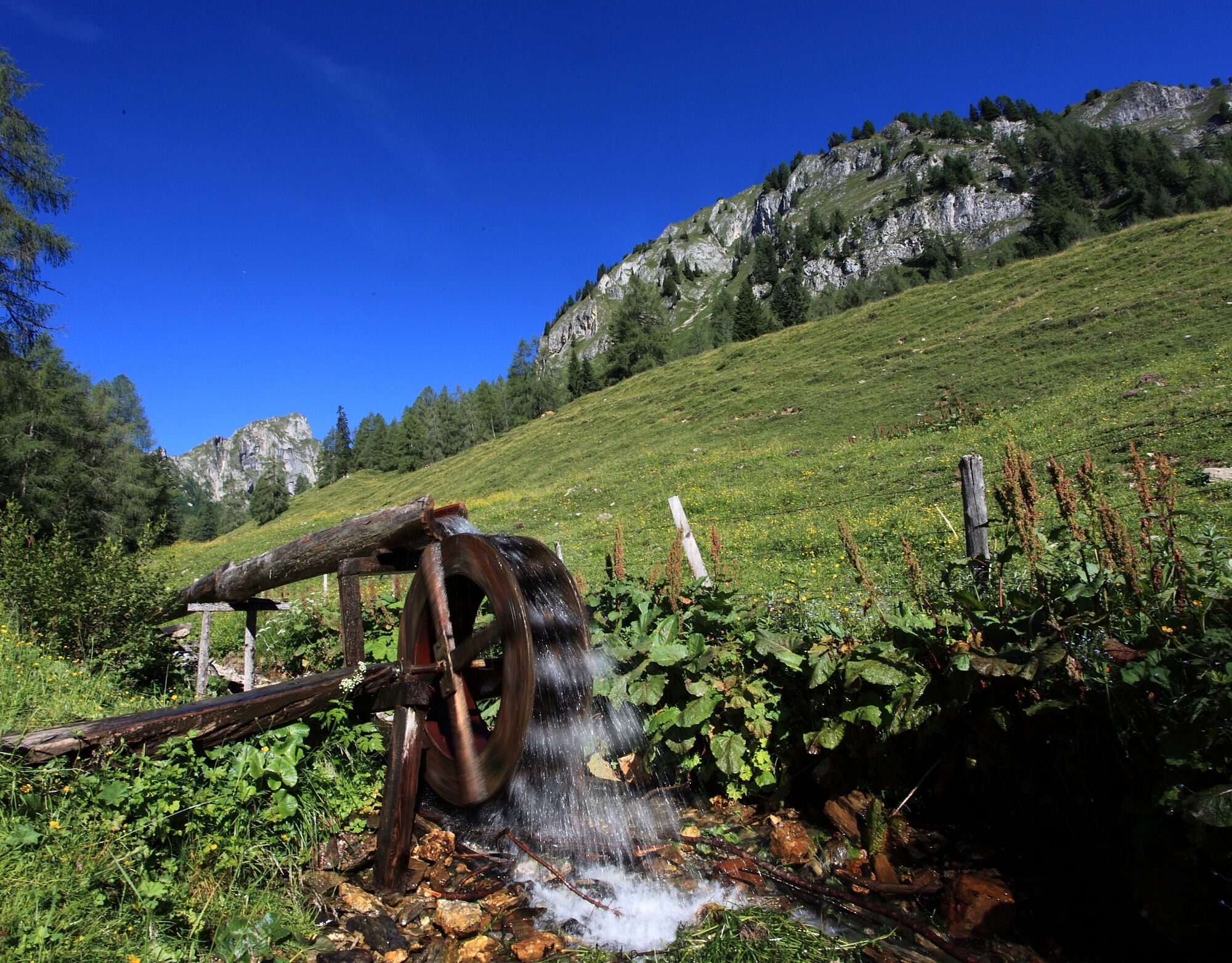
Next is the Niggeltalalm (Igltalalm). A beautiful water wheel, formerly used for churning butter, stands at the stream in front of the hut. This alpine farm is a paradise for children - a stream and a small pond, a large playground as well as cats, dogs, ducks...
The Igltal is one of the wildest areas in our valley. If you are lucky, you may catch sight of a marmot or some chamois.
Return goes back to the Mooslehenalm and then back into the valley.
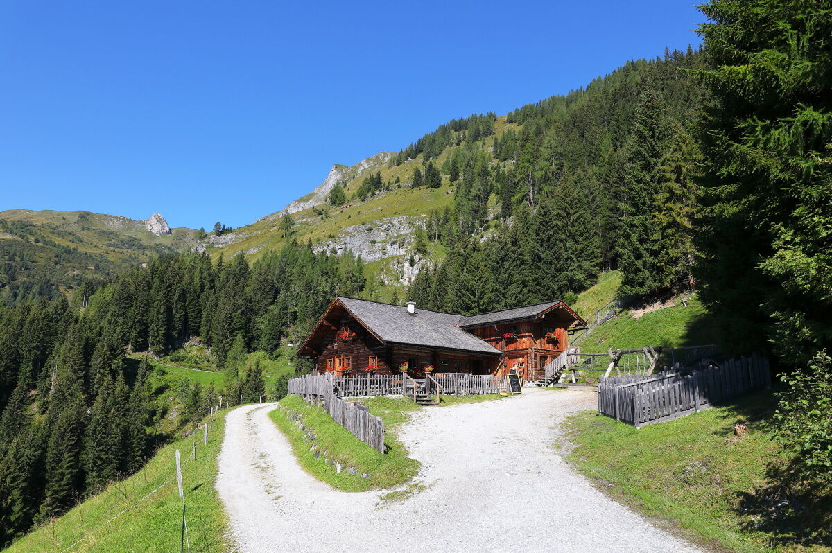
You can reach the start of this route from the center of Großarl via the valley bike path towards St. Johann (approx. 3.7 km). Here you leave the bike path and turn left onto Schiedweg, following it to the Himmelsknoten. Continue on the forest road to the Mooslehenalm, 1,449 m. Ascend the same way to the junction, then take the path to the Viehhausalm, 1,640 m. Return again to the junction and follow the path to the Niggeltalalm, 1,507 m.
Return by the same way.
Mountain bike or e-bike
Helmet and additional protective gear such as gloves, glasses, etc.
Warm clothing and rain protection
For emergencies: first aid kit and mobile phone
Snacks, some drinks, and money for the refreshment stop
Restricted local resident and hiking taxi traffic.
You can reach the starting point of this route by mountain bike via the valley bike path from the center of Großarl in about 3.7 km.
Here you will find all parking options in Großarl and Hüttschlag.
Ascent from the Viehhausalm on a narrow path (trail no. 32) to the Wetterkreuzsattel, 1,840 m above the Viehhausalm (approx. 1/2 to 3/4 hour from the alpine farm), returning by the same path.
Webkameraer fra turen
-
Kreuzkogel
-
Gernkogel - Alpendorf St. Johann
-
Hotel Lammwirt im Großarltal/Ellmautal
-
Bergstation 6er Sesselbahn Harbach
-
Ellmautal - Palfenhof
-
St. Johann-Alpendorf
-
Großarl - Vitalhotel Tauernhof
-
St.Johann-Alpendorf Gernkogel
-
Gernkogel - Alpendorf St. Johann
-
Gernkogel - Alpendorf St. Johann
-
Großarl - Kieserlbahn
-
Grossarl - Hotel Gasthof Schützenhof
-
Großarl - Hotel Kristall Übungslift
-
Bergstation Kieserl
-
Gernkogel - Alpendorf St. Johann
-
Gernkogel - Alpendorf St. Johann
-
Gernkogel - Alpendorf St. Johann
-
Gernkogel - Alpendorf St. Johann
-
Großarl
-
St. Johann-Alpendorf
-
St. Johann-Alpendorf
-
St. Johann-Alpendorf
-
St. Johann-Alpendorf
Populære turer i nabolaget
-
4,6
Panorama hike to the Hochkeil
middelsVandring 6,07 km -
4,2
Ennskraxn (2410m)
tungVandring 14,7 km -
4,8
Gasteiner Höhenweg von Bad Gastein nach Bad Hofgastein
lysVandring 8,58 km -
4,0
Großarl: Unterwandalm - Karseggalm - Breitenebenalm
middelsVandring 5,93 km -
4,8
Großarl: Mooslehenalm – Niggeltalalm – Viehhausalm
middelsVandring 5,44 km -
4,3
Wasserfall Bad Hofgastein
lysVandring 3,89 km -
4,5
Penkkopf via Kleinarler hut from Kleinarl
middelsSkitour 4,35 km -
4,2
Wasserfallweg (UNESCO-Geopark Erz der Alpen)
lysTemaløype 4 km -
4,4
Großarl: Saukaralm - Saukarkopf - Gerstreitalm
middelsVandring 9,14 km -
4,9
Liechtensteinklamm mit Helix
lysTemaløype 3 km
Vandring og sporing


Ikke gå glipp av tilbud og inspirasjon til din neste ferie
E-postadressen din har blitt lagt til på adresselisten.