


Marking: white-yellow-white, white-green-white

Großolbersdorf parking lot at the town hall – GH "Zur Silberstraße" - Meyweg left to the playground - follow the yellow-green marking to the left – after about 1 km only the yellow marking to the right through a small wood to the junction with the hiking trail to Bornwald – cross the B 174 at Halfterhäuser – immediately left follow the yellow marking on the asphalt road for about 1 km – at the rest shelter at the junction to the dam, go straight ahead about 200 m – cross the B 174 to the left towards "Rest area at the B 174" (hiking sign) and continue towards Großolbersdorf – after about 1 km the yellow and green markings meet – go to the playground on Meyweg – left to Schulstraße – past the village museum, church and GH "Zur Linde" back to the parking lot.
Bus - line 233 - stop Großolbersdorf/Sportheim or primary school,
if starting the route at B 174: bus - lines 206/207 - stop Rote Pfütze
Parking lot at the town hall, 09435 Großolbersdorf, Am Rathaus 8 (free of charge),
or rest area at the B174
Municipal administration Großolbersdorf
Am Rathaus 8
09432 Großolbersdorf
Phone: +49 37369 1410
Fax: +49 37369 14120
info@grossolbersdorf.de
www.grossolbersdorf.de
Attractions
- Village museum "Sättlerhaus", Schulstraße 16, open April – Oct., Sat. + Sun. 2:00 – 5:00 pm, Tel. +49 37369 1410
- Stülpnerberg, Warmbadstraße 16, open April – Oct. Sun. 9:00 am – 12:00 pm, Tel. +49 37369 1410
- Karl Stülpner's grave at the cemetery
- License plate museum, Grünauer Straße 3, open Mon – Sat 9:00 am – 4:30 pm, Tel. +49 37369 84560
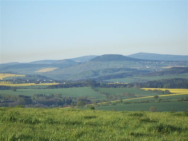
- Rest area at the B174 with viewpoint
Dining options
- Snack bar "Rest area at the B174", Mon-Fri 7:00 am-4:30 pm
- Sports center, Scharfensteiner Str. 13, closed Wed, Tel. +49 37369 9690
- Butcher Göhler, Am Rathaus 2, Mon – Fri, Tel. +49 37369 5675
- GH "Zur Linde", An der Kirche 1, closed Mon-Tue, Tel. +49 37369 9323
- Pizzeria Ultimo, Am Rathaus 5, closed Thu, Tel. +49 37369 88545
Populære turer i nabolaget
-
Katzenstein - Schwarzwassertal - Katzenstein
middelsVandring 15,5 km -
Ehrenfriedersdorf-Waldgeisterweg-Greifensteine
lysVandring 7,33 km -
Schwarzwassertal
middelsVandring 16,7 km -
5,0
Greifensteine und Binge von Geyer
middelsVandring 15,7 km -
5,0
Katzenstein -Grüner Graben - Teufelsmauer
lysVandring 12,9 km -
4,0
Via Mala
lysVandring 5,36 km -
Greifensteine und Waldgeisterweg
middelsVandring 6,86 km -
From the Engeldorf to the hunting lodge – a route with castle views
middelsSykling 22,4 km -
Einsiedel/Erfenschlag Rundweg mit dem Hund
lysVandring 12,0 km -
Zschopau Valley route
middelslangdistanse tursti 130,2 km
Vandring og sporing


Ikke gå glipp av tilbud og inspirasjon til din neste ferie
E-postadressen din har blitt lagt til på adresselisten.