


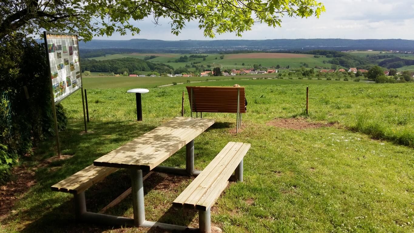
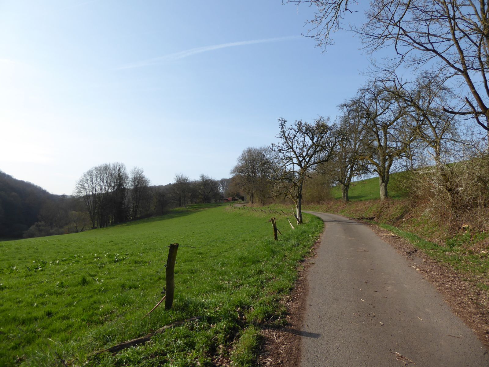
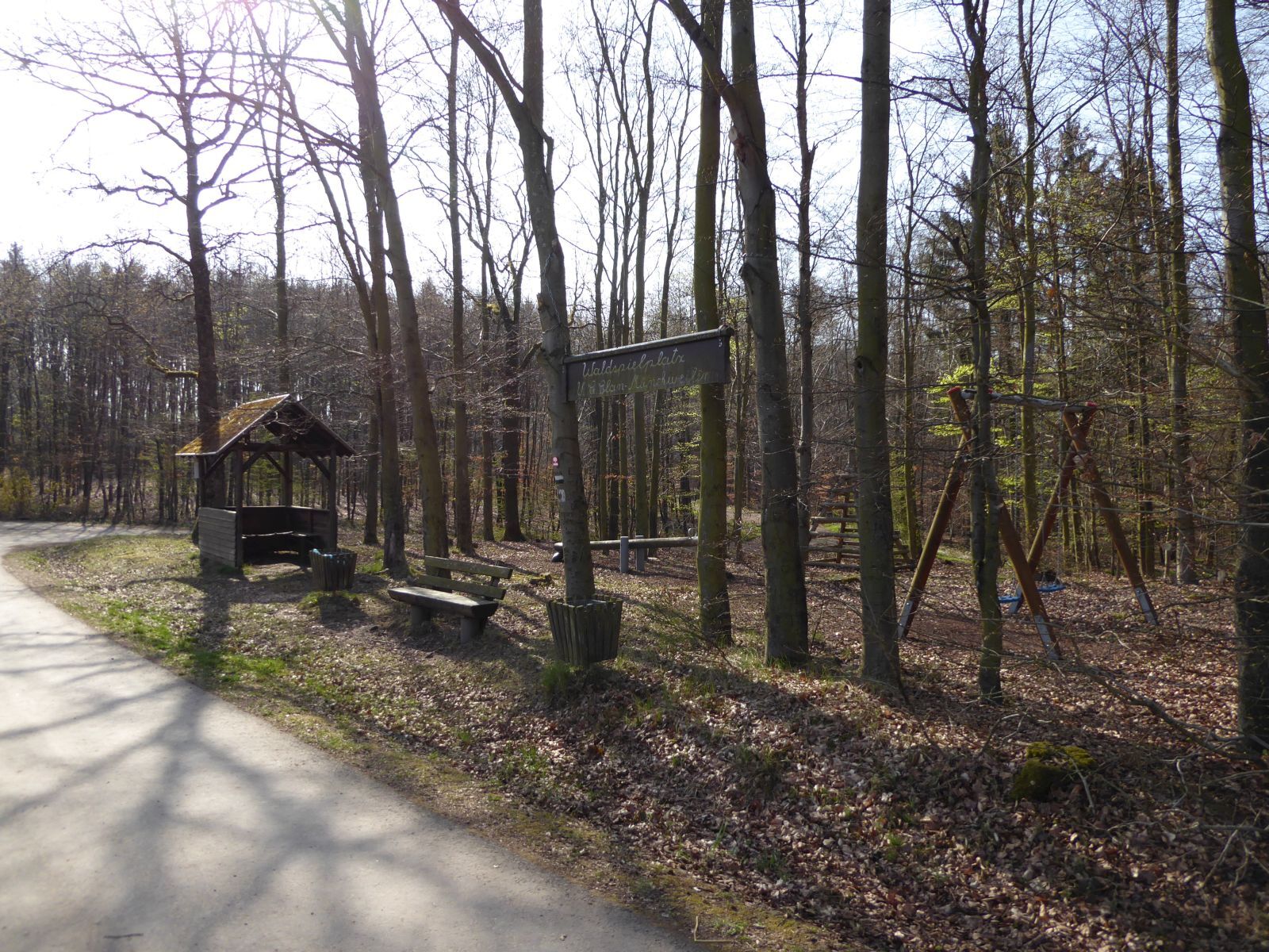
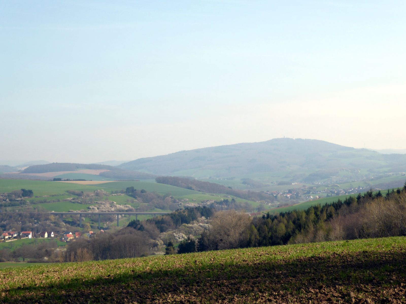
On this circular hiking trail, you walk in open countryside and pass through some forest sections. Soon you will reach a forest playground. Enjoy the distant view of the Northern Palatine Uplands, the...
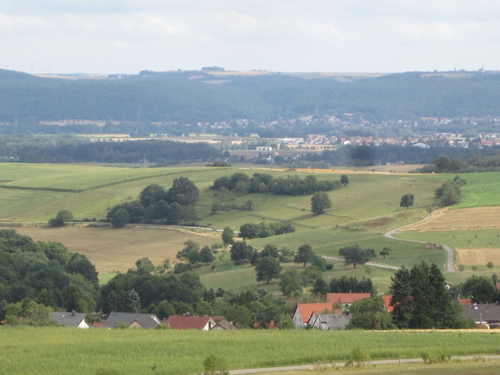
On this circular hiking trail, you walk in open countryside and pass through some forest sections. Soon you will reach a forest playground. Enjoy the distant view of the Northern Palatine Uplands, the "Prussian Mountains," the Westrich moor depression, and the Sickingen Heights on the further hiking route.
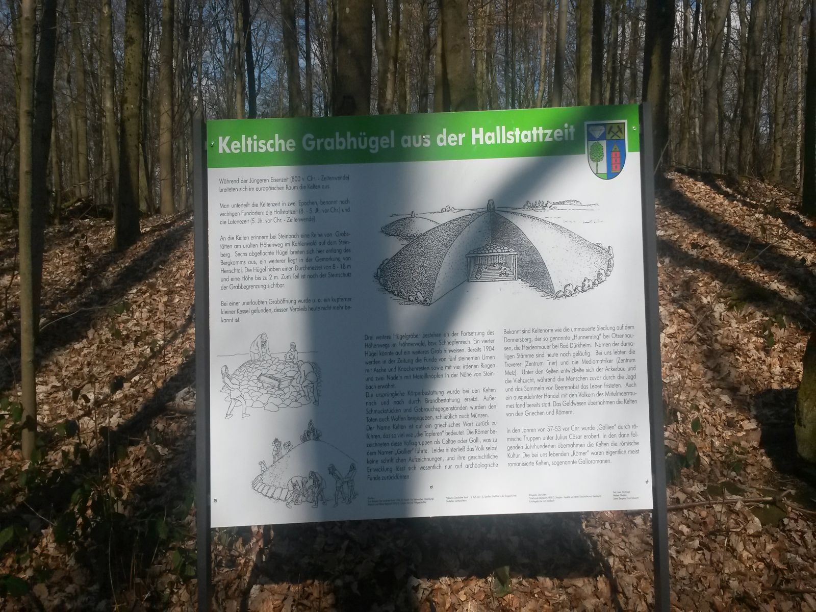
You will find Celtic burial mounds by the wayside.
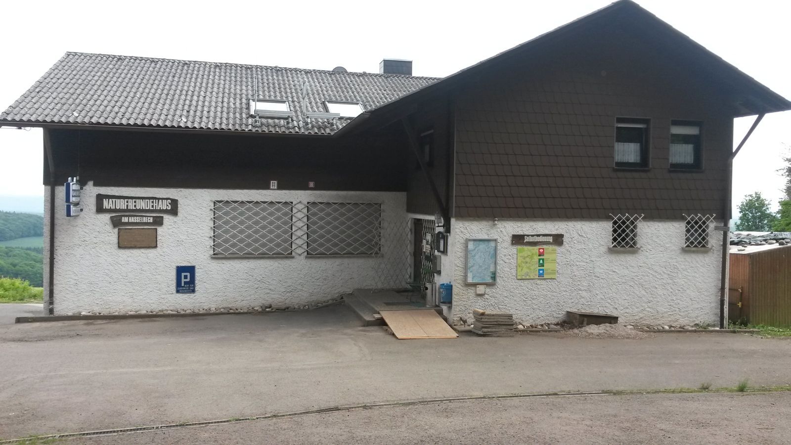
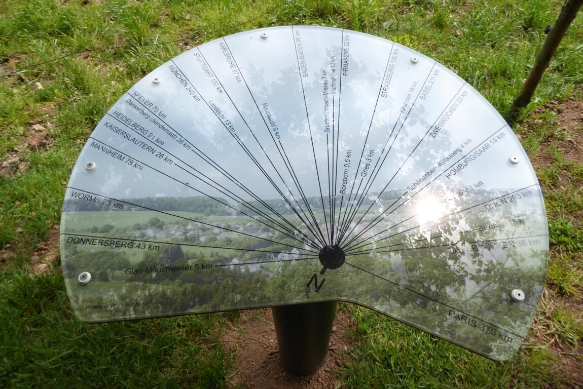
At the nature friends' house "Haselrech" (observe opening times!), you can refresh yourself with dishes from Palatine cuisine. After a few minutes, you will reach a unique panoramic view. An information board gives geological information about the landscape structure "Palatine Westrich."
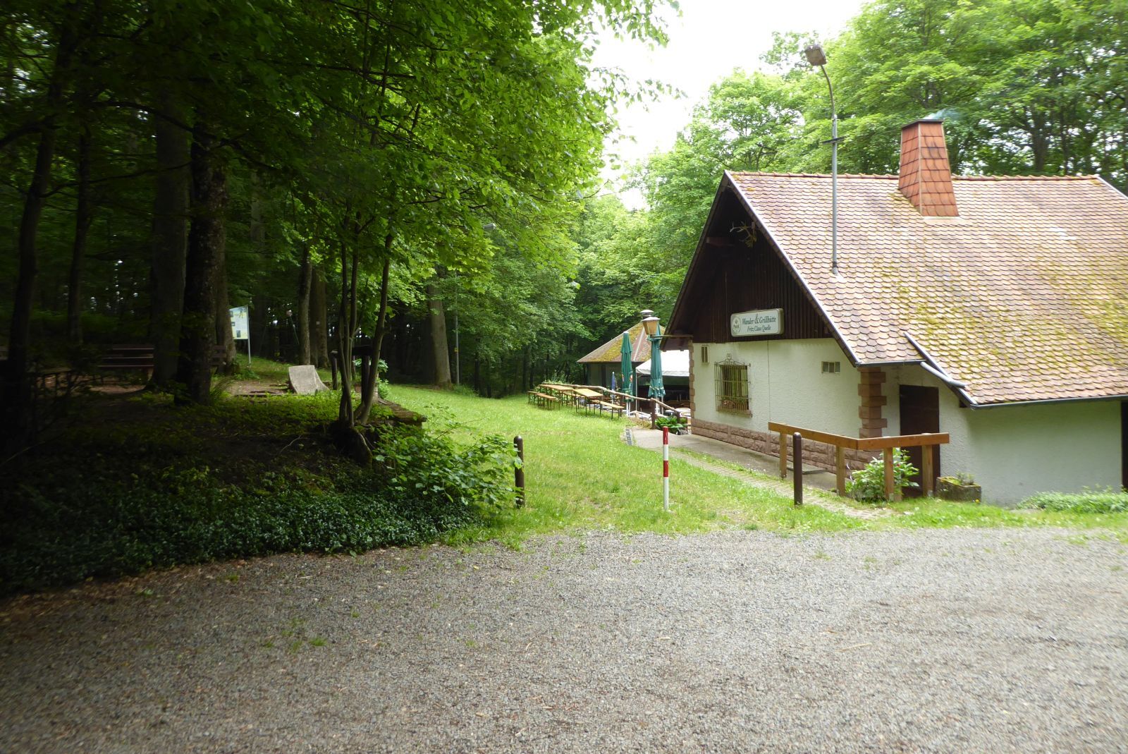
In the Brücker Wald, you will come across the managed hiking hut "Fritz-Claus-Quelle" (observe opening times!).
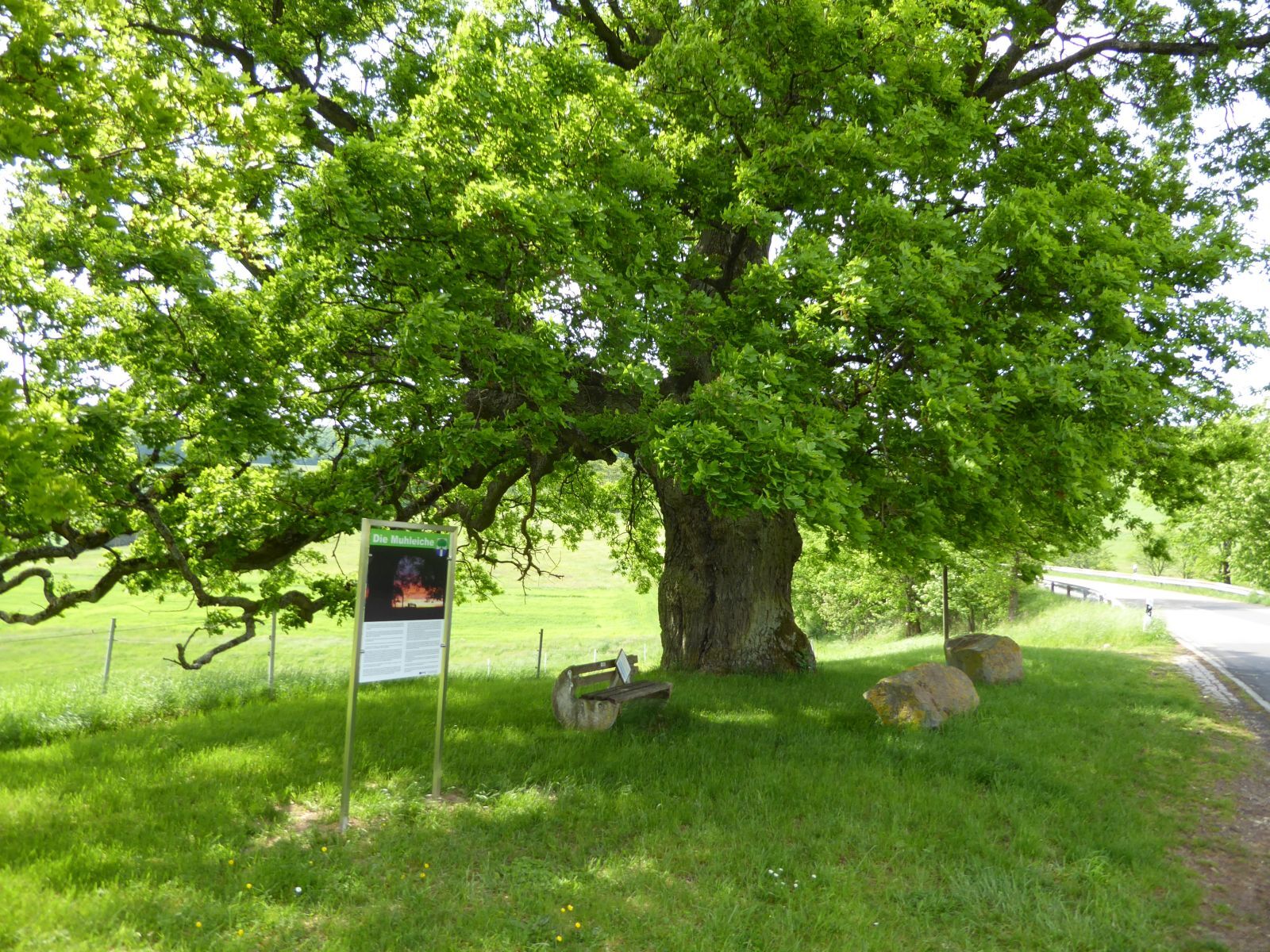
Shortly before Börsborn, you reach the approximately 500-year-old Muhleiche, the landmark and heraldic tree of Börsborn.
UFFBASSE! – Campaign for a considerate coexistence in nature
- Always behave considerately, friendly, and attentively towards everyone you meet on the way.
- Respect nature, do not destroy plants and always stay on the paths.
- Remember a rubbish bag for the way and take your waste back home with you.
- Please always keep your dog on a leash. Other visitors and animals will thank you.
- Observe all path closures for your own safety. Even on weekends.
- Park only in designated parking spaces. Leave space for emergency access and agricultural machinery.
- Give priority to agricultural and forestry traffic.


Börsborn (community center) - turn right onto the main street - at the town exit turn left onto the main street - straight ahead - crossing Kinderbach - continue north to the forest playground - turn left over Klopfberg to the nature friends' house "Haselrech" - continue straight over Steinberg, Schnepfenrech, Brückerwald - turn right to the hiking hut "Fritz-Claus-Quelle" - after the hut turn left and go straight to the K8 - briefly follow the K8 to the entrance of Börsborn - turn right into Jakobstraße - main street - Börsborn (community center)
Ja
For our hiking routes, we recommend the following equipment as standard:
- Sturdy footwear
- Weather-appropriate clothing
- Sun and rain protection
- Sufficient supply of food and drinks, as there are not always places to eat or shop, or they may be closed.
- Although the paths are very well marked throughout, it is advisable for safety reasons to always carry a suitable
hiking map so that, for example, in a thunderstorm or emergency you can quickly find a safe area.
- Hiking poles recommended.
General information:
Especially in autumn, note that fallen leaves can conceal unevenness, roots, stones, or holes in the path. After thunderstorms or heavy rain, trees may still fall or branches may drop. In adverse weather conditions, natural paths can become muddy and slippery. Not all rocks or precipices are secured with ropes or railings. Sure-footedness is required in places. Expect such path impairments when hiking. If you believe certain sections are not passable for you, you should avoid them.
NOTE:
We strive to announce all closures due to forestry work or hunting groups on this platform. Still, sometimes hiking trails are closed without us being informed. If you unexpectedly encounter a path closure or detour, please follow the instructions for your own safety.
A62 - exit Glan-Münchweiler
L358 to Glan-Münchweiler
B423 to Steinbach am Glan
K8 to Börsborn
Glan-Münchweiler train station
Bus 285 to Börsborn
Community center - Hauptstraße 27, 66904 Börsborn
Coordinates: Longitude 7° 24' 4'' / Latitude 49° 26' 25''
Tourist info:
Rathausstraße 8, 66901 Schönenberg-Kübelberg, Tel.: 06373 / 504-0
Accommodation directory and gastronomy guide of the vacation region
and flyer about the tourist info: poststelle@vgog.de
Nature friends' house "Haselrech" - http://www.naturfreunde.de/haus/naturfreundehaus-am-haselrech
Hiking hut "Fritz-Claus-Quelle - http://www.tourenwelt.info/huettenliste/huette.php?huette=38828
The oak stands in the area called In der Muhl, the local term for depression. It is by far the thickest tree in the Kusel district.
Populære turer i nabolaget
-
Bruchmühlbach-Miesau - Sagenhafter Waldpfad
middelsVandring 17,8 km -
3,0
Bridges - Dream Tour Diamond
tungVandring 15,2 km -
Kusel - Preußensteig
tungVandring 25,6 km -
Flower Garden Loop
middelsSykling 34,0 km -
4,0
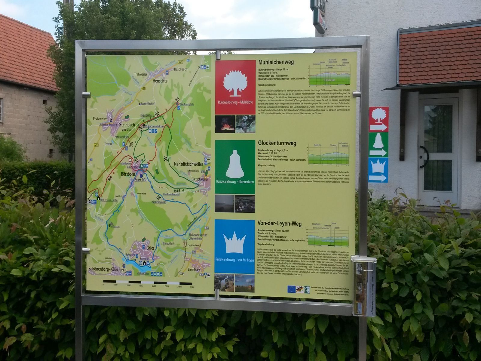
Börsborn - Von-der-Leyen-Weg
middelsTemaløype 12,2 km -
Breitenbach - Panorama route
middelsTemaløype 11,7 km -
Waldmohr - Rundweg Verladerampe
lysVandring 6,40 km -
Blaubach - Aussichtsreich zur Burg Lichtenberg
middelsVandring 12,2 km -
Bruchmühlbach-Miesau - Beetle Safari
lysTemaløype 7,04 km -
Altenkirchen - Cherry Land Path (circular route - 22.6 km)
middelsTemaløype 22,5 km
Vandring og sporing


Ikke gå glipp av tilbud og inspirasjon til din neste ferie
E-postadressen din har blitt lagt til på adresselisten.