


Bilder av brukerne våre

Schwede-Bure (Sweden's Well) - as this wild romantic place is called - has been a refuge for Oberwesel residents for centuries.
They already sought protection there during the Thirty Years' War in the...
Schwede-Bure (Sweden's Well) - as this wild romantic place is called - has been a refuge for Oberwesel residents for centuries.
They already sought protection there during the Thirty Years' War in the 17th century from the Swedes. In later times, it was a meeting point for many lovers who found protection from prying eyes there and immortalized their love with engravings in the slate rock.
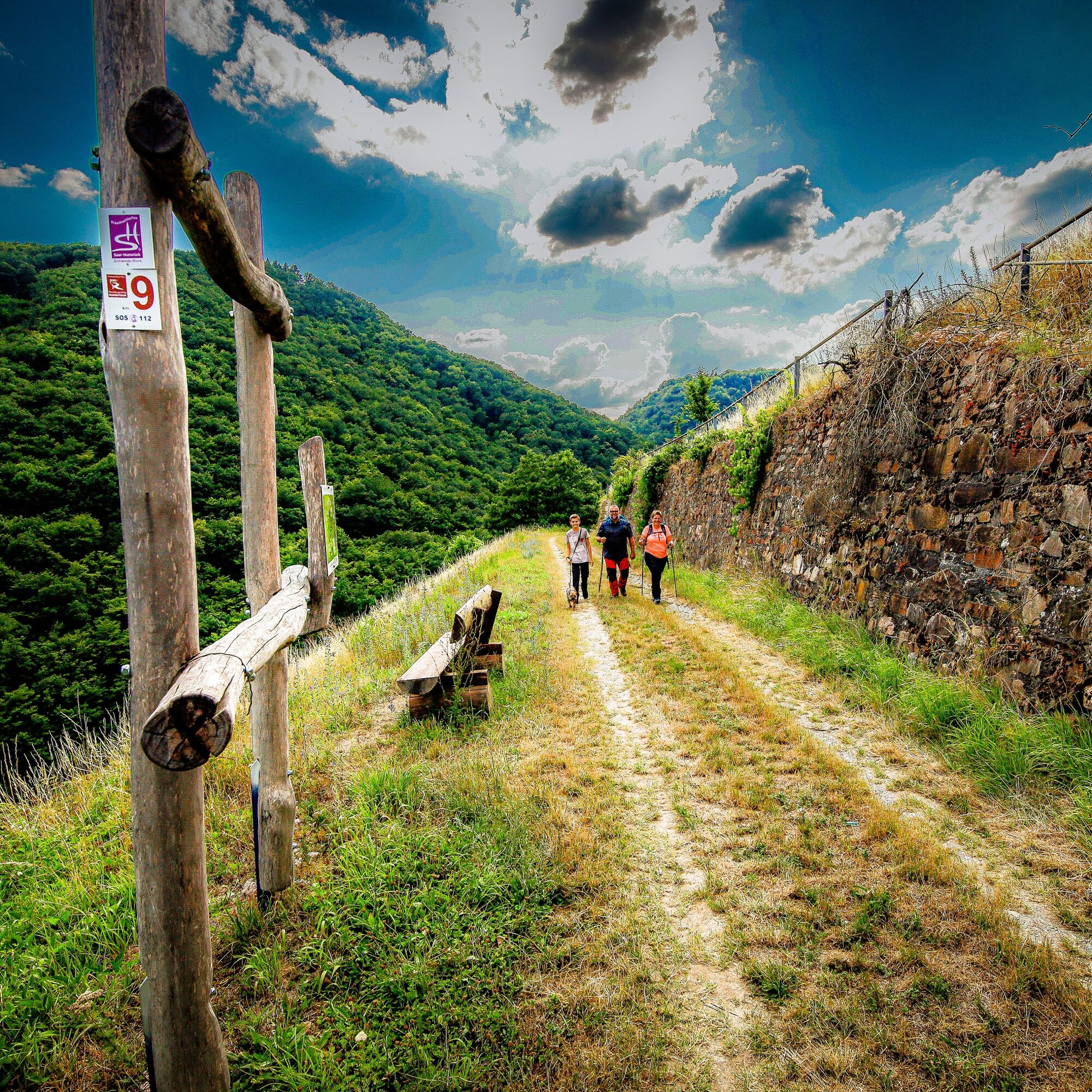
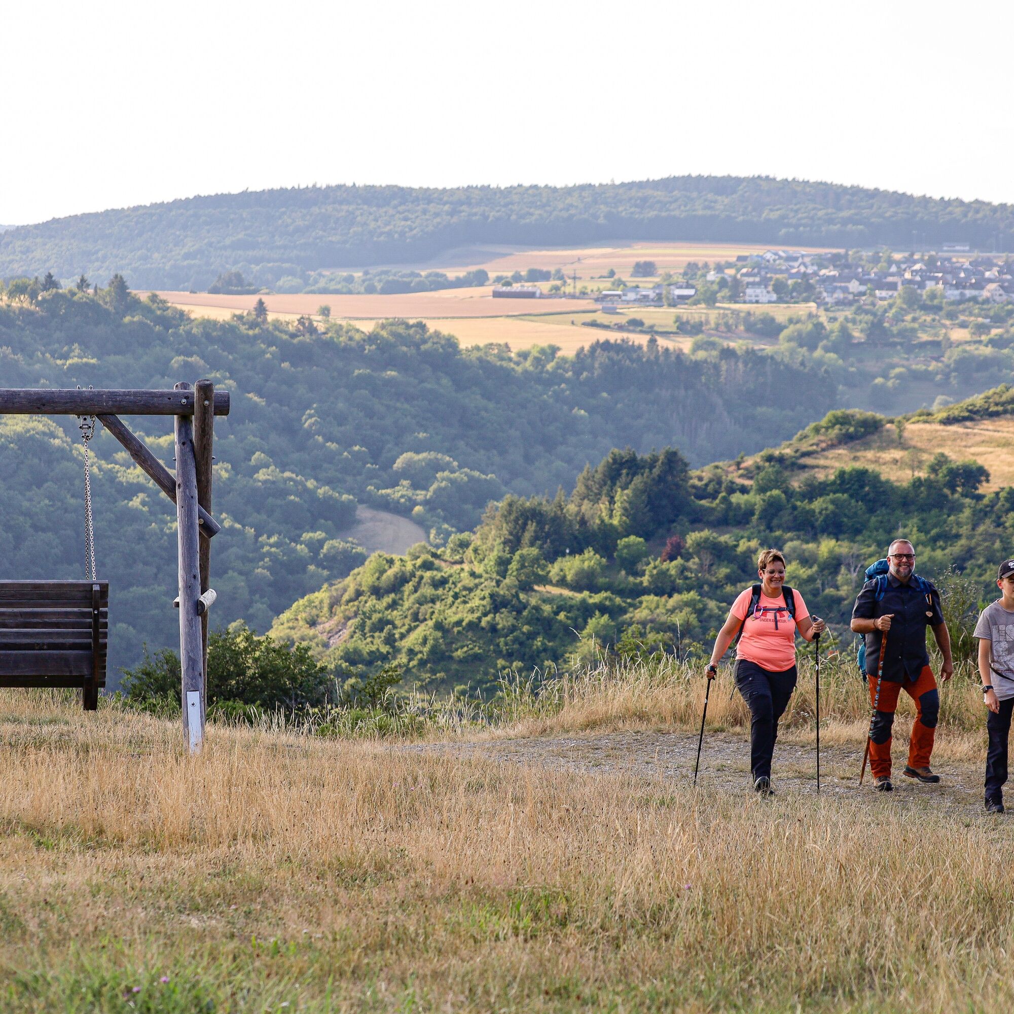
The varied route passes many cultural and historical sites, e.g., the Oberwesel city wall with its towers, the Jewish cemetery, and the Kalvarienberg Chapel. The path winds - partially on narrow trails - through small forests, meadows, and vineyards. In between, fantastic viewpoints invite you to linger.
The Traumschleife was rated in 2022 by the German Hiking Institute with 72 experience points.

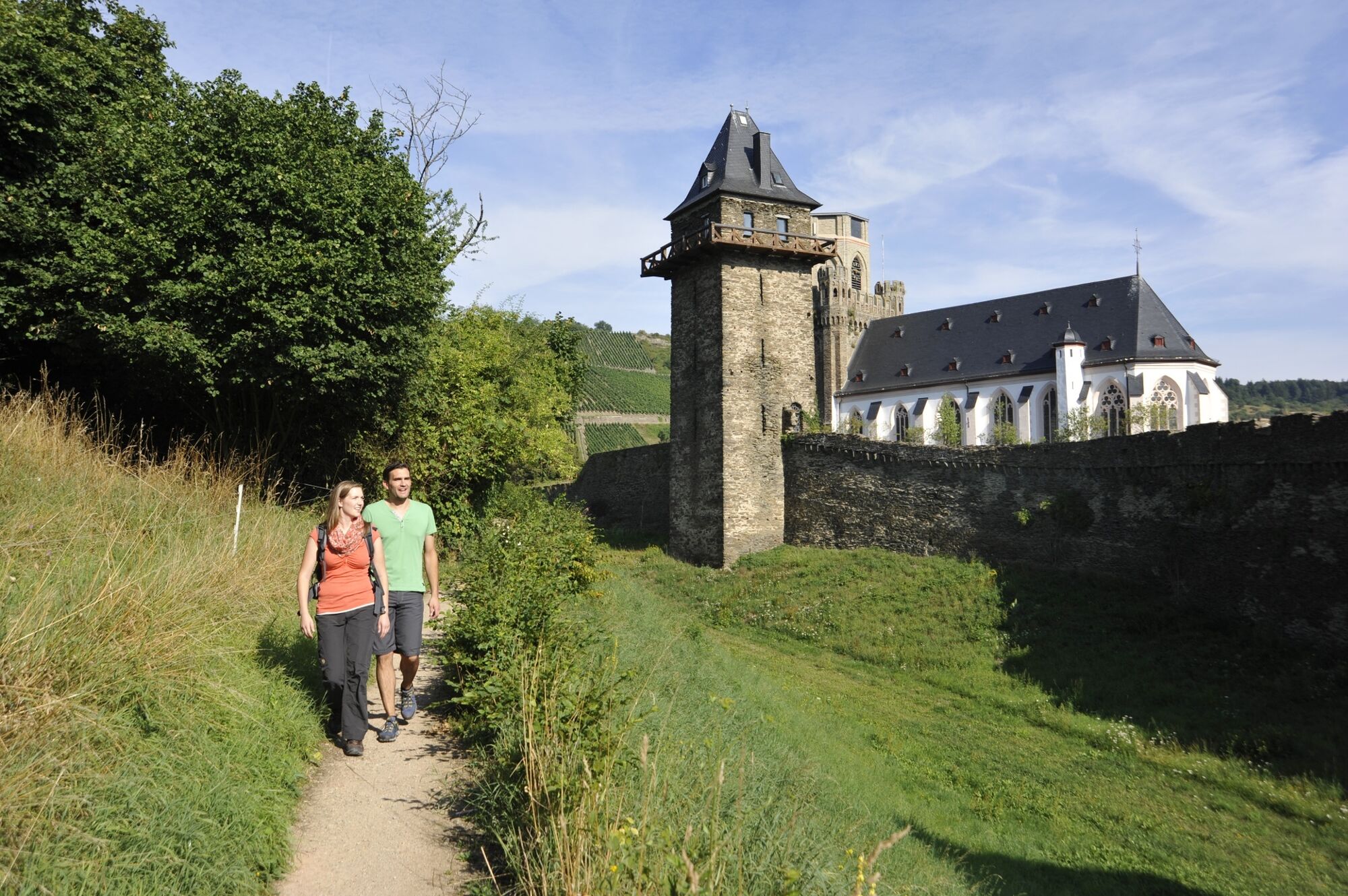
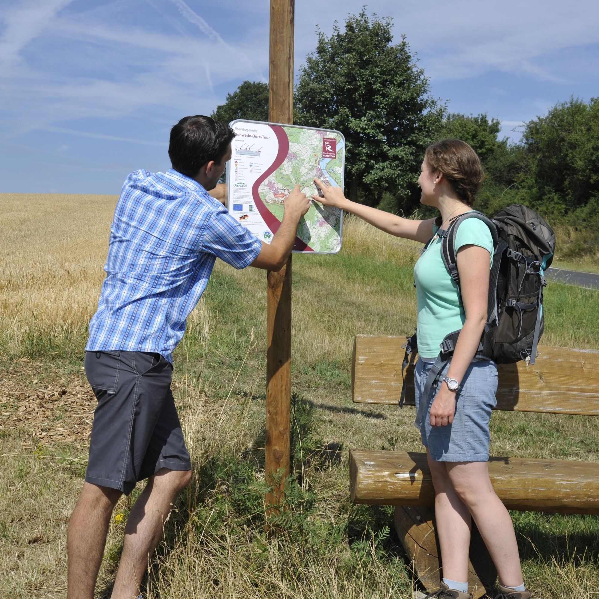
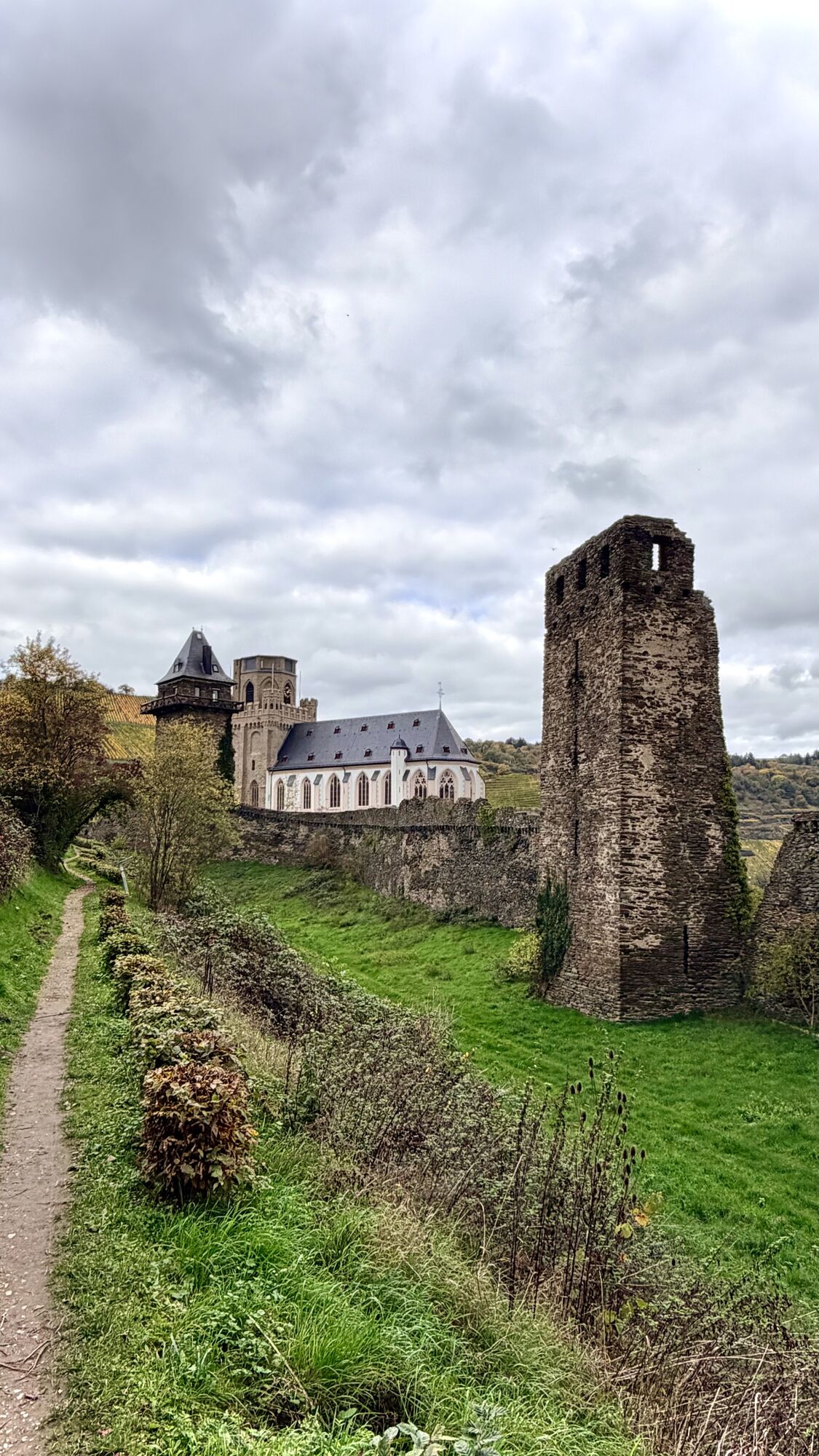
Starting at Schaarplatz in the heart of Oberwesel. Following the signs, you pass a medieval fountain and a small vineyard, then continue on a narrow path into the Schützengraben. This leads along the medieval city wall with its defensive towers northwards to the Martinskirche, a former collegiate church built around 1350.
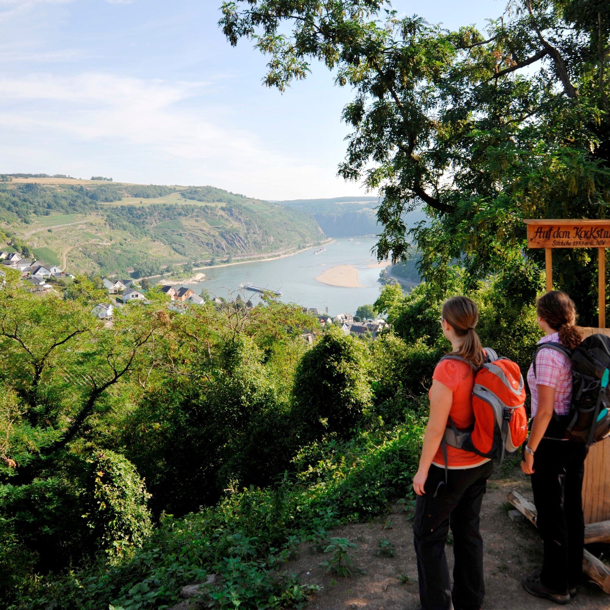
After crossing the street, a narrow path leads uphill along old garden plots to the "Michelfeld." Shortly after, the viewpoint "Auf dem Kackstuhl" is reached, offering a magnificent view of the Rhine.
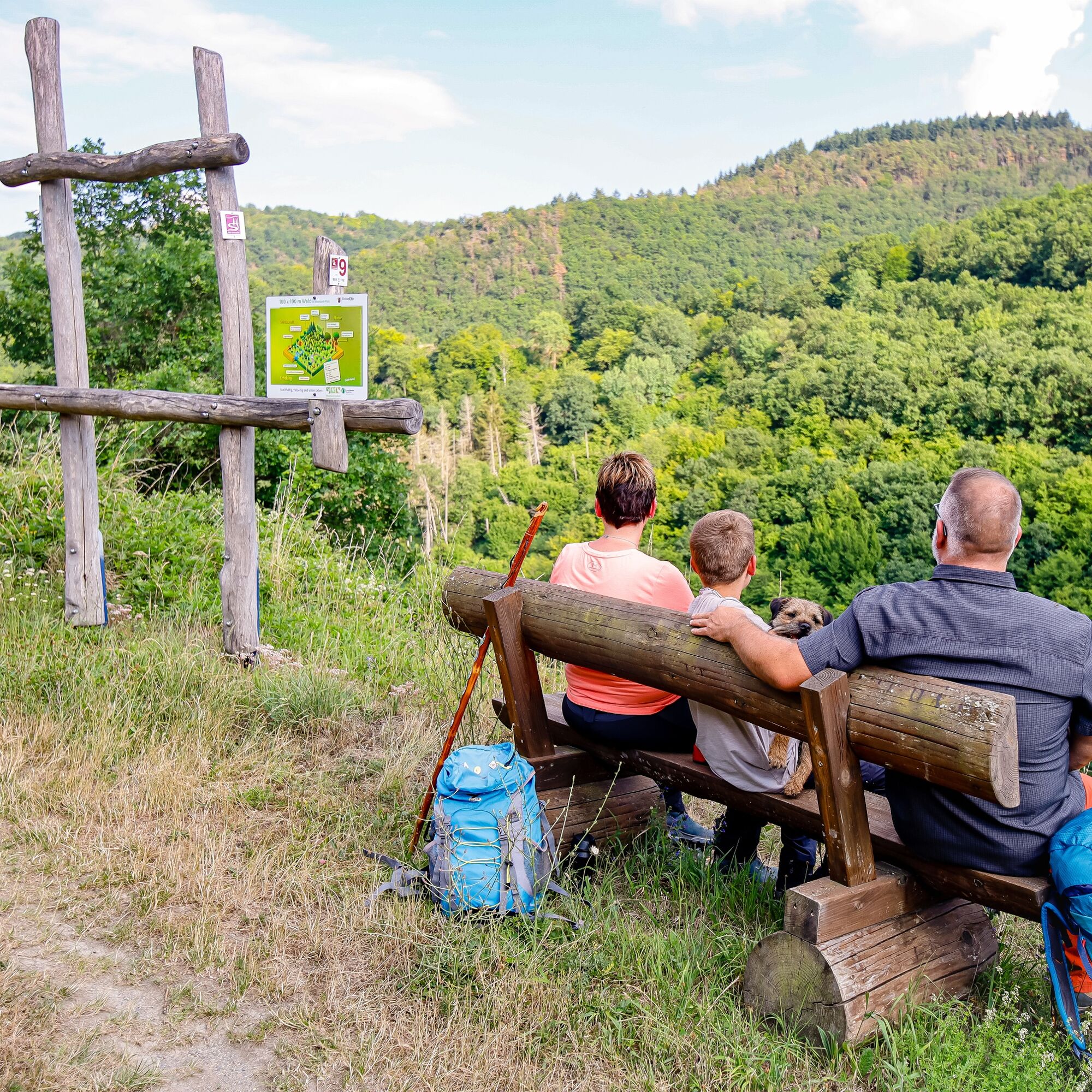
Now the path slowly ascends to the Hardthöhe and then continues over meadows and fields with breathtaking views to the approximately 2700 sqm former Jewish cemetery. The oldest tombstone probably dates from 1718, the last burial took place on January 25, 1942.
After another kilometer - initially uphill and then slightly downhill - you reach the "Rheingoldschänke," whose beautiful terrace invites you to rest.
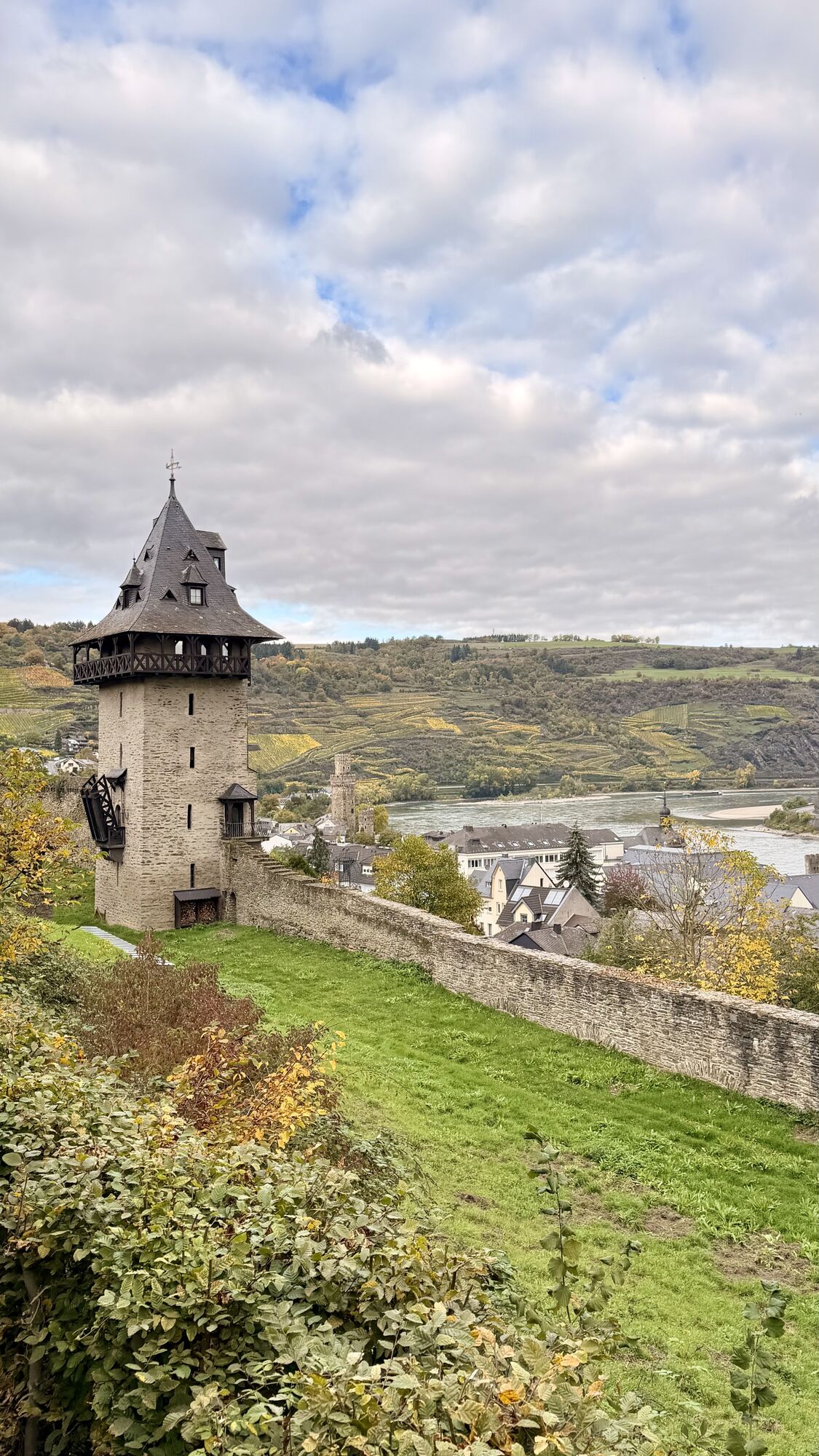
Refreshed, we follow the path through willow trees, meadows, and a short forested area to the "Guckshöll," which opens up a fantastic view through the Niederbachtal to the Rhine with the Martinskirche as well as the Katzen and Ochsen towers.
From there, the path rises again briefly past a fir plantation until the highest point of the tour is reached, where you can enjoy the panoramic view in all directions. Those who want to make a short detour to Damscheid to, for example, take a look at the 12th-century Church of St. John the Baptist with its Romanesque tower, have only a short distance to go from here.
Otherwise, the route now goes south to the "Hardt" hiking car park and from there continues along a beautiful meadow path lined with blooming, fragrant bushes. After about 2 km, just past the "Hunsrück" viewpoint, turn left onto a small path that leads through a low forest area within a few meters to the path back to Oberwesel. Soon you come to a quarry where the approximately 300 to 400 million-year-old shale layers can be beautifully seen. The route then continues eastwards along initially fallow and then cultivated vineyards.
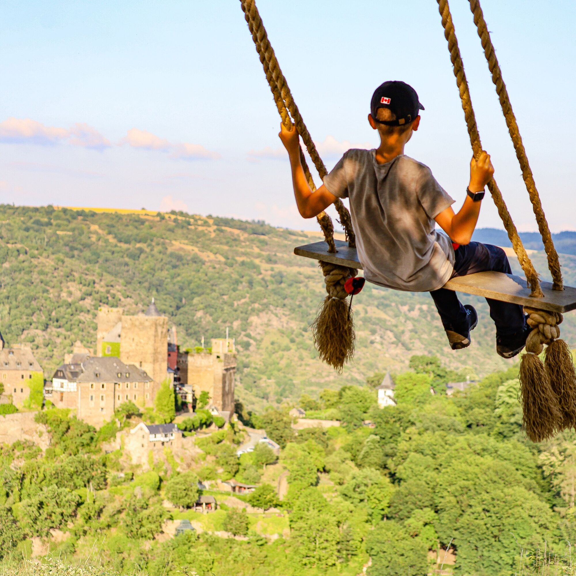
Just before the path is paved again, take the left onto the vineyard wall. For the next 80 meters, you walk along the foot of the vineyards and can learn about Oberwesel wine and the Goldemund vineyard location. On the right, you can see the small winemaking village of Engehöll with the "Dolorous Mother of God Church," built in 1925 in Neo-Baroque style on a rocky ridge. The path continues gently uphill through the vineyards, passing an old slate shelter used by the winemakers. Ahead towers the Schönburg, which appears even more imposing the closer you get.
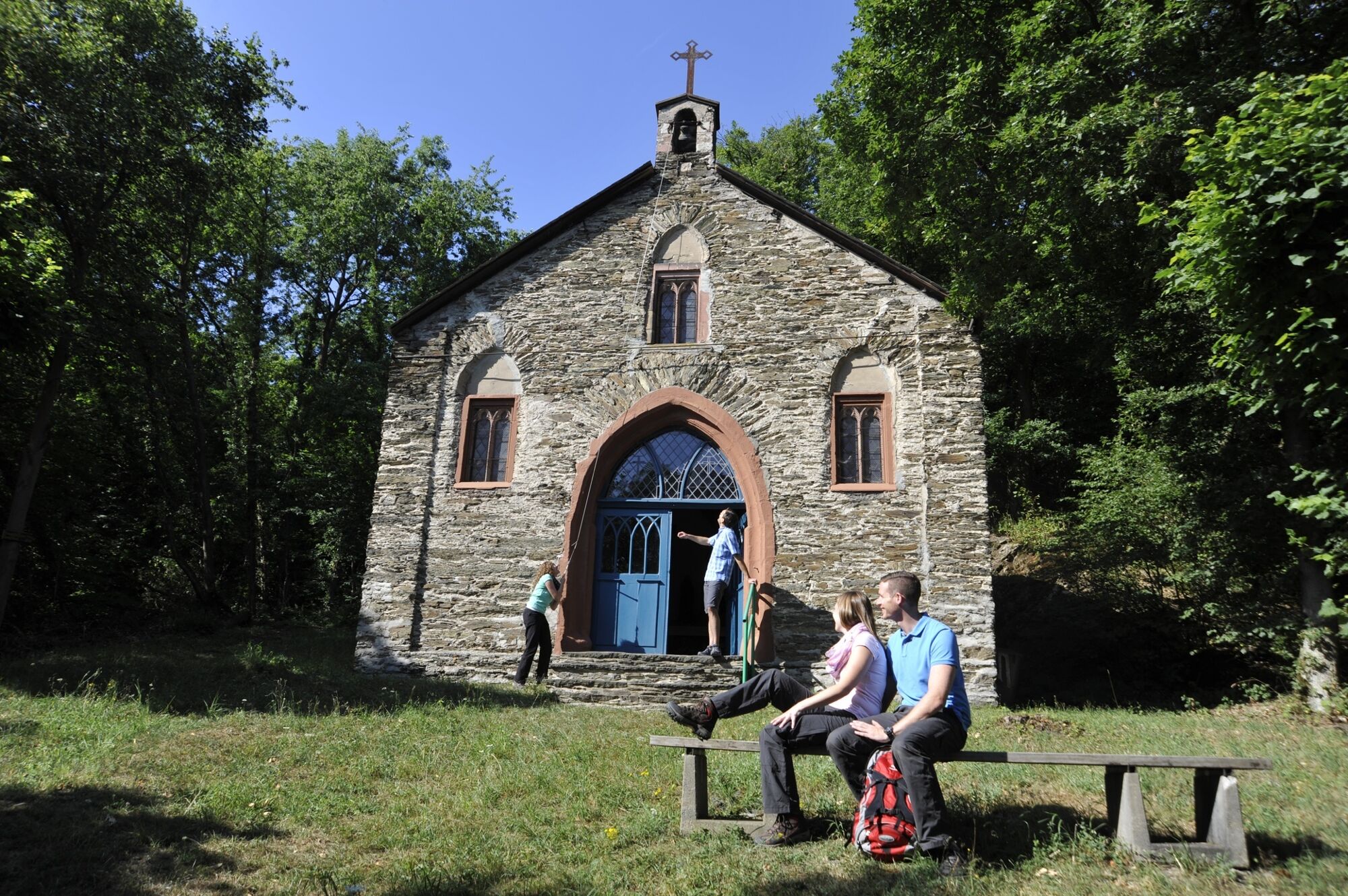
After about 1 km, a path with large steps leads left up into a magnificent oak grove. The "Landsknechtsblick" viewpoint with its views of Oberwesel and the Rhine invites you to take a short break before you finally reach the "Schwede-Bure" via a wooded path! This wild and romantic place has always enchanted lovers who immortalized their love vows in the slate rock there. Those who wish can still carve a little heart into the specially installed slate board today. The path then continues to the Kalvarienberg Chapel built in 1845, which used to be the destination of processions. It is worth taking a look inside or ringing the bell on the left at the door with the rope, which can be heard throughout Oberwesel. The way back now goes down the Stations of the Cross in reverse order, and soon you reach the first houses of Oberwesel again at the Schützengaben - the starting point. Anyone who has not yet explored the city of towers and wine before the hike should do so now.
Sturdy footwear/hiking boots are recommended
No special safety advice
Along the B9 from the direction of Koblenz and Bingen
By bus and train to/from Oberwesel station - timetable information
On the B9
Parking at Oberwesel Station
Hiking car park Damscheid/Hardt
Ja
Tourist Information Oberwesel
Rathausstraße 3
55430 Oberwesel
Tel.: 0049 (0) 6744/ 71 06 24
Email: info@oberwesel.de
Web: www.oberwesel.de
A look inside the Kalvarienberg Chapel built in 1845 and a walk along the Oberwesel city wall are worthwhile.
Populære turer i nabolaget
-
5,0
Traumschleife Mittelrhein
tungVandring 14,7 km -
Wisper Trail Wispertalsteig
middelsVandring 14,0 km -
5,0
Dream Loop Upper Baybach Valley
tungVandring 15,6 km -
Stadtmauerrunde BACHARACH
lysVandring 9,20 km -
5,0
Traumschleifchen Baybachquellen
lysVandring 6,22 km -
5,0
Vogtei Circular Hiking Route
tungVandring 18,9 km -
Traumschleife Mittelrhein
tungVandring 14,7 km -
5,0
Traumschleifchen Pfalzblick
lysVandring 5,68 km -
5,0
World Heritage Trail Upper Middle Rhine Valley
tunglangdistanse tursti 119,3 km -
UNESCO World Heritage Upper Middle Rhine Valley - Around the Central Valley
tungVandring 92,6 km
Vandring og sporing


Ikke gå glipp av tilbud og inspirasjon til din neste ferie
E-postadressen din har blitt lagt til på adresselisten.