


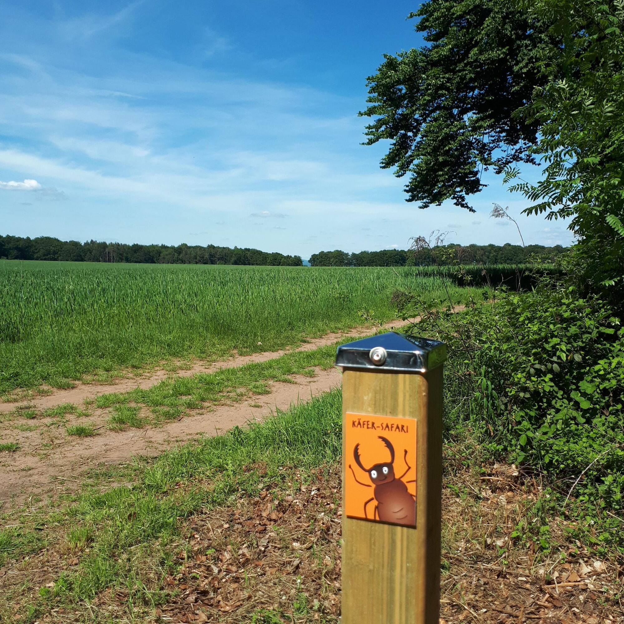
The Beetle Safari is a varied hiking experience for young and old. A short (4 km) or long (7 km) route can be selected. The mascot, Luca the stag beetle, points the way. From station to station he tells...
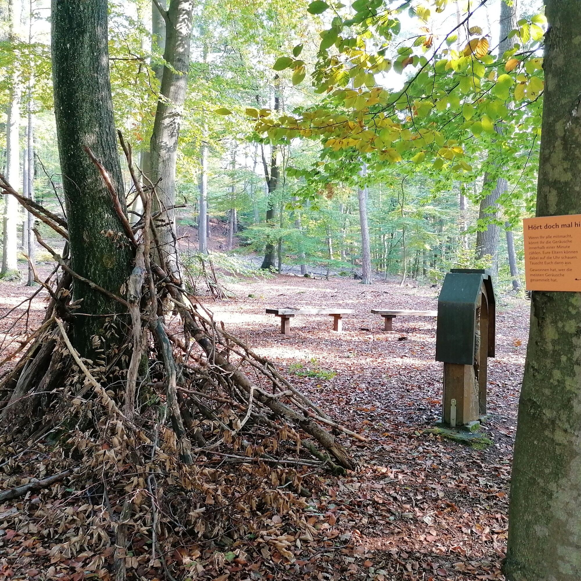
The Beetle Safari is a varied hiking experience for young and old. A short (4 km) or long (7 km) route can be selected. The mascot, Luca the stag beetle, points the way. From station to station he tells about nature, the environment, and the forest inhabitants of the region. For example, you have to guess animal sounds, discover a mud hole, or win a strength contest against an ant.
The route runs mainly on wide forest and gravel paths and is suitable for all-terrain strollers. Rest areas invite you to have a picnic.
The tour becomes a little adventure with the "Nature Explorer Rally" flyer. This is available, as is the route description, at the car park. With the magnifying glass (available at the Fritz-Claus Hut), solving the tasks in the flyer is no problem. After the hike and with the correct solution word, a surprise awaits hikers in the hut.
UFFBASSE! – Campaign for respectful coexistence in nature
- Always behave considerately, friendly and cautiously towards everyone you meet on the way.
- Respect nature, do not destroy plants and always stay on the paths.
- Remember a trash bag for the way and take your rubbish back home.
- Always keep your dog on a leash. Other visitors and animals will thank you.
- For your own safety observe all path closures. Even on weekends.
- Park only in designated parking lots. Leave room for emergency routes and agricultural machines.
- Give priority to agricultural and forestry traffic.

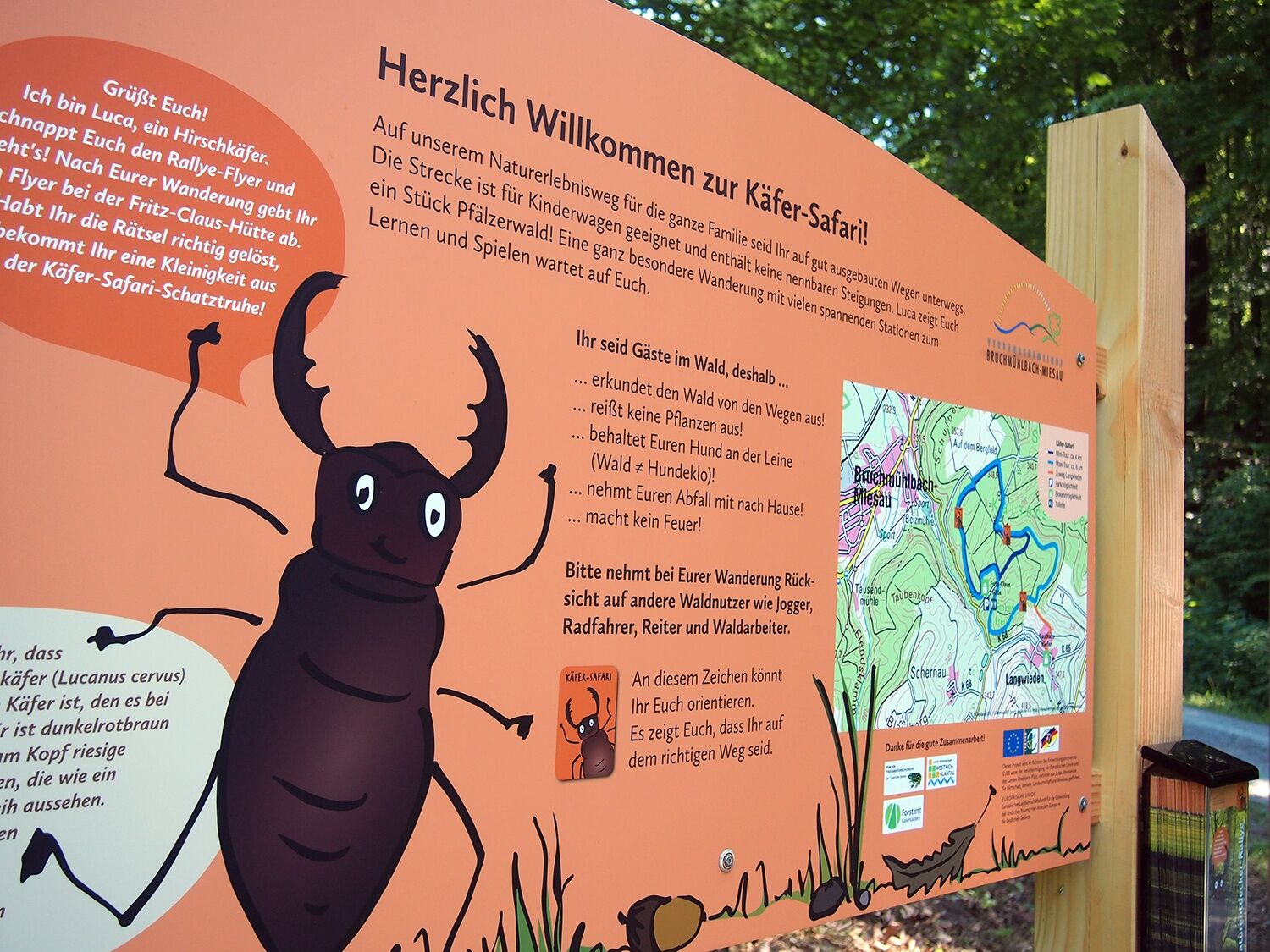

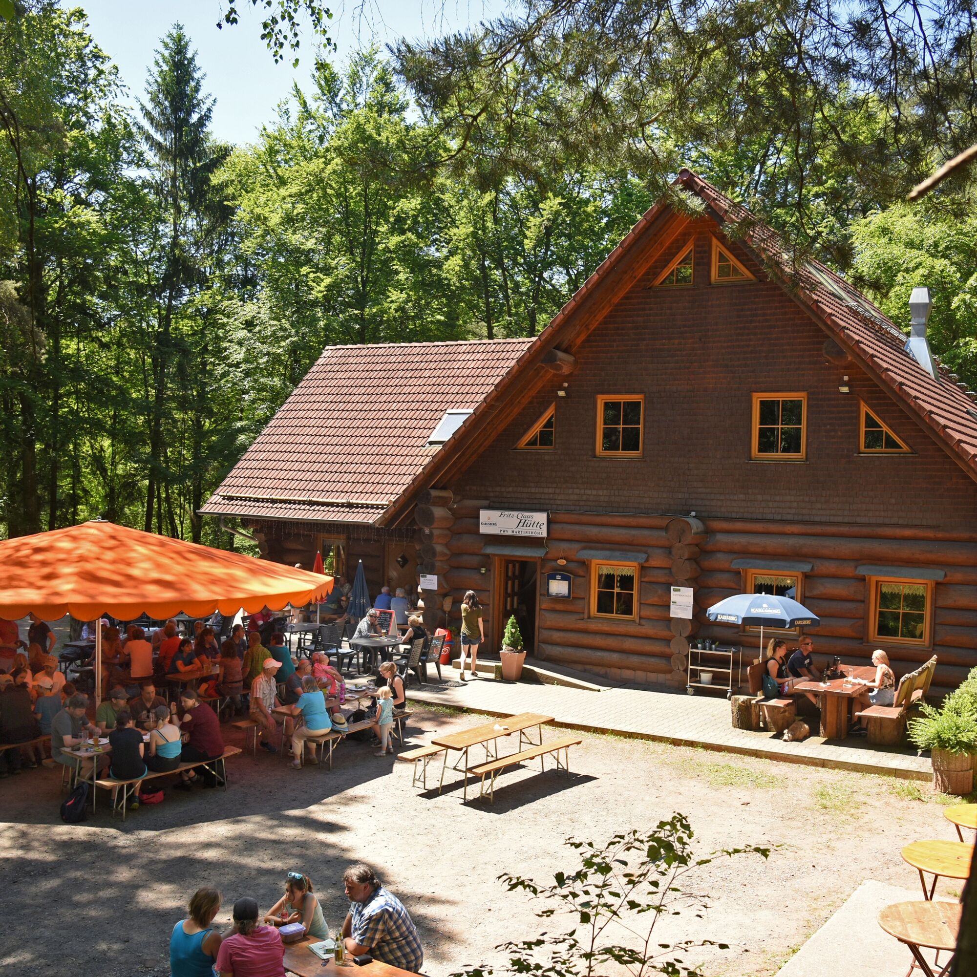
Starting point of the Beetle Safari is the hiking car park at the Fritz-Claus Hut. To the east you will see the overview board of the nature discovery trail. (You will also find the flyers for the route here.)
TIP: Use the starting point for a souvenir photo with your family at our photo board.
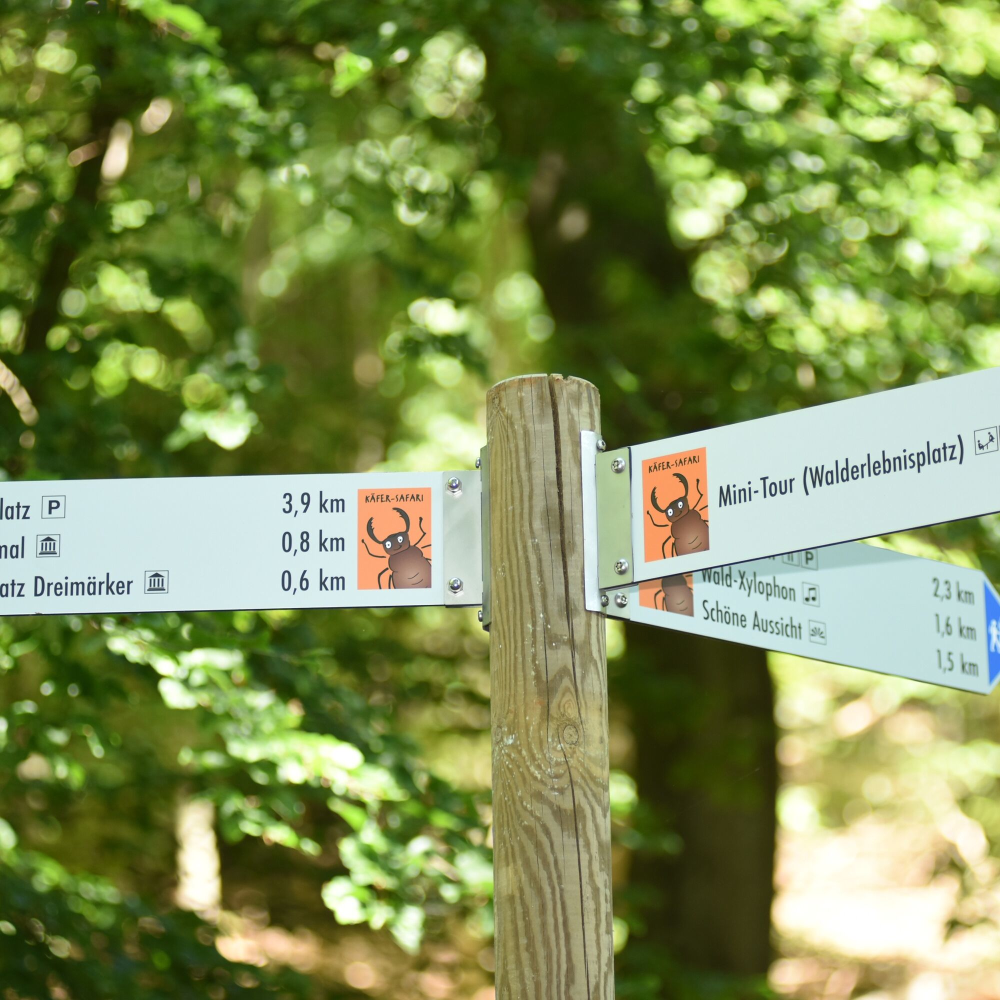
From here follow the gravel path for about 300 meters. Then turn left onto a forest path until you reach the second station. Following a left curve you will soon encounter the sports trail. Turn left and then keep right again.
From now on you can test your fitness at the sports stations in the middle of the forest. When the forest clears, you have reached the so-called "Bergfeld". This agricultural area located at altitude is the largest of its kind in the region.
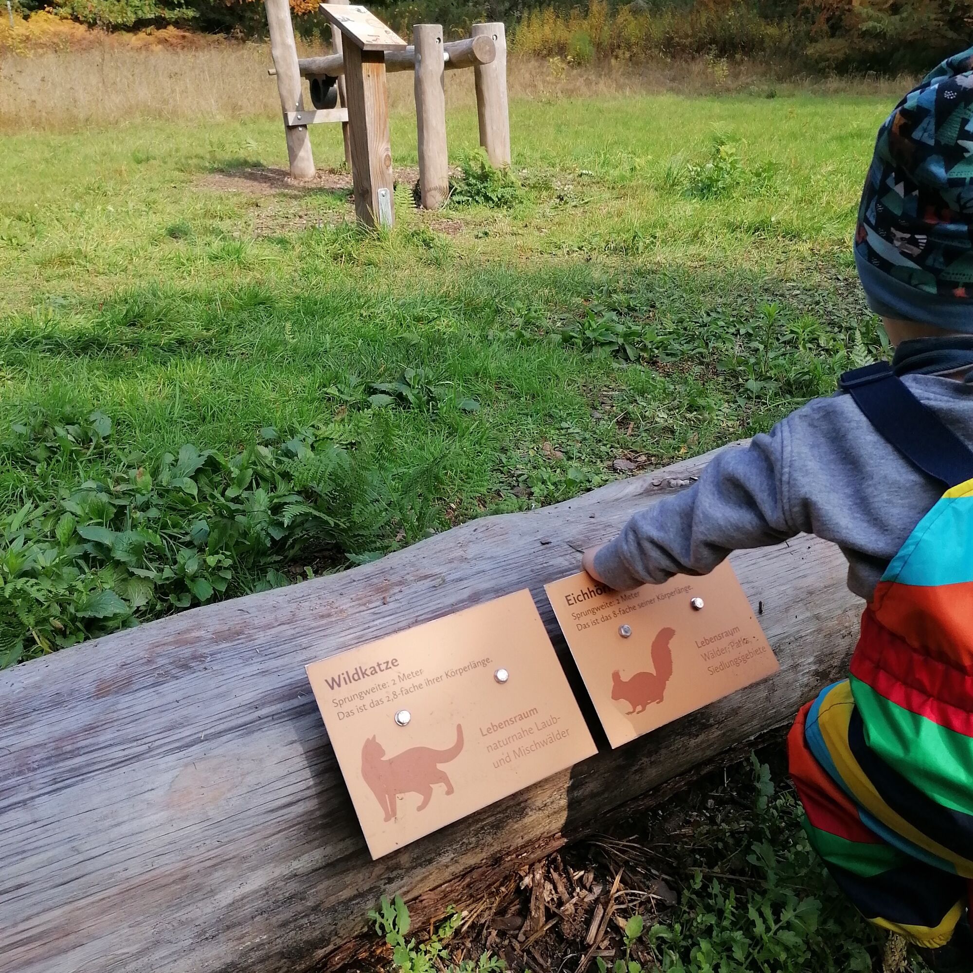
Along the field you will reach, shortly before the Beetle Safari turns right back into the forest, a bench and the third station. Here you can discover the animal sounds of some native forest inhabitants with your children.
The wide forest path leads you to the next station at the "Dreimärker". At the boundary stone, you have the opportunity to listen to the sounds of nature in peace and relax. Luca the stag beetle offers a great game tip at the relaxation lounger.
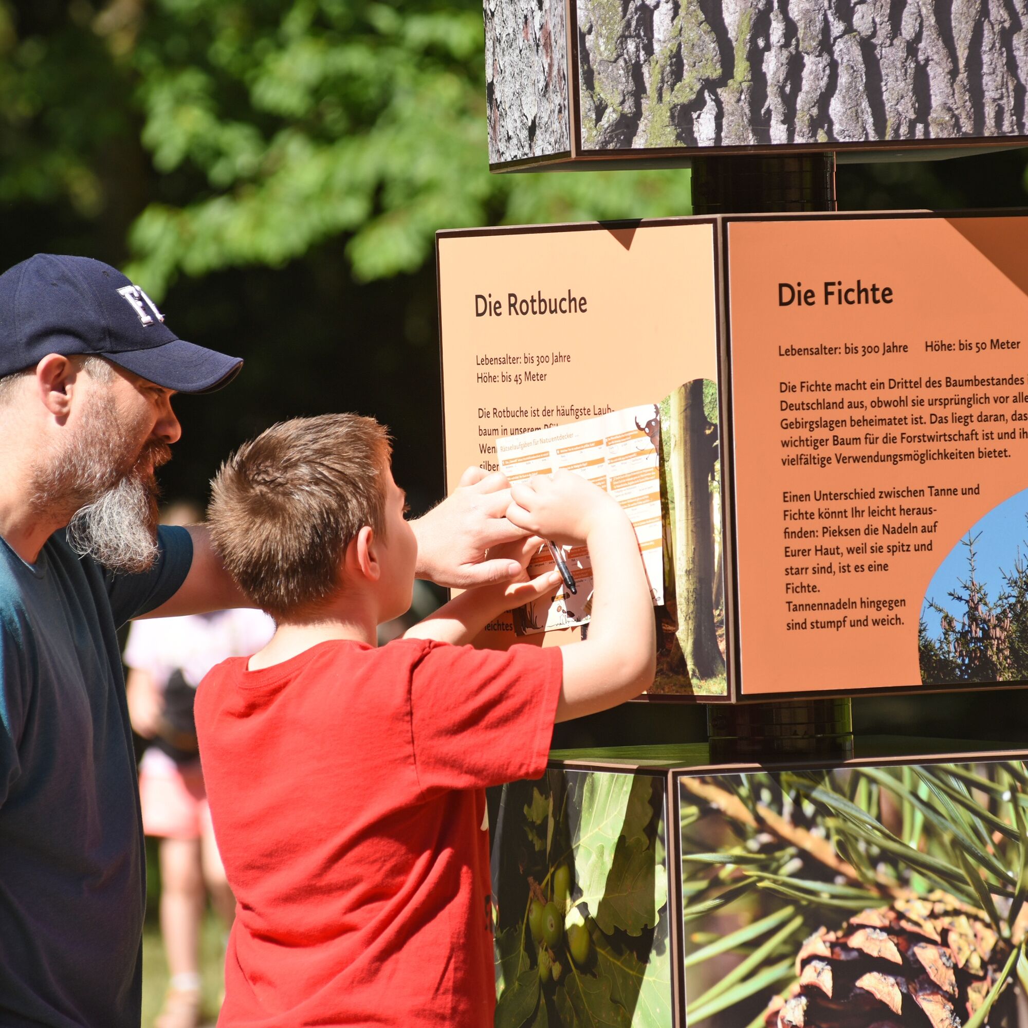
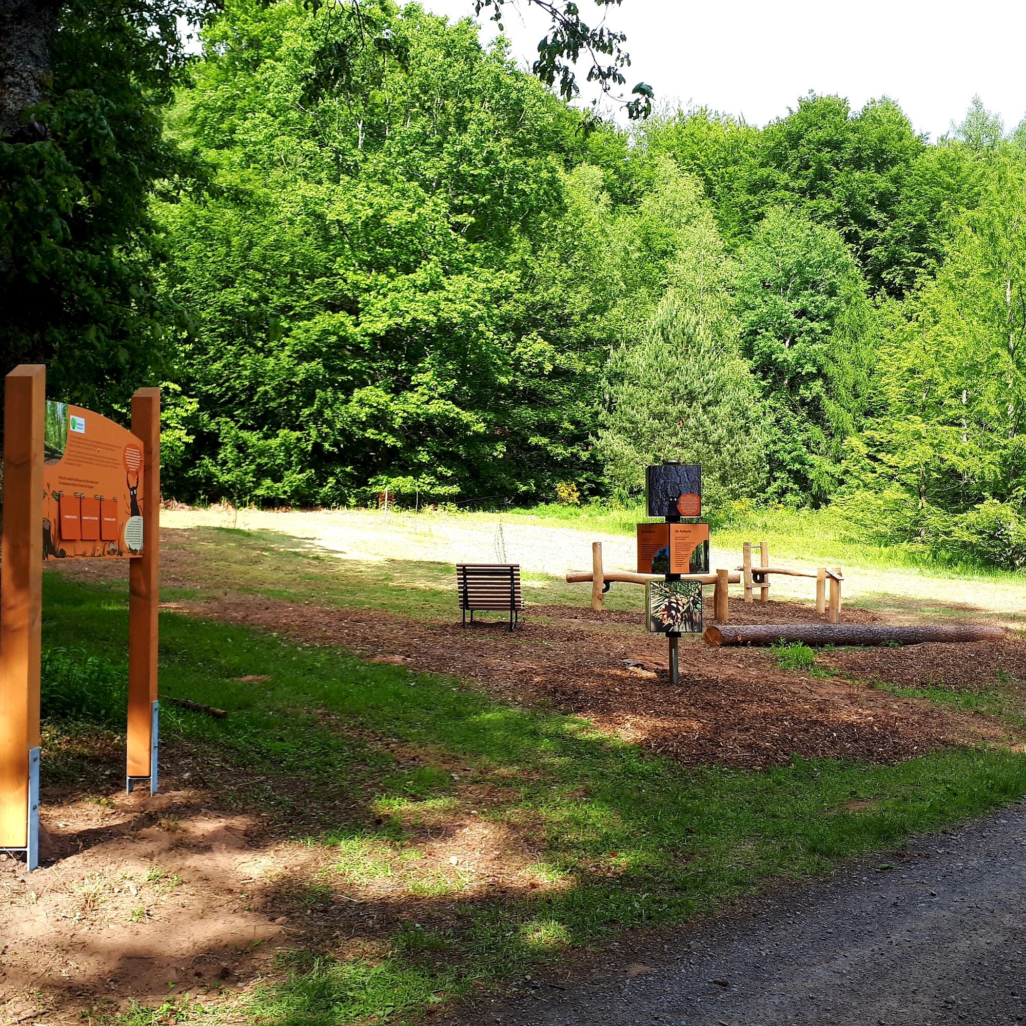
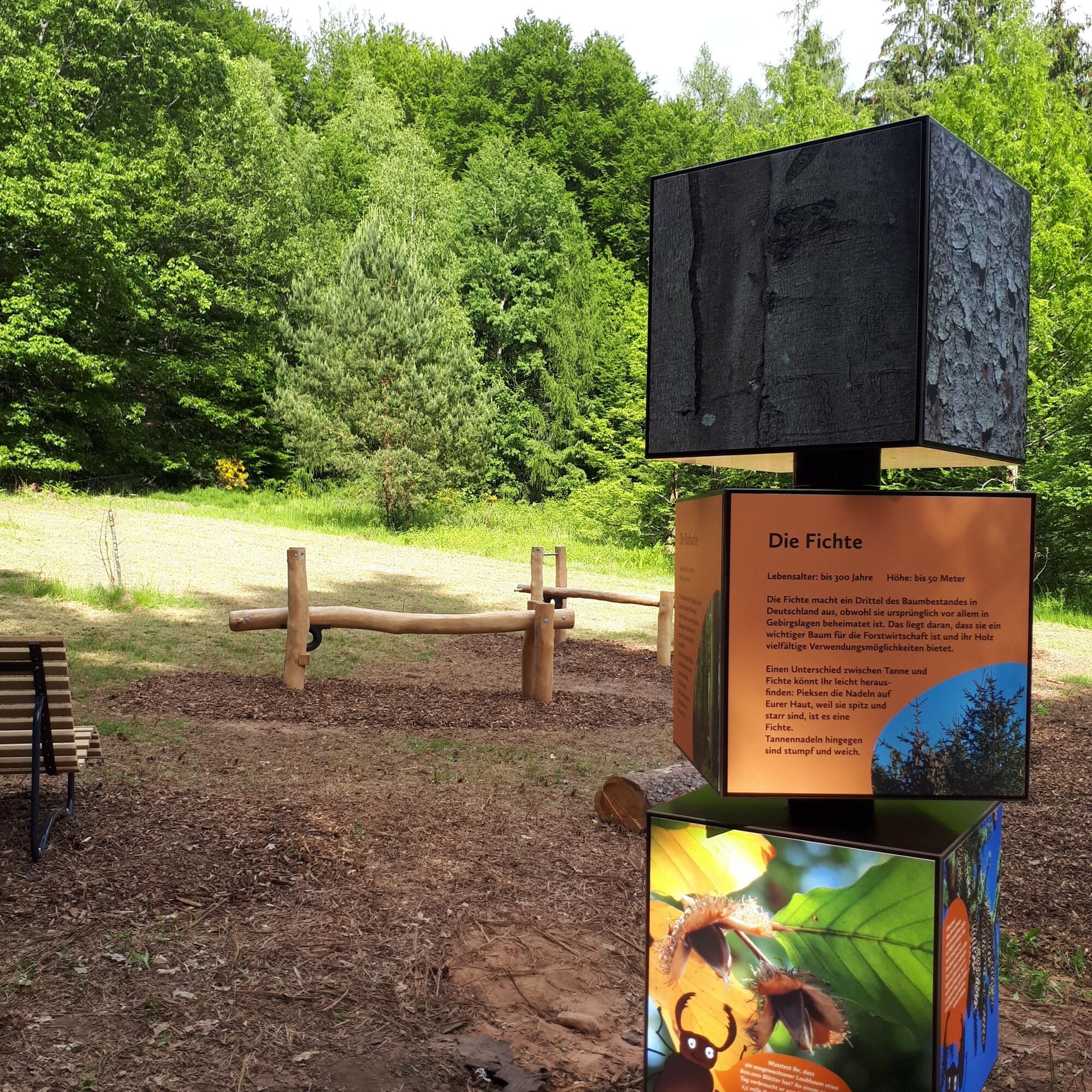
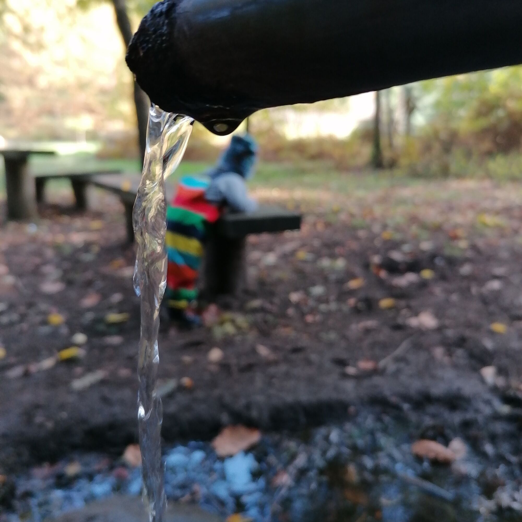
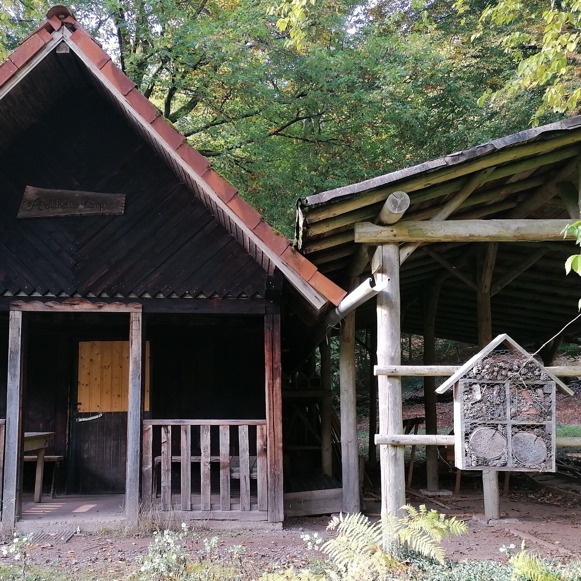
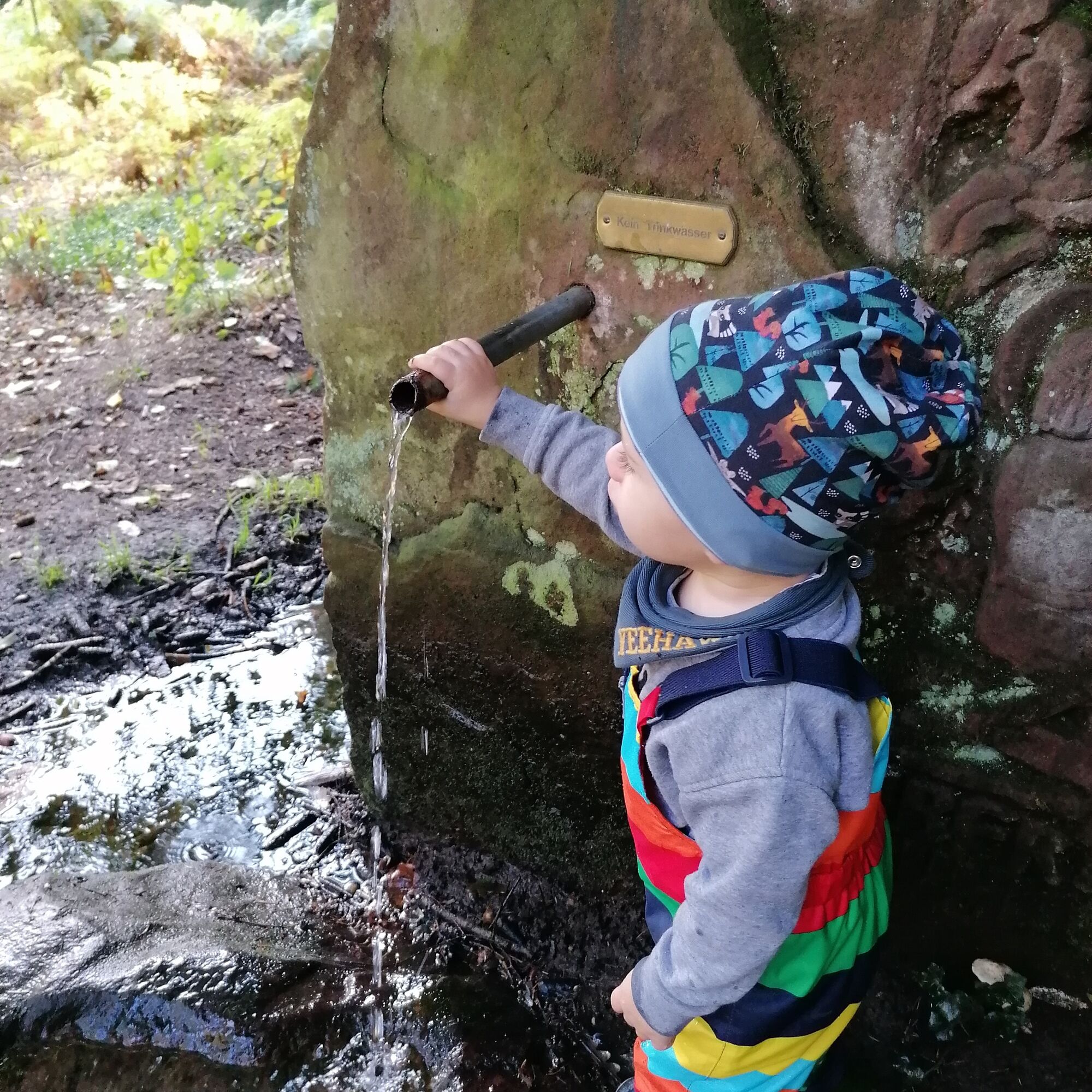
Continue along the wide gravel path towards the Hubertus fountain / forest experience area. There you will find picnic areas and can discover the nature stations. A mud hole invites you to play at the Hubertus fountain. At the animal long jump and the weightlifting stations, you can measure yourself against the abilities of the forest inhabitants and at the tree dice you can demonstrate what you know about trees. Questions about the work of the foresters are answered on the information board of the forestry office.
If you choose the mini route, from here follow the gravel path past the stations and the right curve. The path leads straight back to the starting point.
If you opt for the maxi route, from the forest experience area continue along the forest road above the clearing. Follow the Beetle Safari further towards Langwieden. Use this section of the path to solve the tasks with the magnifying glass from the nature explorer rally.
After a while, you have the opportunity to visit a beautiful viewpoint. You will have a view of Langwieden and the "Cathedral of the Sickinger Höhe" seen above (church, Martinshöhe). TIP: On some days you can observe horses in the adjacent pasture here.
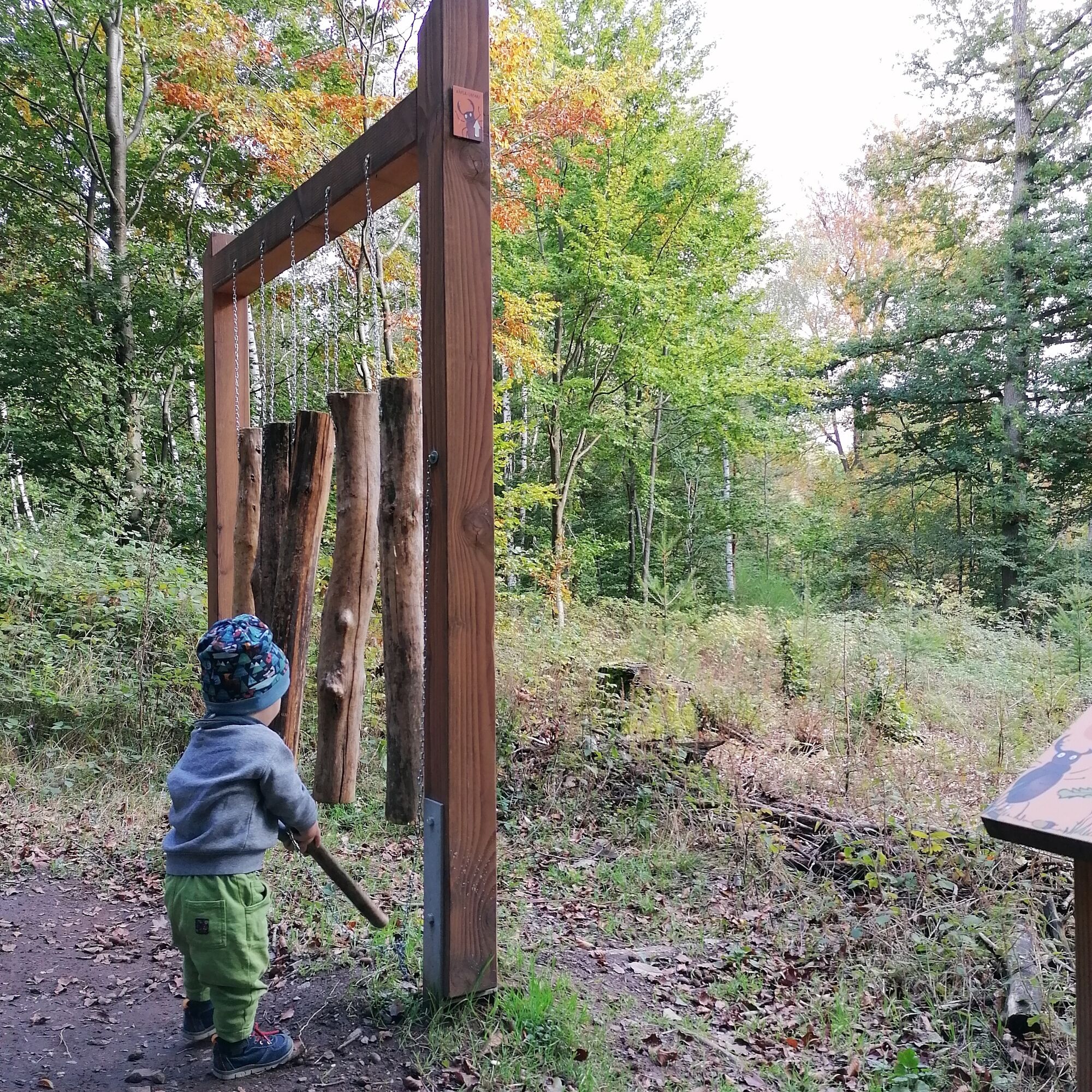
Back on the circular path, you will soon reach the forest xylophone station. Do you know the local trees and their sounds? The final stretch leads you left onto a forest path after 400 meters. Shortly before reaching the car park, you meet the gravel path again, which leads you back to the starting point.
Ja
Ja
For our hiking routes, we recommend the following standard equipment:
- Sturdy footwear
- Weather-appropriate clothing
- Sun and rain protection
- Sufficient supply of food and drinks, as not everywhere has catering or shopping facilities or they may not be open.
- Although the paths are very well marked throughout, for safety reasons always carry a suitable
hiking map so that you can quickly find a safe area, for example in the case of a thunderstorm or emergency.
- Hiking poles recommended.
General information:
Especially in autumn, note that fallen leaves on the ground can conceal uneven surfaces, roots, stones or holes in the path. After thunderstorms or rainstorms, trees may still fall or branches fall afterwards. Especially under adverse weather conditions, natural paths may have muddy and slippery sections. Not all rocks or cliffs are secured with ropes or railings. Sure-footedness is required in places. You must expect path impairments of this kind when undertaking a hike. If you consider certain sections of the path impassable for you, you should avoid them.
NOTE:
We strive to announce all closures caused by forest work or hunting societies on this platform. Nevertheless, there are situations where hiking trails are closed and we may not have been informed. If you unexpectedly encounter a trail closure or detour, please observe the instructions for your own safety.
Coming from the A6 motorway from Saarbrücken or Kaiserslautern, take exit 11 Bruchmühlbach-Miesau. Then turn right onto the L358 following the signs to Bruchmühlbach. Turn left onto Kaiserstraße towards Bruchmühlbach. After passing through the town, turn right onto Langwieder Straße/ L466 towards Martinshöhe. After about 1.8 kilometers the Fritz-Claus Hut hiking car park is on the left side.
Hiking car parks at the Fritz-Claus Hut, between Bruchmühlbach and Martinshöhe on the L 466.
Coordinates: 49° 22' 44" N / 7° 28' 59" E
Ja
Tourism Office Bruchmühlbach-Miesau
Am Rathaus 2, 66892 Bruchmühlbach-Miesau
Tel.: 06372 / 9220106
E-mail:
Internet: www.tourismus-vgbm.de
Pfälzer Bergland
Capture beautiful moments: a photo wall awaits hikers at the starting point. Memories can be shared online with others using #beetlesafari.
Populære turer i nabolaget
-
Bruchmühlbach-Miesau - Sagenhafter Waldpfad
middelsVandring 17,8 km -
3,0
Bridges - Dream Tour Diamond
tungVandring 15,2 km -
Flower Garden Loop
middelsSykling 34,0 km -
4,0
Börsborn - Von-der-Leyen-Weg
middelsTemaløype 12,2 km -
Waldmohr - Rundweg Verladerampe
lysVandring 6,40 km -
Altenkirchen - Cherry Land Path (circular route - 22.6 km)
middelsTemaløype 22,5 km -
5,0
Kottweiler-Schwanden - Kottenweg
middelsTemaløype 16,2 km -
Börsborn - Muhleichenweg
middelsVandring 11,3 km -
Pfälzer Seentour
middelsSykling 60,9 km -
Henschtal - Eichhörnchenweg im Hodenbachtal
middelsVandring 8,18 km
Vandring og sporing


Ikke gå glipp av tilbud og inspirasjon til din neste ferie
E-postadressen din har blitt lagt til på adresselisten.