


Points of interest :
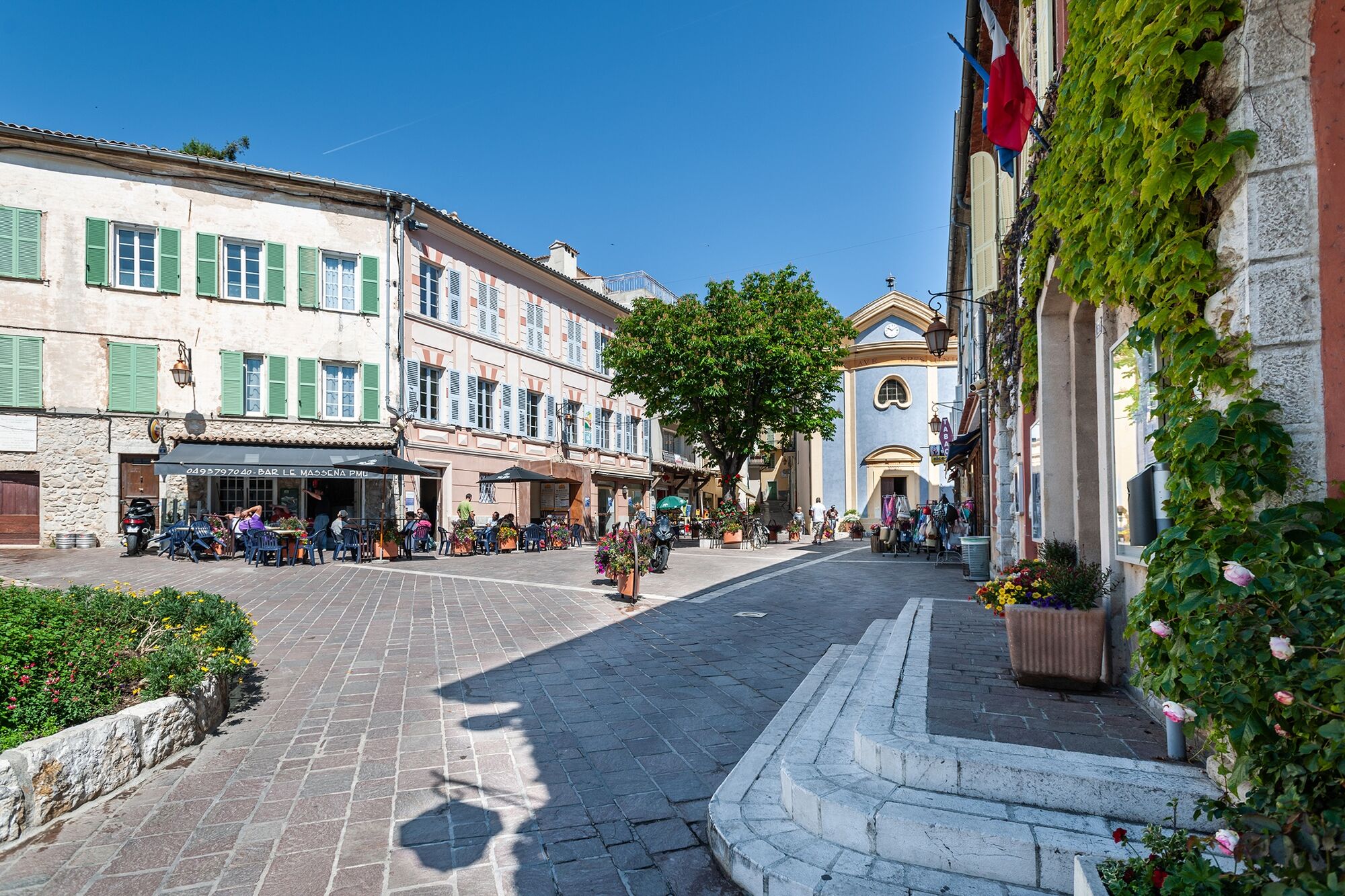
The village and its signposted trail: Discover the village and its treasures with a treasure hunt! Pick up a brochure of the monuments along the way from the tourist office. Cailletier...Points of interest : The village and its signposted trail:
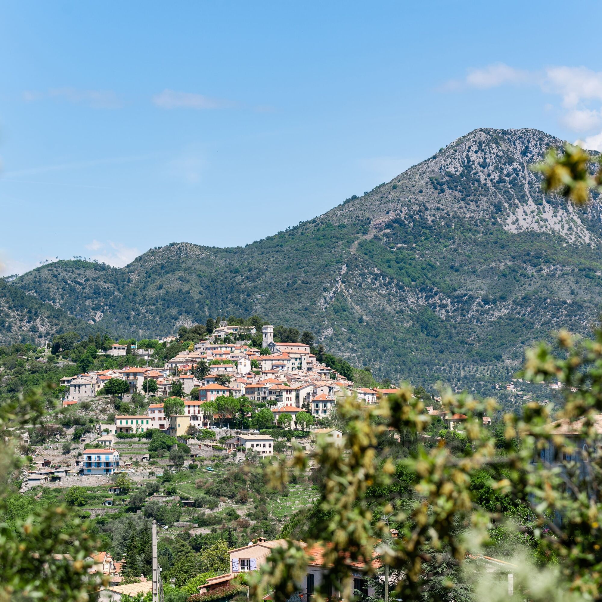
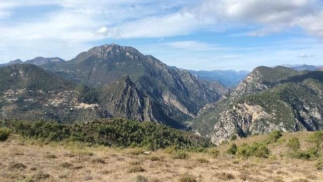
Discover the village and its treasures with a treasure hunt! Pick up a brochure of the monuments along the way from the tourist office. Cailletier olive trees: this ancient variety, originally from the Alpes-Maritimes, is grown in Levens. Its olives, known as "caillettes" or "olives de Nice", are elongated ovals with tasty pulp, green then black when ripe. Calades: Stones were once tightly packed together to block each other, creating "calades" or cobbled paths of communication. Enjoy the quality of the path leading down from the village and in the Sargier area, and appreciate how each stone has stood the test of time. An equestrian paradise: on the way up to Mont Arpasse, there are several viewpoints over Levens and its large meadow. The panorama from the summit: a view of Mont Férion, Cima, Mont Chauve, the Var valley and the Côte.... A history of folds: The confluence of two rivers, the Var and the Vésubie. Geological curiosity about folding on the right bank of the Var: Alpine surrection.
If you arrive by bus (n°19), go to the parking lot.
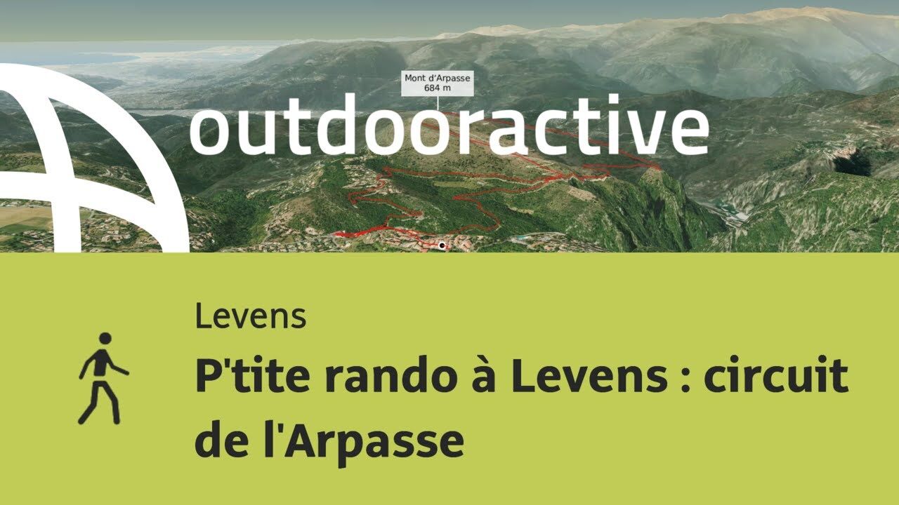
Walk along the parking lot to the pedestrian zone. Continue for 150m, until you see the blue chapel. From Place de la République, turn right at the fountain, into Rue Heraut, then up the stairs (beacon no. 291) onto the "Chemin des Valettes" (gravel and cobblestone) which descends to the south of the village. Follow the road to the right (beacon no. 292), past the forester's barracks. Leave the road at marker no. 293 and climb a wide path which soon becomes flat, before descending on wide switchbacks. Cross the Vallon de l'Albarée and continue to marker no. 294. Head due south on a path that rises to the summit, reaching the highest point of Mont Arpasse (695m, marker no. 295). Cross the plateau to the north, descend towards the pylons, walk 50m and take the narrow path on the right. Follow this ridge path, which offers fine views of Bonson, the Gabre hamlet and Plan du Var, before rejoining the true Levens-Plan du Var path at marker no. 296. Follow this wide path to the right (east), crossing the Arpasse ravine (446m) and rising without difficulty to the small Albarée collet to reach beacon no. 294 again. Take the forest track (due south) which passes through a small chestnut grove at the start of the Albarée valley, before rejoining the route de la Mole (558m). Turn left (north) on this road, which in three twists and turns leads back to the sapeurs forestiers base, from where, on the right (beacon no.292), the Chemin des Valettes leads to the village center.
- Walking shoes are recommended
- Bring a backpack with water, a cap, a picnic or a few provisions, and warm, waterproof clothing.
- Flashlight or headlamp to avoid being caught out by nightfall
- First-aid kit
- Find out about local weather conditions before you leave
- Don't overestimate your abilities
- Inform someone close to you of your destination and departure time.
- Use the paths marked in yellow and respect the direction of travel
- Trails are shared: mountain bikers, horse riders and hunters may also use your route.
- Be an eco-citizen: take back your garbage, be discreet so as not to frighten off wild animals and don't pick wild flowers or plants - a photo is enough of a souvenir,
- Respect private property, cultivated areas and natural spaces, and close gates after you've passed through.
- In summer, when the weather is hot, vegetation is very sensitive to the risk of fire, so don't light any fires - you're endangering your own safety and that of others.
From Nice, take the A8 motorway, then the M18 towards Levens (approx. 35-minute drive).
Bus route n°19 from Nice, "Levens village" stop
The Lignes d'azur network offers a single fare system throughout the Nice Côte d'Azur metropolitan area. Validation is compulsory each time you board the bus, whatever ticket you use. To consult all fares, click here :
At the entrance to the village, free public parking is compulsory (Avenue Edouard Baudoin).
All outdoor activities in the Nice Côte d'Azur region can be found at https://outdoor.nicecotedazur.org
All outdoor activities in the Nice Côte d&039;Azur region can be found at
Populære turer i nabolaget
-
The "Route des Paysages" between the coast and the middle country of Nice
lysMotorrad 147,7 km -
VTT FFC circuit no. 7 - The Olive Trees Loop
lysTerrengsykkel 8,09 km -
FFC mountain bike circuit no. 1: The Mont Chauve route
middelsTerrengsykkel 11 km -
FFC bike circuit no. 5: on the Tour De France routes (big loop)
middelsRennrad 74,2 km -
FFC MTB route no. 25: The summit of Broc
middelsTerrengsykkel 18,9 km -
MTB FFC circuit no. 50: le Calamel
middelsTerrengsykkel 18,0 km -
Utelle - Roquebillière / Pagarine route (stage 4)
middelsVandring 20,0 km -
Nice - Aspremont / Pagarine Route (stage 1)
middelsVandring 15,8 km -
FFC MTB circuit no. 6: The collet des Sausses
middelsTerrengsykkel 7,39 km -
Route n°1 - 2 days - Stage 2 Isola Village - Nice
tungRennrad 139,4 km
Vandring og sporing


Ikke gå glipp av tilbud og inspirasjon til din neste ferie
E-postadressen din har blitt lagt til på adresselisten.