


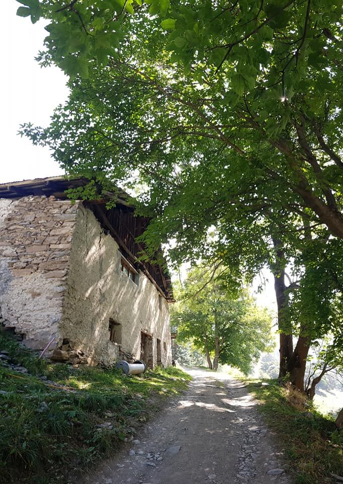
Trail no. 11 to Tachier is an easy single track through the forest and is one of the easiest and most popular trails in Sauze d'Oulx. The flat terrain of the first part to Tachier becomes more challenging...
Trail no. 11 to Tachier is an easy single track through the forest and is one of the easiest and most popular trails in Sauze d'Oulx. The flat terrain of the first part to Tachier becomes more challenging on the way to Malafosse Alta. In fact, the dirt road that links the two hamlets is steeper in places.
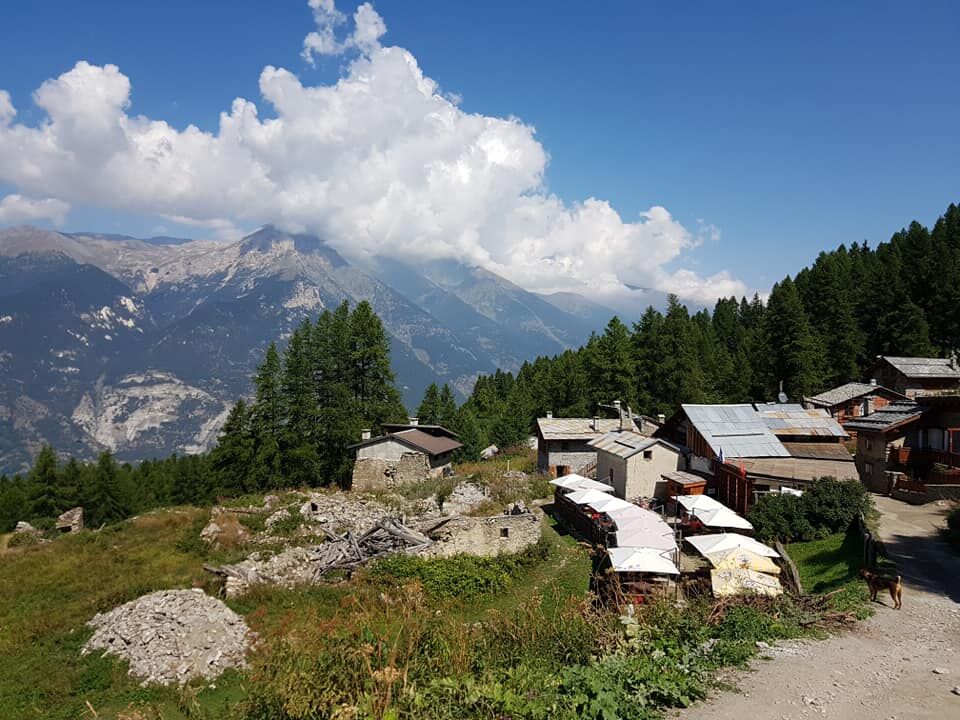
After this short stretch, however, the road flattens out and the path leads to Malafosse Alta, immersed in an enchanting woodland setting, where in summer you can buy excellent cheeses at the malga.
For those who prefer an easier walk, it is also possible to take the cart track that starts just above the path and runs alongside it.
Assistance and technical description by Barbara Demonte - environmental guide.
From the centre of Sauze d'Oulx, walk along the first part of via Clotes and continue along via Miramonti to piazzale Miramonti. From here, turn left and take the flat road to the right that leads to the start of the Sportinia chairlift (via Prariond). Follow the road until the second bend and descend to the car park on the right, slightly lower than the road. The entrance to the path is at the very end of the car park. After about 40 minutes' walk you will reach Borgata Tachier.
Ja
Ja
Wear clothing and footwear appropriate to the environment and season.
From Turin follow the signs for Tangenziale Nord in the direction of Trafori - Frejus. Then take the A32 motorway in the direction of Bardonecchia and exit the motorway at the Oulx bypass signpost, in the direction of Monginevro Sestriere. At the end of the first tunnel, continue on the left towards Sauze d'Oulx.
Train from Turin P.N to Bardonecchia (Oulx-Cesana-Claviere-Sestriere stop
Bus arrives line 285 from Oulx to Sauze d'Oulx.
Sauze d'Oulx P.le Prariond near the start of the Sportinia chairlift.
Before starting out on any excursion, it is advisable to consult weather bulletins or ask the local Tourist Offices for information. It is good practice not to undertake a hike alone, always inform yourself of your destination.
Do not throw rubbish into the environment but take it with you, collecting any rubbish left by others.
The hiking times given are approximate and may vary depending on weather conditions and your own abilities.
It is also possible to take the dirt road that starts just above at the main car park, but the road is open to motor traffic and bicycles.
Those who wish can continue on to Malafosse Alta, where there is also an alpine pasture with the production and sale of dairy products, but the path, at least in the first part, becomes a little more demanding.
Populære turer i nabolaget
-
5,0
BARDONECCHIA Decauville
lysVandring 7,29 km -
BARDONECCHIA Colle Sommeiller
middelsTerrengsykkel 25,4 km -
5,0
CESANA T.SE To Fenils (No. 48)
lysVandring 4,29 km -
5,0
BARDONECCHIA Col des Acles - Passo della Mulattiera
tungVandring 6,57 km -
SESTRIERE Assietta Road
middelsTerrengsykkel 43,3 km -
BARDONECCHIA Punta Colomion - Passo della Mulattiera - Pian del Colle Ring
tungTerrengsykkel 25,1 km -
BARDONECCHIA Rocce della Sueur - Tour jaune de Barabbas
middelsVandring 4,12 km -
CESANA T.SE Val Thuras Valley
middelsVandring 7,58 km -
La Via dei Saraceni (Sauze d'Oulx)
middelsTerrengsykkel 33,6 km -
BARDONECCHIA Punta Colomion - Puys - Beaulard Ring
middelsTerrengsykkel 24,7 km
Vandring og sporing


Ikke gå glipp av tilbud og inspirasjon til din neste ferie
E-postadressen din har blitt lagt til på adresselisten.