


Bilder av brukerne våre
-
 © Patrick FresenbergerOpprettet den 16.10.2022
 -
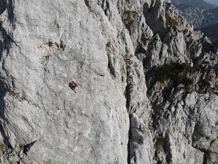
 © Mario ThomaschützOpprettet den 29.05.2025
 -
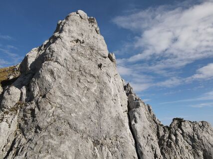
 © Mario ThomaschützOpprettet den 29.05.2025
 -
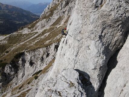
 © G. WalterOpprettet den 14.08.2025
 -

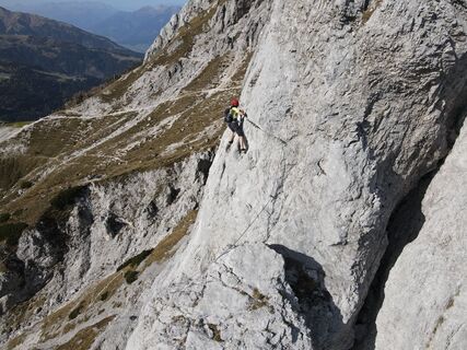
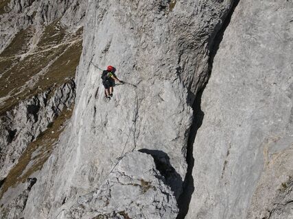
 © Markus RabitschOpprettet den 16.08.2024
 -
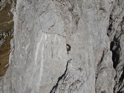
 © Markus RabitschOpprettet den 16.08.2024
 -
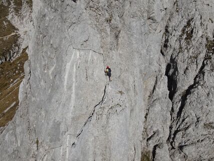
 © Markus RabitschOpprettet den 16.08.2024
 -
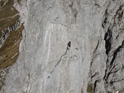
 © Dražen MartinovićOpprettet den 12.09.2023
 -
 © Michael BertholdOpprettet den 29.10.2022
 -
 © Michael BertholdOpprettet den 29.10.2022
 -
 © Michael BertholdOpprettet den 29.10.2022
 -
 © Michael BertholdOpprettet den 29.10.2022
 -
 © Michael BertholdOpprettet den 29.10.2022
 -
 © Michael BertholdOpprettet den 29.10.2022
 -
 © Michael BertholdOpprettet den 29.10.2022
 -
 © Michael BertholdOpprettet den 29.10.2022
 -
 © Michael BertholdOpprettet den 29.10.2022
 -
 © Michael BertholdOpprettet den 29.10.2022
 -
 © Michael BertholdOpprettet den 29.10.2022
 -
 © Michael BertholdOpprettet den 29.10.2022
 -
 © Michael BertholdOpprettet den 29.10.2022
 -
 © Michael BertholdOpprettet den 29.10.2022
 -
 © Michael BertholdOpprettet den 29.10.2022
 -
 © Michael BertholdOpprettet den 29.10.2022
 -
 © Michael BertholdOpprettet den 29.10.2022
 -
 © Michael BertholdOpprettet den 29.10.2022
 -
 © Michael BertholdOpprettet den 29.10.2022
 -
 © Michael BertholdOpprettet den 29.10.2022
 -
 © Michael BertholdOpprettet den 29.10.2022
 -
 © Michael BertholdOpprettet den 29.10.2022
 -
 © Patrick FresenbergerOpprettet den 16.10.2022


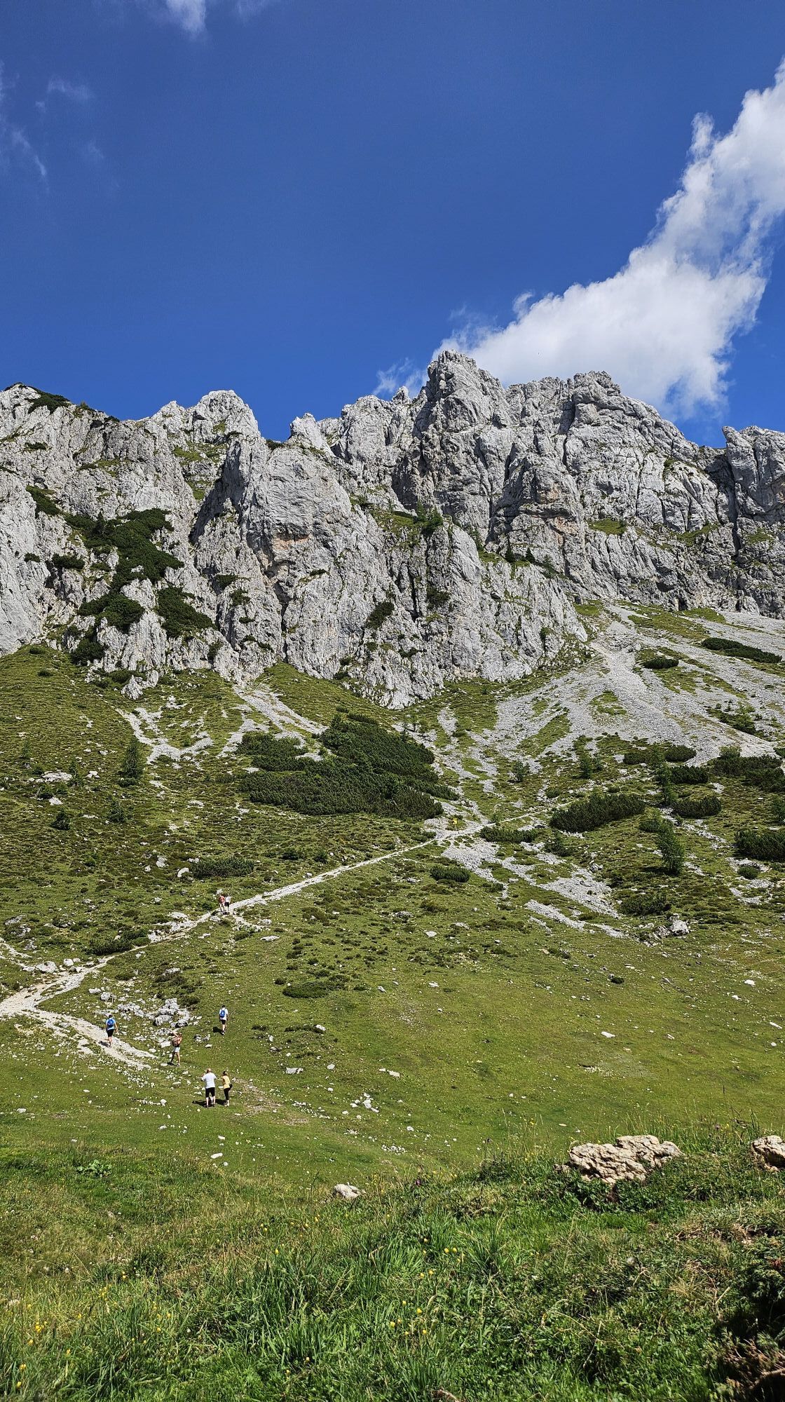
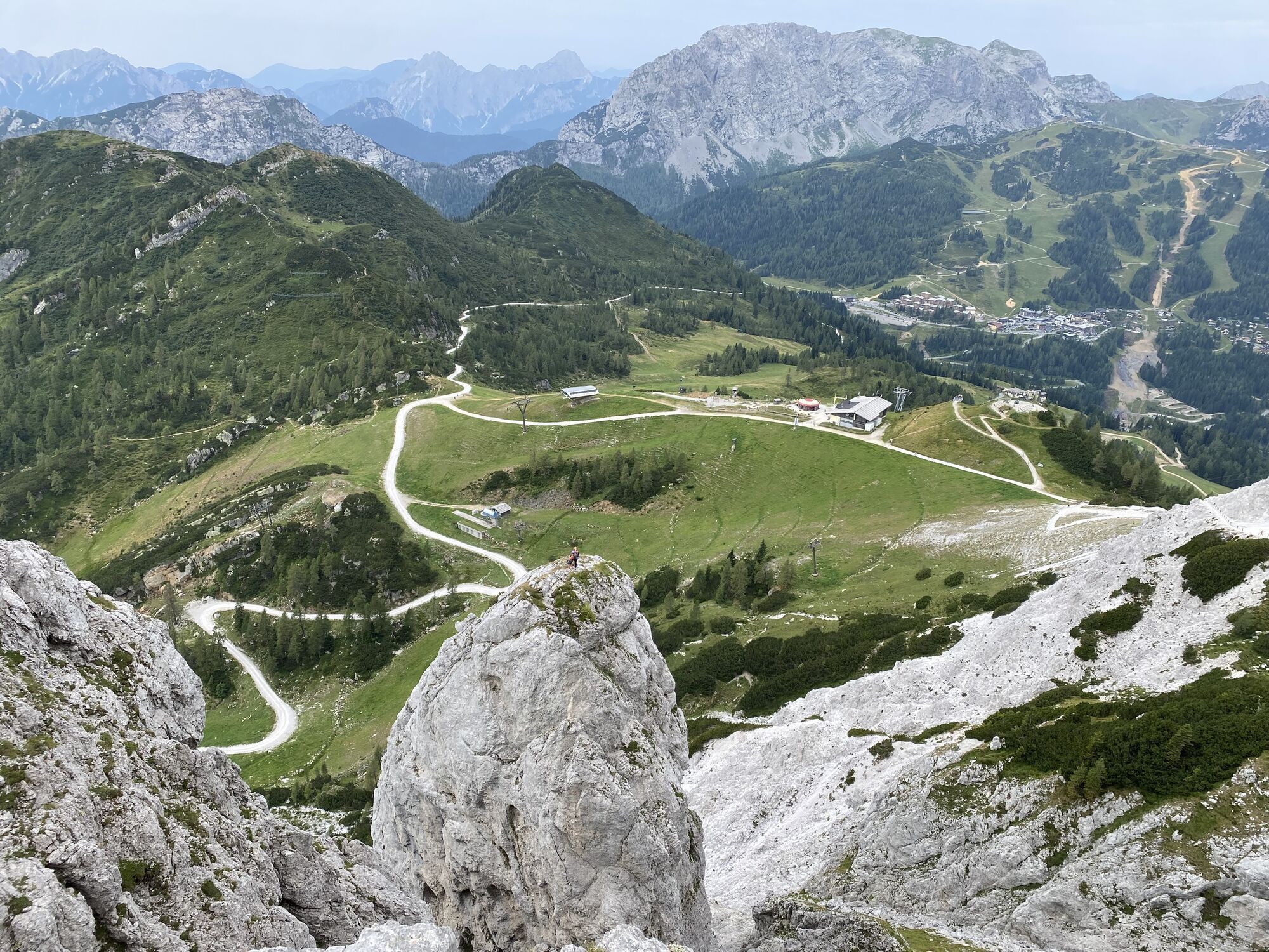
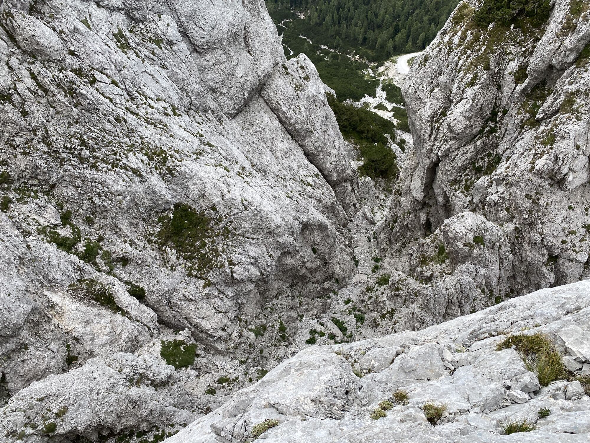


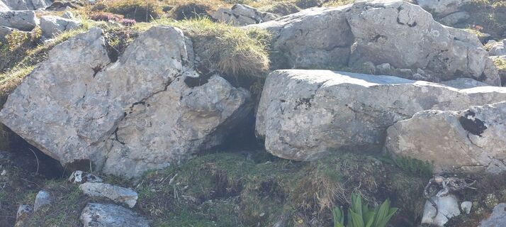
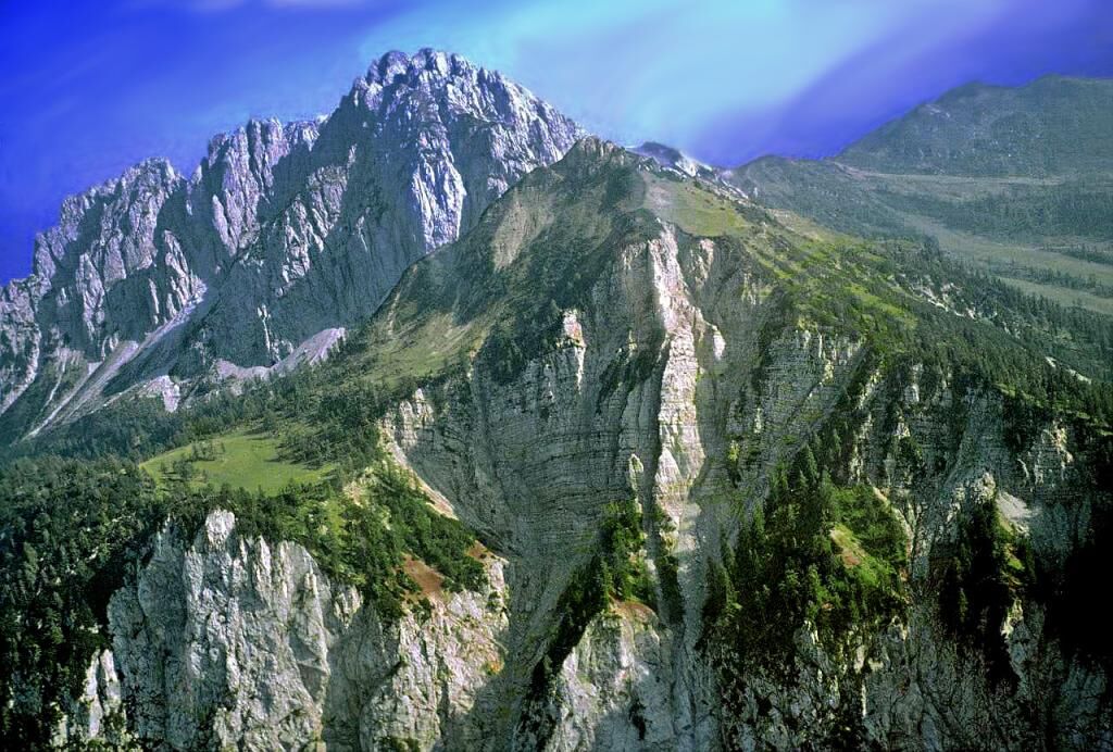
On the way from Watschiger Alm to the Kammleiten, the path crosses shortly before the summit a rock unique to this area. It consists of colorful, decimeter-sized rounded rubble of limestone and dolomite....
On the way from Watschiger Alm to the Kammleiten, the path crosses shortly before the summit a rock unique to this area. It consists of colorful, decimeter-sized rounded rubble of limestone and dolomite. The rock is referred to as “Muschelkalk conglomerate” or Uggowitz breccia and was formed in the Early Triassic period (about 230 million years ago). The 44 m thick rock forms the entire summit of the Kammleiten, only in the lower part is it interlayered with a layer about four meters thick of green volcanic tuffs. These tuffs could be an indication of formation through an earthquake or a volcanic eruption that shook the seabed and lifted parts of the subsoil over the surroundings. Thus, angular rock debris may have accumulated at the foot of the high block, which was reworked, transported, crushed, and rounded near the coast. The consolidation into a conglomerate occurred due to the weight of the overlying rocks.

Ja
via the B90 Nassfeld federal road to Nassfeld, turn towards the valley station Gartnerkofel chairlift
Arrival in Tröpolach is possible by public transport.
www.nassfeld.at/mobilitaet
Gartnerkofel chairlift valley station
Populære turer i nabolaget
-
5,0
RW_N9 Weißenbachklamm
tungVandring 8,16 km -
4,7
Stage 1 - FVG1 Tarvisio - Venzone (C101)
middelsLangdistansesykkelvei 64,7 km -
4,5
Bergstation Weißensee bis Golz
middelsVandring 14,8 km -
3,0
Hermagor: Gartnerkofel
Vandring 7,70 km -
5,0
Möselalm - Weißbriach/Gitschtal
lysVandring 5,12 km -
5,0
Nassfeld Grenze - Gartnerkofel
lysVandring 8,41 km -
4,6
Weißenbachklamm 19a
middelsVandring 5,31 km -
4,1
Malurch Nassfeld
middelsVandring 9,60 km -
4,0
RW_N16 Slow Trail Pressegger See
lysVandring 5,73 km -
4,0
GS_W2 Golz via Kohlröslhütte
tungVandring 19,3 km
Vandring og sporing


Ikke gå glipp av tilbud og inspirasjon til din neste ferie
E-postadressen din har blitt lagt til på adresselisten.