


The premium route P5 Plesse leads as a circular hiking trail with 9 km through the 190 ha large nature reserve Plesse-Konstein and shines with highlights such as the waterfall in Elfengrund (travertine),...
The premium route P5 Plesse leads as a circular hiking trail with 9 km through the 190 ha large nature reserve Plesse-Konstein and shines with highlights such as the waterfall in Elfengrund (travertine), Plesse Tower, and Plesse Rocks (formed by rockfalls in 1640 and 1755), as well as a detour to the National Natural Monument Green Belt Hessen. Enjoy the tranquility at the Elfengrund waterfall and take your time; perhaps you will discover a dipper.

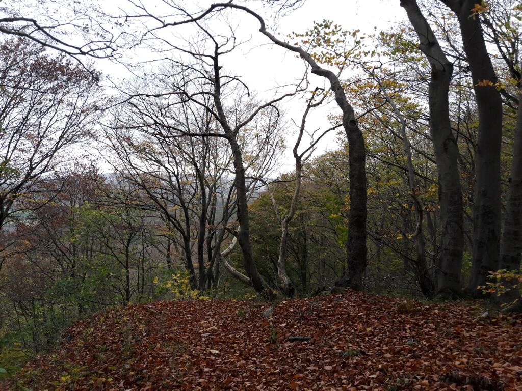

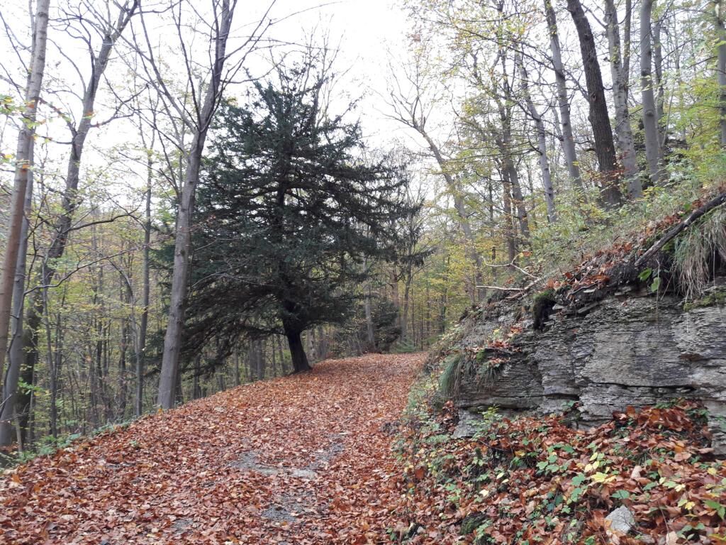


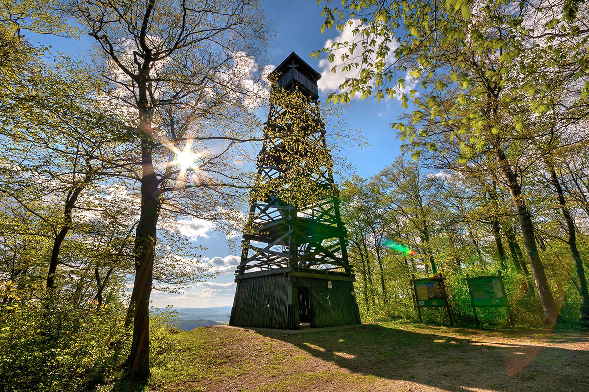
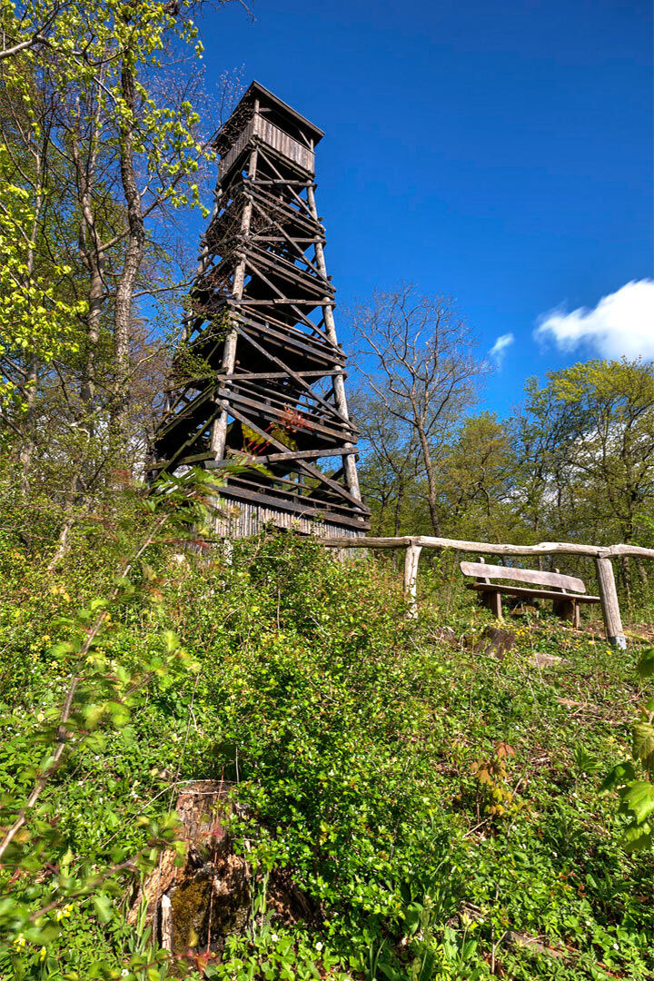

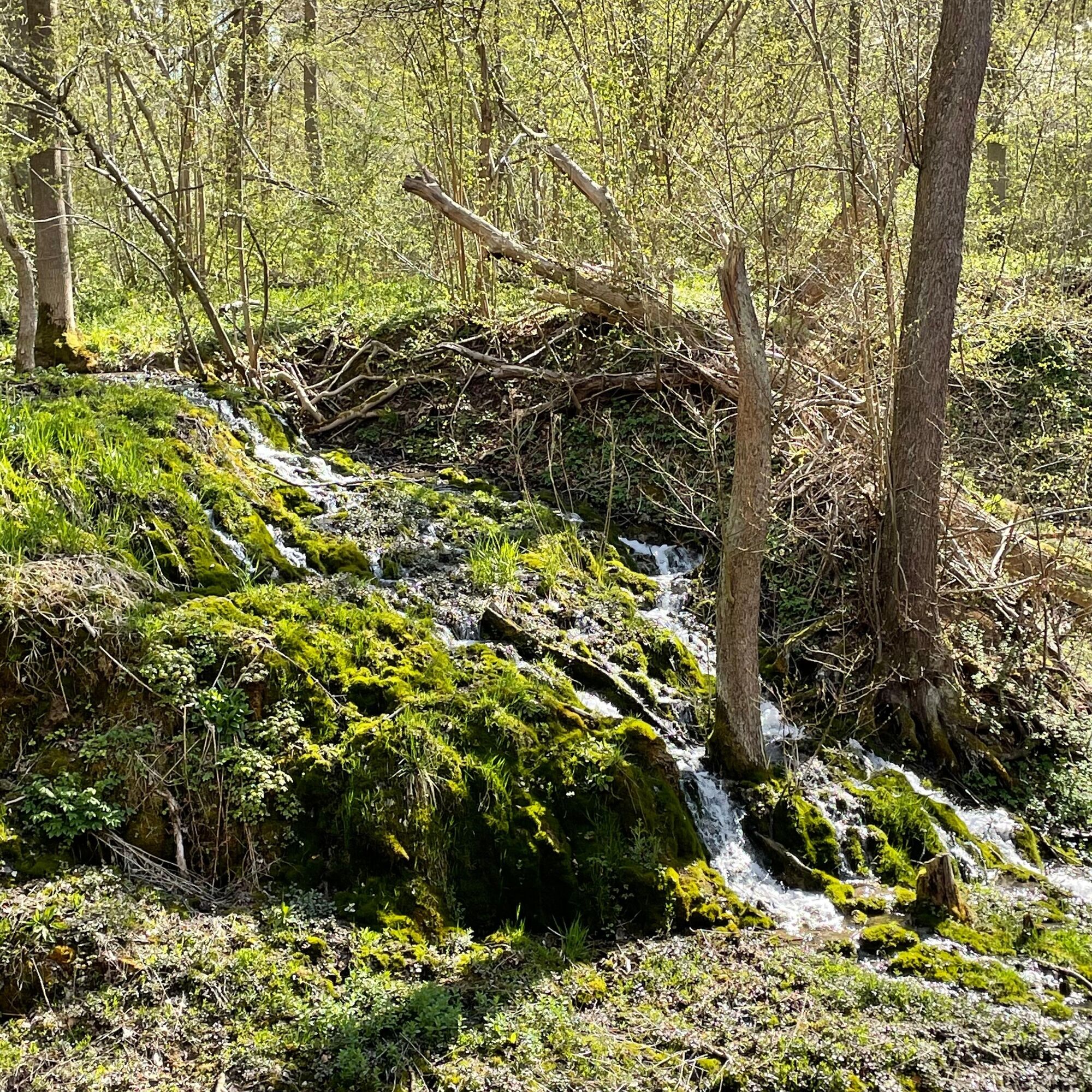
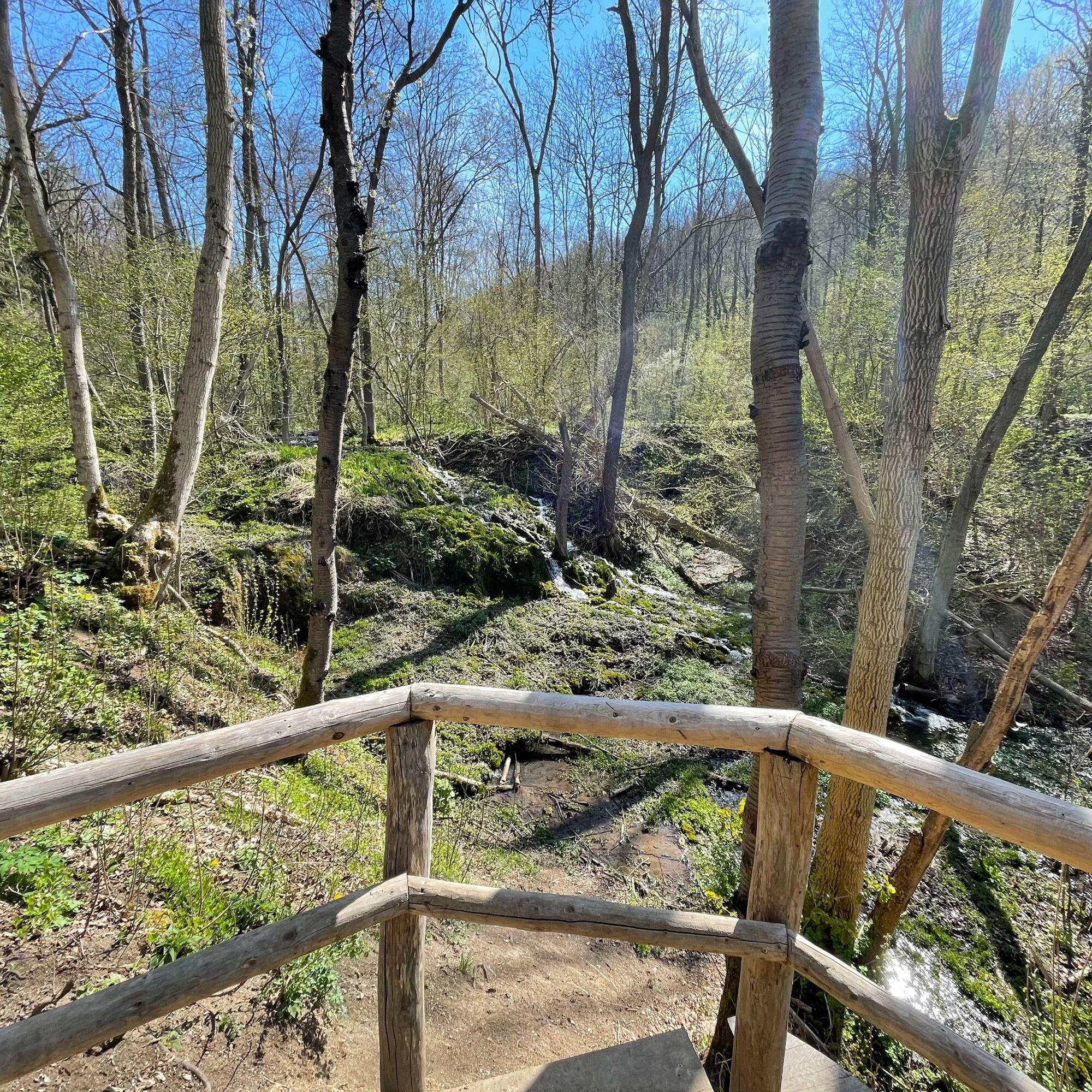
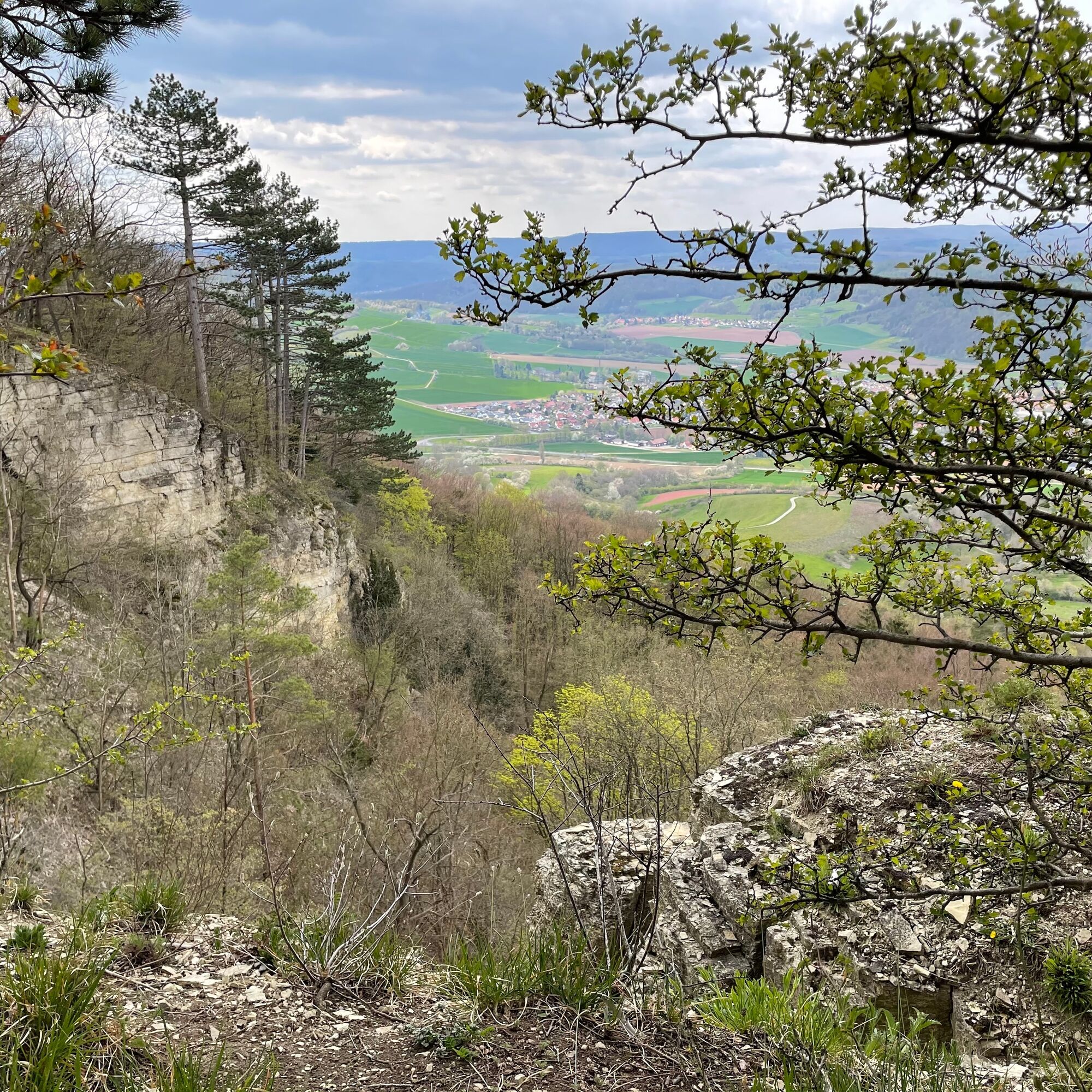
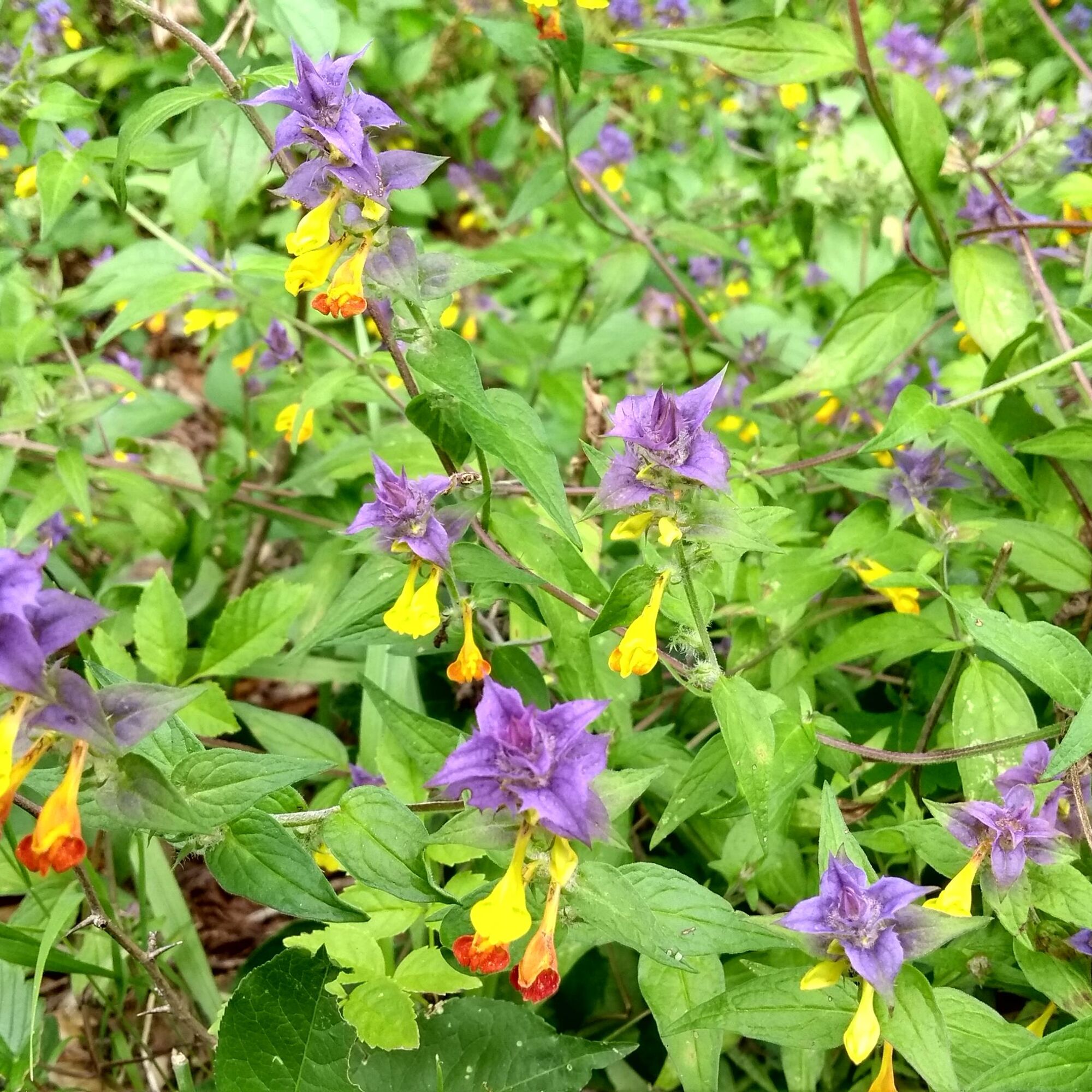

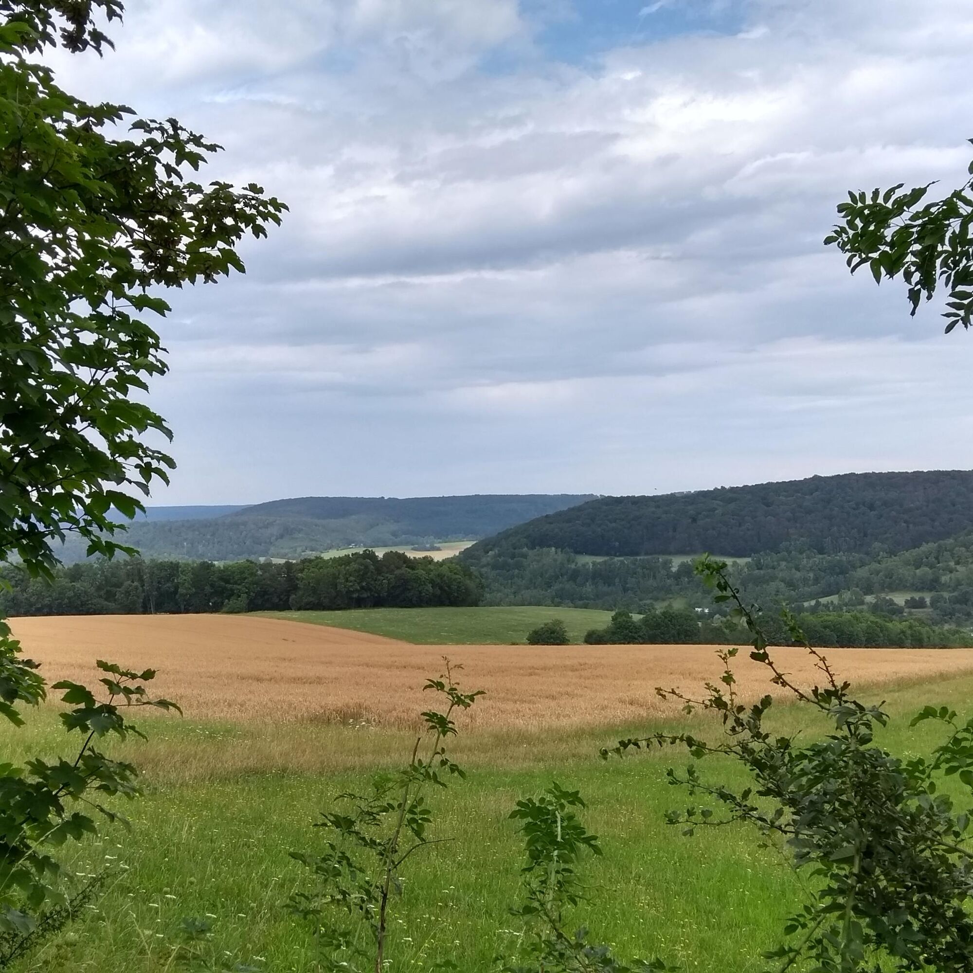
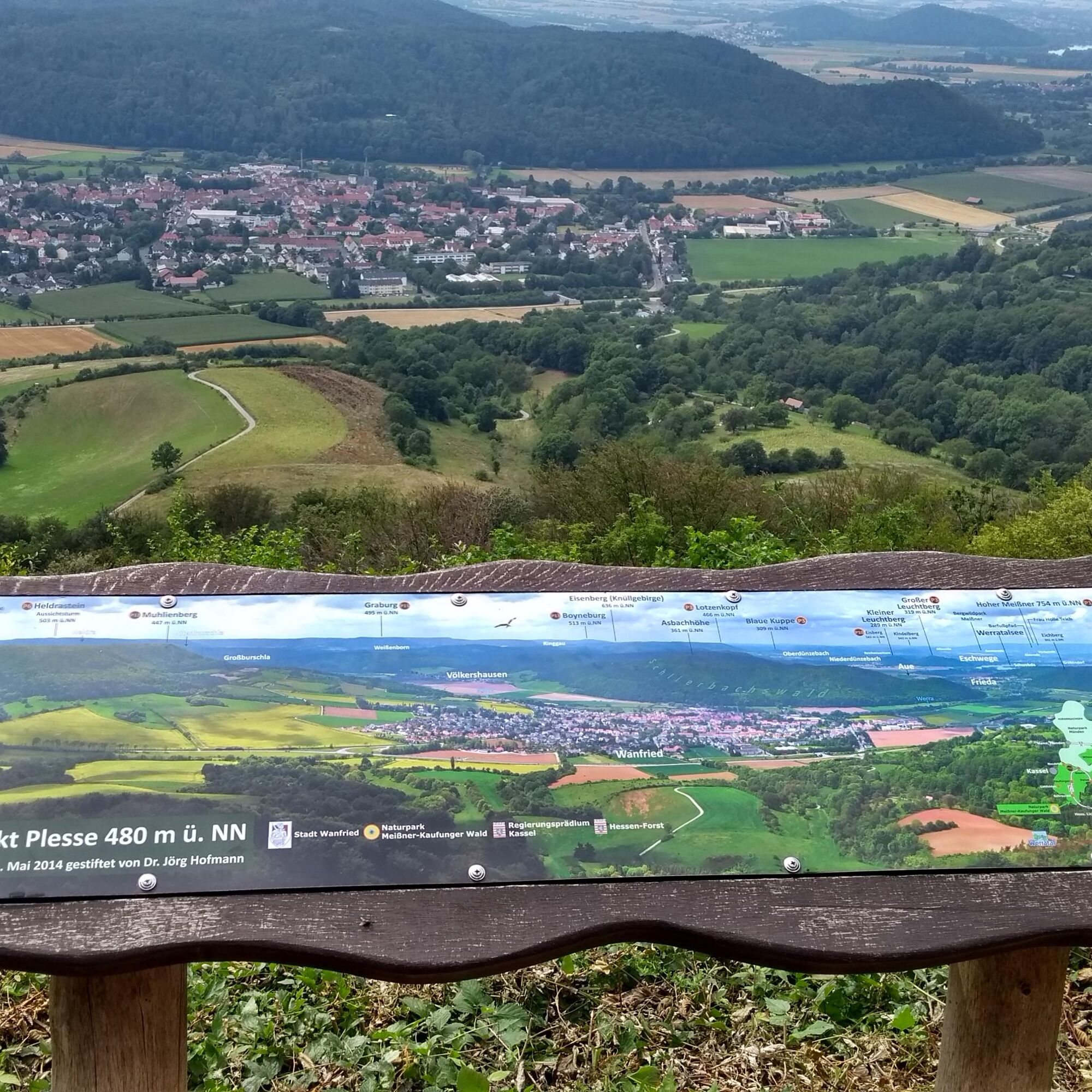
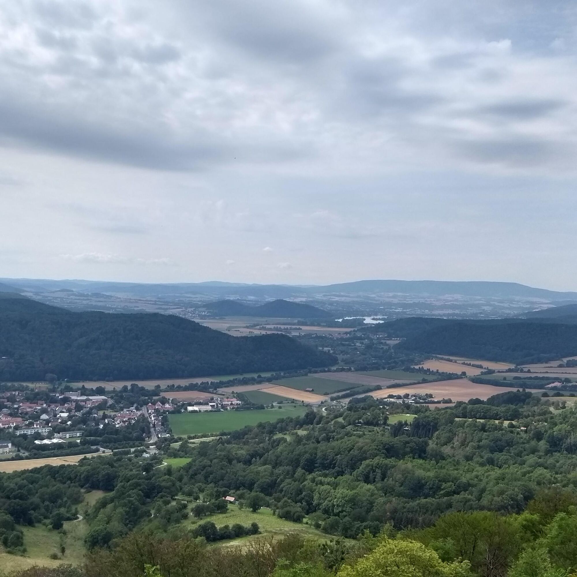
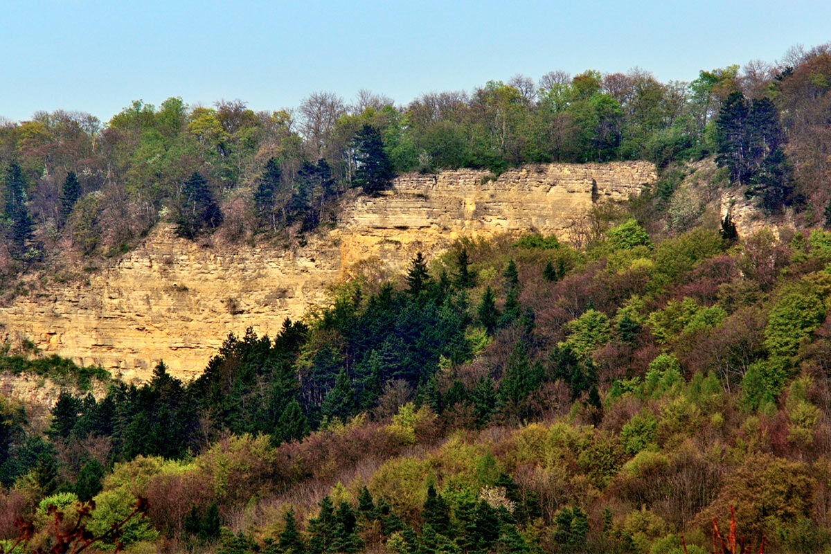
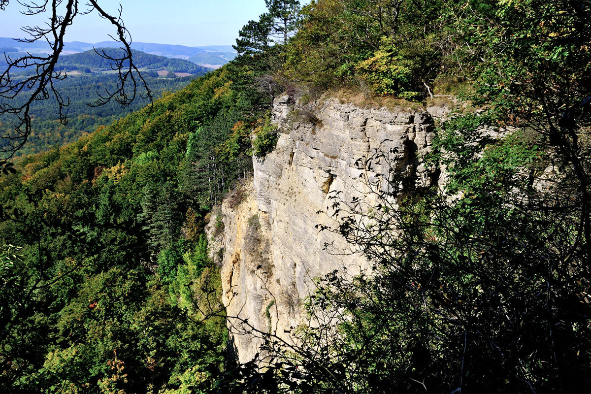

Passing flatland hay meadows, some of which are grazed by sheep, the path from Wanfried first leads to the Elfengrund waterfall. This cascades over travertine and grows higher through biochemical processes. The path leads through species-rich limestone-beech forests. Occasionally, a yew can be spotted. Since 2023, the forest along the premium route has been designated as a natural forest and taken out of management; it is intended to develop into a primeval forest and serve biodiversity. Further along, the path leads directly to and through the National Natural Monument Green Belt Hessen. At the steep wall of the Plesse rock, formed by rockfalls in 1640 and 1755, the peregrine falcon nests, and the rare eagle owl also lives here. On top of this Muschelkalk plateau and its rock and scree slopes, rare plants such as limestone asters, orchids, gentians, and Turk's cap lilies have settled. The viewpoint at and the view from the Plesse tower offers a magnificent view over the Werra valley. The return goes through meadows and forests and past orchards. The FFH area "Plesse-Konstein-Karnberg," through which the P5 partly leads, is part of the biotope network Green Belt and the European Natura 2000 protected area network.
The half-timbered old town of Wanfried is also well worth seeing; it clearly flourished mainly during the Renaissance period, when Wanfried was a harbor especially for the imperial city of Mühlhausen.
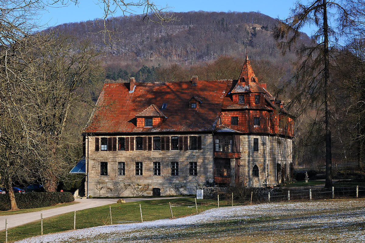
In the premises of the nearby Kalkhof, which can be seen lying in the valley from the path, the Wanfried Agreement between Americans and Soviets was signed in September 1945 and sealed by a common toast with alcoholic drinks. Colloquially, the resulting changed border is called the "Whisky-Vodka line." To ensure the railway line was entirely on American territory, several villages changed their affiliation to the Soviet and US occupation zones.
The route can be extended via the Dietemann path (24) or the circular route 3 Kratzberg.
Overnight accommodation directly on the route :
Hotel-Restaurant Zum Schwan, Marktstr. 20, Wanfried, Tel. 05655 3200061
Rittergut Wanfried, holiday apartments, www.rittergut-wanfried.de
Further accommodation options: www.naturparkfrauholle.land
Ja
Moderate difficulty route, sturdy hiking boots required.
Please observe the current notices at Important notes on current restrictions on our hiking trails (naturparkfrauholle.land)
Navigation: Hiking parking lot Plesseblick, at the end of Plouescatstraße, 37281 Wanfried
Federal road 249
Nearest DB train station: Eschwege Stadtbahnhof.
Route planner of the Northern Hesse Transport Association: www.nvv.de
Bus lines 78, 200, 236, stops Wanfried Stadtpark or Wanfried Bahnhofstraße
Three hiking parking lots are equipped with information boards and free to use. Hiking parking lot Plesseblick, at the end of Plouescatstraße, 37281 Wanfried (with signed access path to P5), hiking parking lot Grillplatz on the outskirts of Wanfried, hiking parking lot Elfengrund on the B249 between Wanfried and Mühlhausen.
Year-round, best time April to October.
Information on accommodation options, excursion tips, guided hikes, and news from the Geo-Nature Park Frau-Holle-Land: www.naturparkfrauholle.land, Tel. 05657 644990 or 0561 1003-1382.
Here you can book an experienced nature park guide to accompany you on your tour.
A detour to the small but worth seeing Renaissance town of Wanfried, where the terminus of the Weser-Werra shipping was once located.
A nice place to stop is at the historic harbor called Schlagd.
Populære turer i nabolaget
-
Premium route P4 Hessische Schweiz - Walkable Green Belt
tungVandring 19,3 km -
Premium trail P6 Heldrastein - Walkable Green Belt
middelsVandring 12,8 km -
Premium route P19 Datterode, Goose Lads' Route
middelsVandring 9,55 km -
Thüringer Fernradwege - 02 - Werratal-Radweg - Etappe 5: Eisenach → Eschwege
middelsLangdistansesykkelvei 62,8 km -
Werra Water Hiking 8: Creuzburg - Treffurt
middelsKajak / Kanu 26,7 km -
5,0
TOP Wanderweg Heyerode
middelsVandring 9,31 km -
Premium route P3 Blaue Kuppe - Eschwege
tungVandring 19,0 km -
Werra-Umland-RadTour👍
lysEl-sykkel 40,3 km -
Rundtour Frankenroda - Treffurt mit Ritterburg Normannenstein
tungTerrengsykkel 33,0 km -
Premium path P12 Mainzer Köpfe - Walkable Green Belt
middelsVandring 9,57 km

Vandring og sporing


Ikke gå glipp av tilbud og inspirasjon til din neste ferie
E-postadressen din har blitt lagt til på adresselisten.