


Vanskelighetsgrad: T4


The proposed loop covers part of the Alta Via dei Rondoi, an incredibly rewarding route that runs among the peaks of the Cavallo - Col Nudo group.
The hike initially climbs along karst slopes through splendid...
The proposed loop covers part of the Alta Via dei Rondoi, an incredibly rewarding route that runs among the peaks of the Cavallo - Col Nudo group.
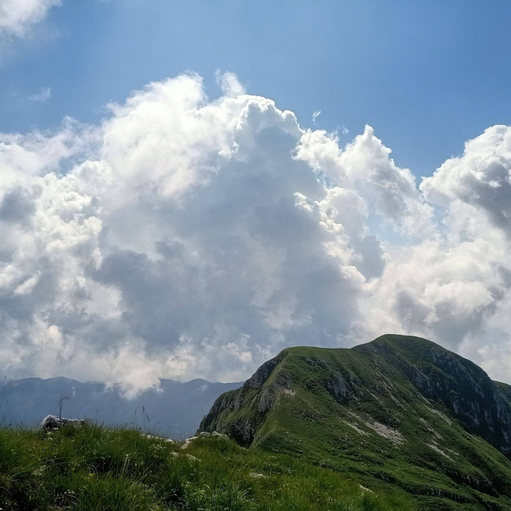
The hike initially climbs along karst slopes through splendid beech woods preceding the meadows of the Val Sughet, an amphitheater enclosed between the mountain group’s peaks, with notable karst phenomena and alpine flora of incredible beauty.
The small valley is climbed entirely up to the Palantina pass at 2055m to continue along steep meadows towards the summit of the Cimon di Palantina.
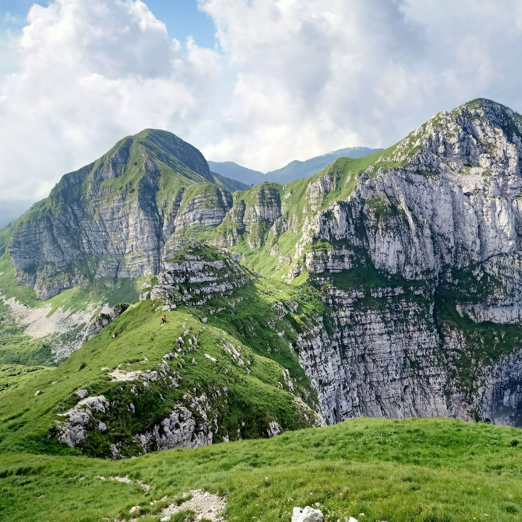
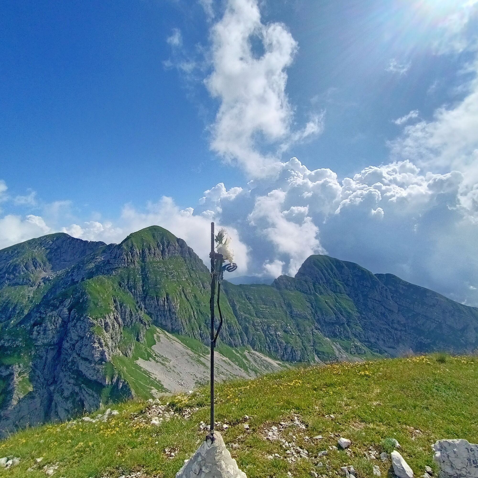
The variety of landscapes and panoramas is remarkable and is also offered in the subsequent expert-only ridge traverse, where encountering some chamois is not uncommon.
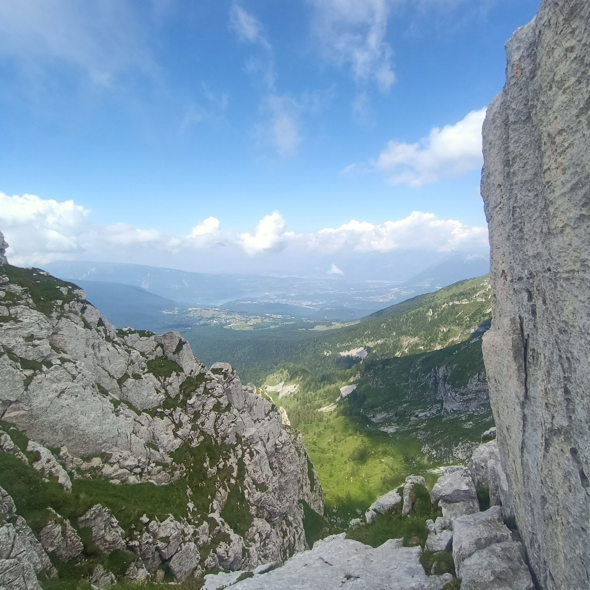
The route descends to the Colombera pass and continues along the northeast face of Colombera with a ferrata section. From the summit, the climbing difficulties decrease and the Tremol, the last peak of the route, offers a panorama reaching as far as the Adriatic Sea.
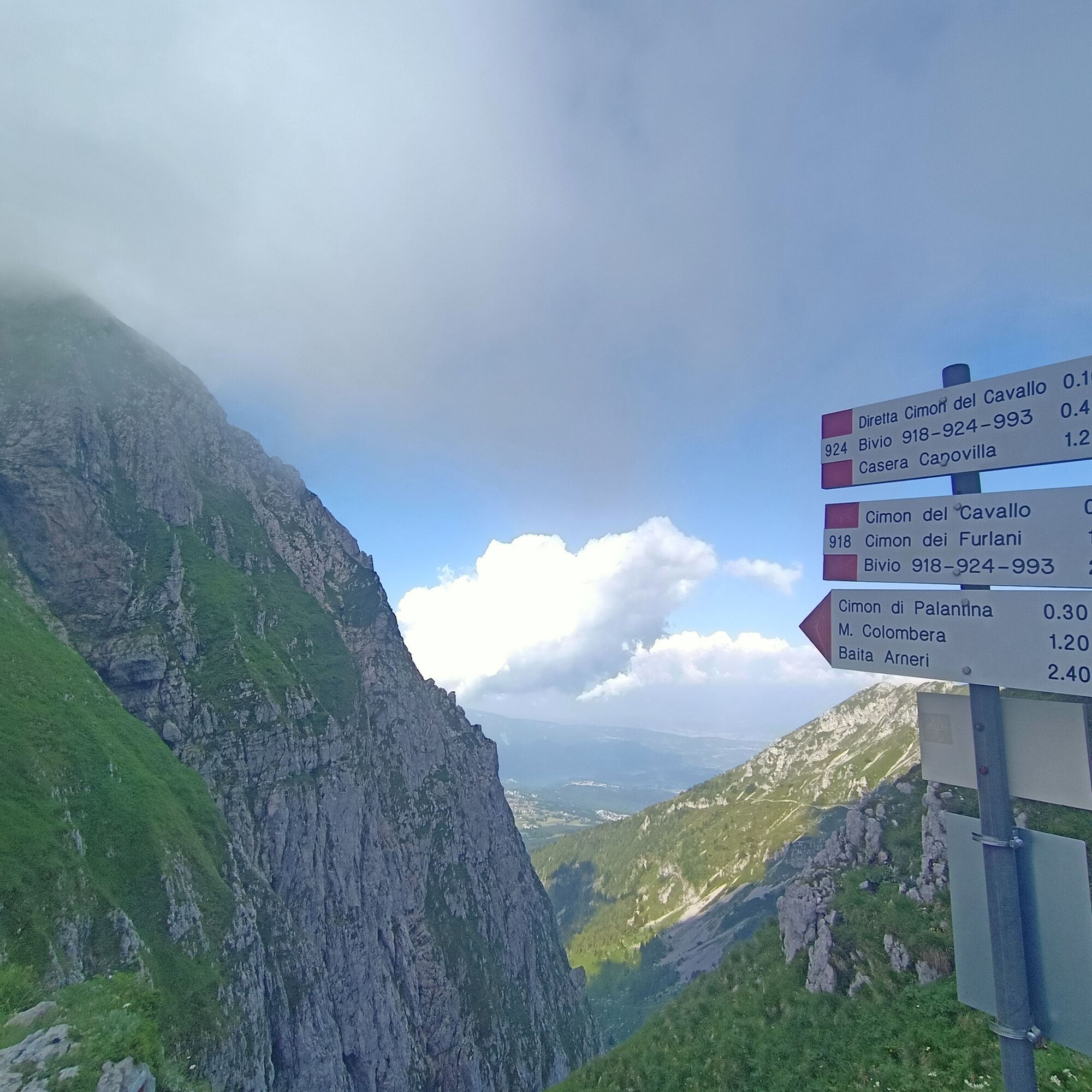
Just past the Piancavallo medical guard clinic, heading towards Casera Capovilla, on the left you will find the signs for trail CAI 924 which climbs uphill through a beech forest towards Val Sughet.
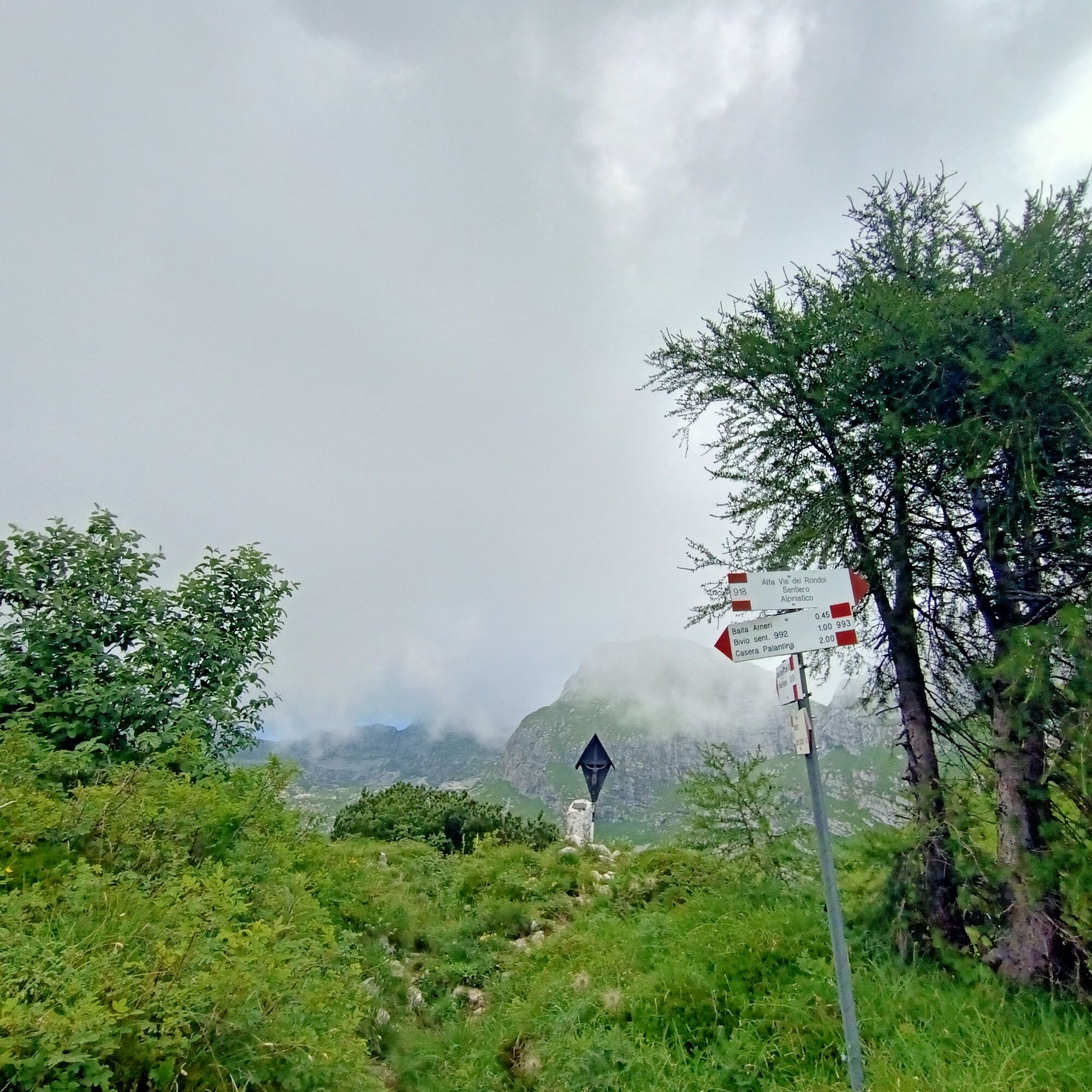
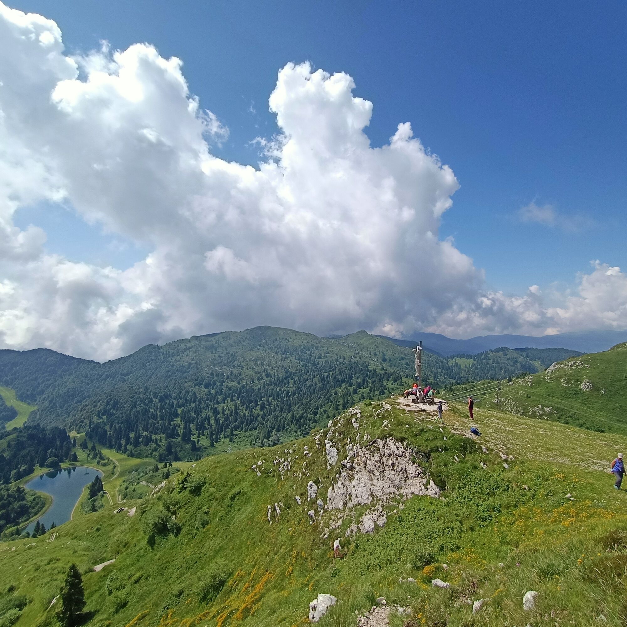
Upon reaching the meadows with a view of the overlying peaks, at a crucifix, continue straight ahead. The path heads for the wide notch of the Palantina pass, staying on the steep right slopes and with a final slightly downhill section reaches the pass.
Continuing straight, ascend the steep meadows, heading southwest, leading to a small pass with large rocks. Turning right, you quickly reach the grassy summit ridge of the Cimon di Palantina.
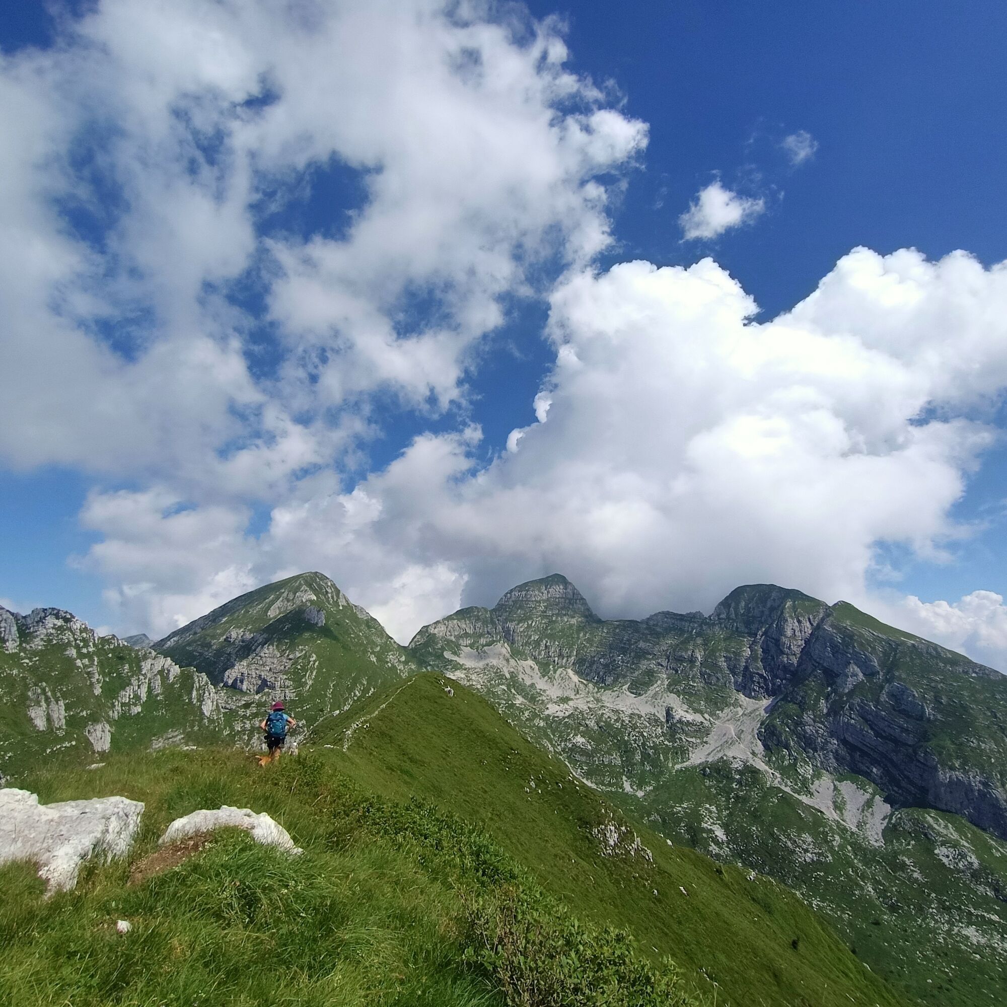
Descending back to the pass, continue along the ridge crest with a couple of Grade I sections until the notch of the Colombera pass at 1974m.
Directly along the route equipped with a cable, climb laboriously towards the summit, which is reached shortly after the end of the equipment.
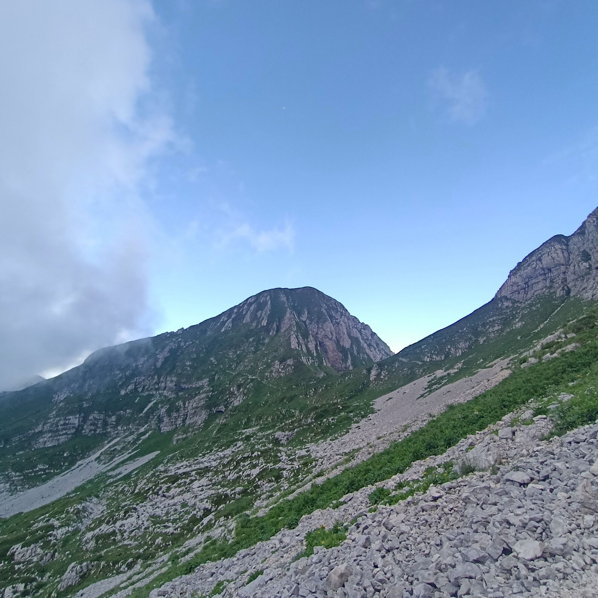
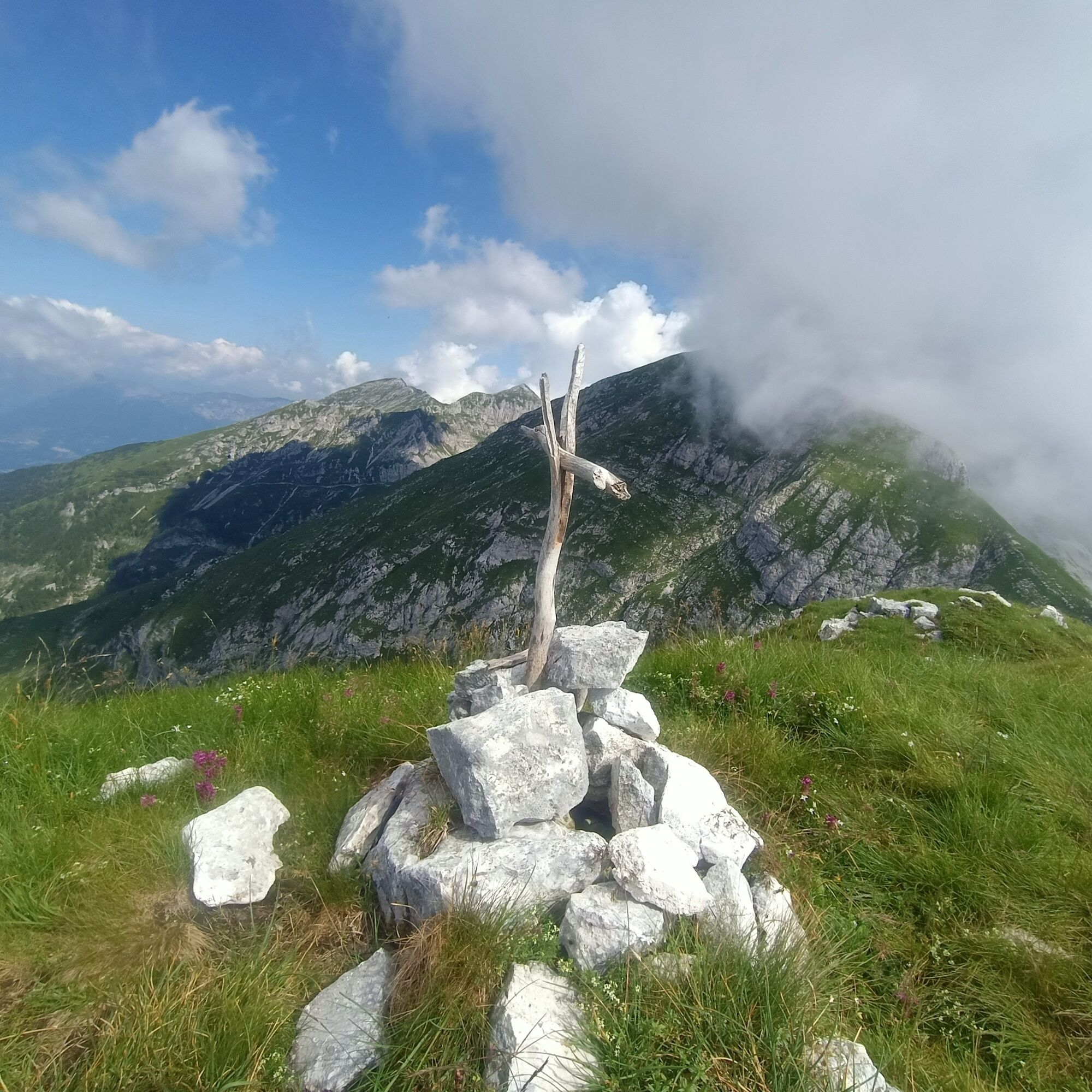
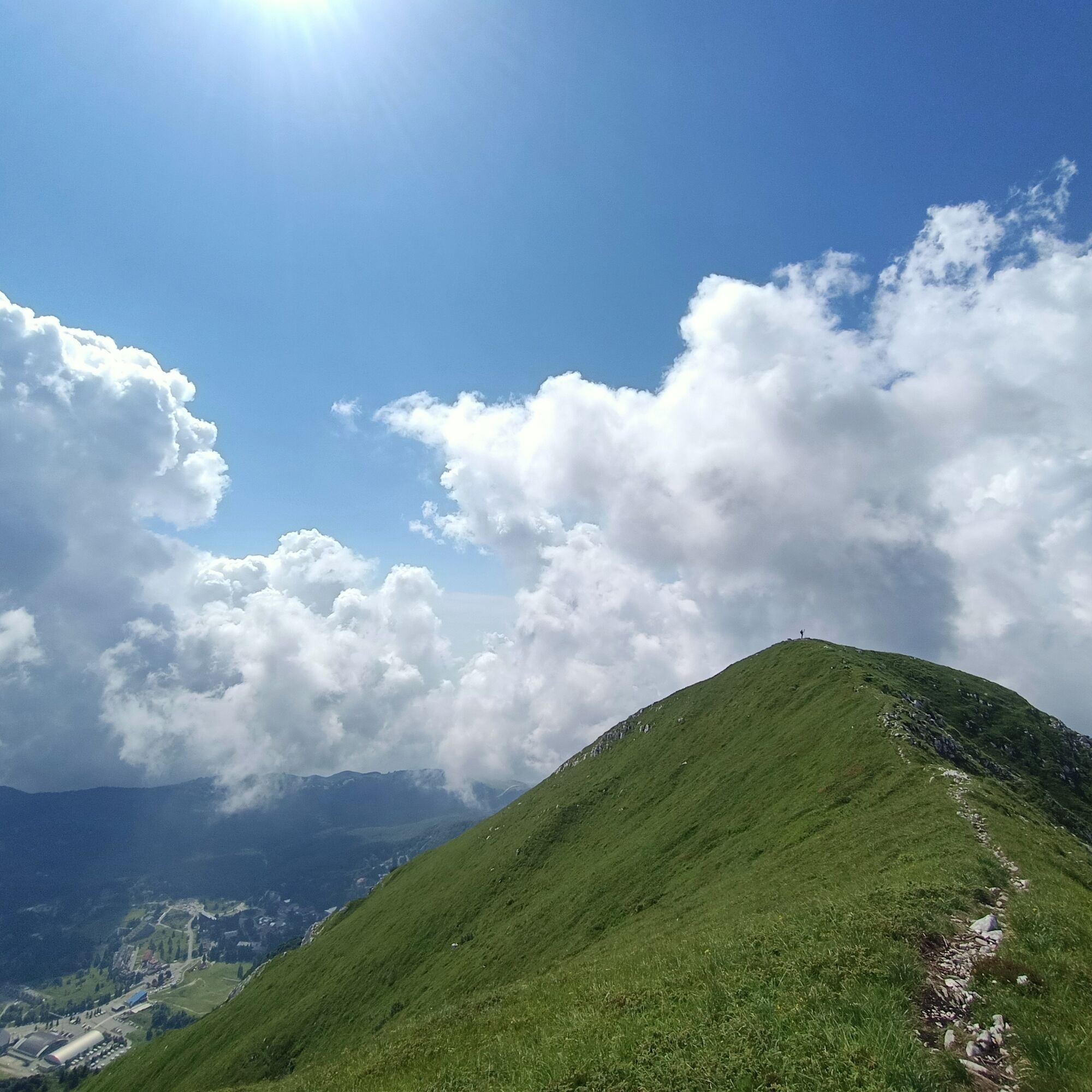
Descending the obvious trail CAI 918 heading east, reach the Tremol pass and continuing along a wide grassy ridge, reach the summit of Mount Tremol.
Always along the ridge, heading south on CAI 918, descend quickly to a large crucifix from where you turn right (stakes with markings) reaching the ski slopes.
Just below, to the left, signs indicate the way to the Arneri refuge which can be reached in about 20 minutes. Following the Salomon ski slope track lower down towards the center of Piancavallo, until a right-hand hairpin where, to the left, a wide trail branches off again marked with the white-red CAI signs.
Following the path through the forest downhill, you soon reach the starting point.
Ja
Ja
Standard hiking equipment, helmet, and via ferrata kit.
Hike not to be undertaken in case of uncertain weather (the upper part is exposed to lightning and the steep terrain can become very slippery when wet).
It is necessary to carry a via ferrata kit and protective helmet for the ascent section from the Colombera pass to the Colombera summit.
From the Palantina pass to the Colombera summit it is necessary to have a steady step, no dizziness, and mountain hiking skills suitable for experienced hikers.
Along the loop there are no water sources; on particularly hot days, consider carrying an adequate amount of water.
From Aviano (PN) follow the municipal road that climbs with wide switchbacks to the Piancavallo locality.
Upon reaching the roundabout at the entrance to the village, continue along Via Collalto (to the right) towards the sports facilities. At the next fork follow the signs for the medical guard clinic and the ice rink, reaching the facility located a short distance away.
The Piancavallo tourist center is served by local public transport lines (bus).
There are many parking options near the Ice Rink and the sports field. The route starts near the latter, overlooking the camper rest area.
T4
For hikers not adequately prepared it is advisable to walk the route in reverse, thus ensuring the possibility to reach without particular technical difficulties or exposure first the summit of Mount Tremol and then that of Mount Colombera.
The Arneri refuge offers dining service during opening periods.
Populære turer i nabolaget
-
4,5
RING OF LAKE BARCIS
lysVandring 5,64 km -
Pian del Cansiglio: Passeggiata nei dintorni di Vallorch
lysVandring 6,60 km -
SAN DANIELE AND SUSAIBES TRAIL
lysVandring 4,34 km -
Cansiglio pian de l’osteria
lysEl-sykkel 12,1 km -
Circular route of Casera Valle Friz and Arneri Refuge among karst dolines and splendid blossoms
middelsVandring 11,7 km -
5,0
Piancavallo - Cimon di Palantina
middelsVandring 9,33 km -
4,0
Dint Trail
middelsVandring 4,34 km -
Malghe di Collalto loop
middelsVandring 8,67 km -
3,5
Pala d'Altei da Grizzo
lysVandring 11,5 km -
Loop along the Gerometta Path and Col Cornier
middelsVandring 10,4 km

Vandring og sporing


Ikke gå glipp av tilbud og inspirasjon til din neste ferie
E-postadressen din har blitt lagt til på adresselisten.