


Vanskelighetsgrad: 2


Beautiful bike route around Bannwaldsee – with splendid views of lakes, the surrounding mountains, and numerous opportunities for a refreshing break amidst nature.

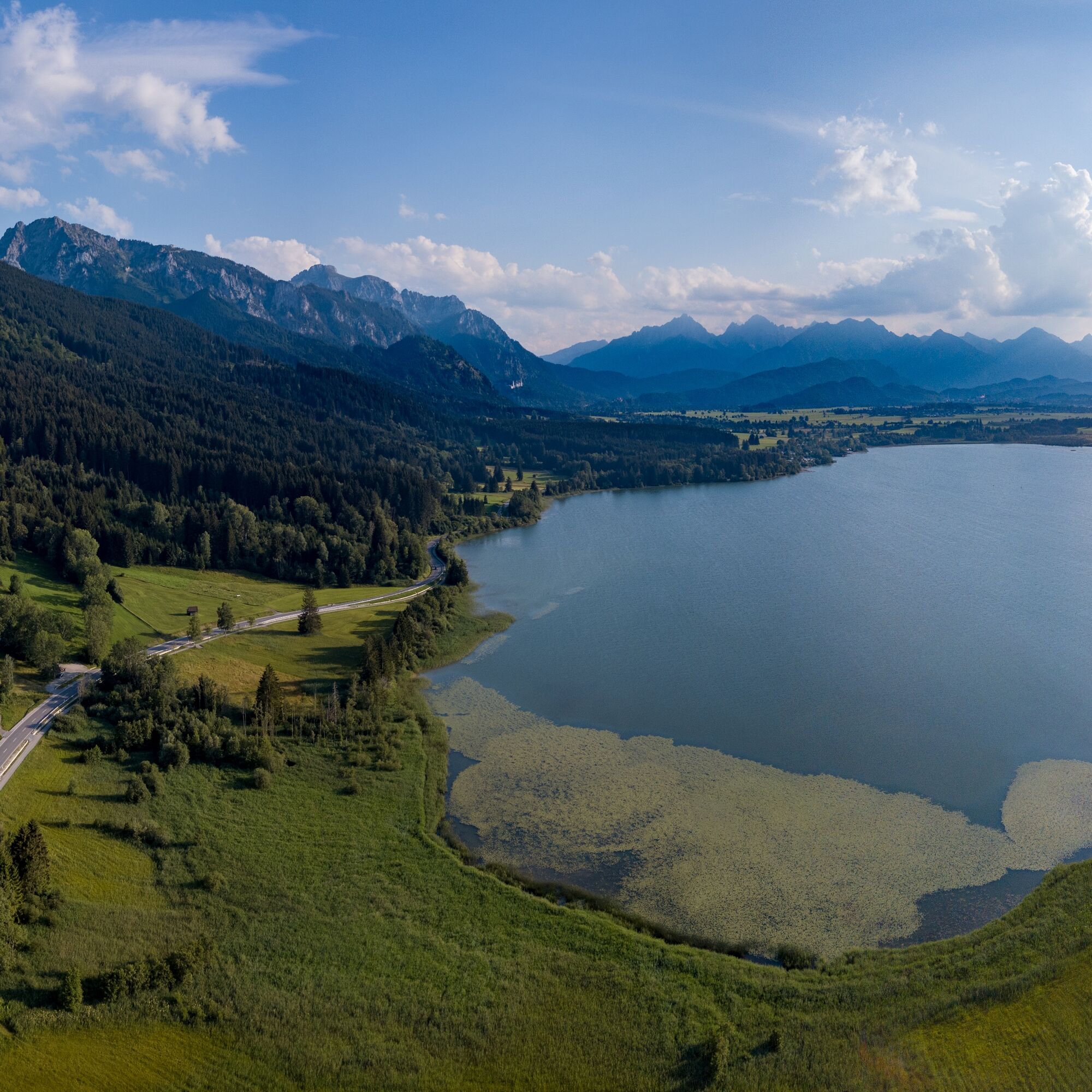
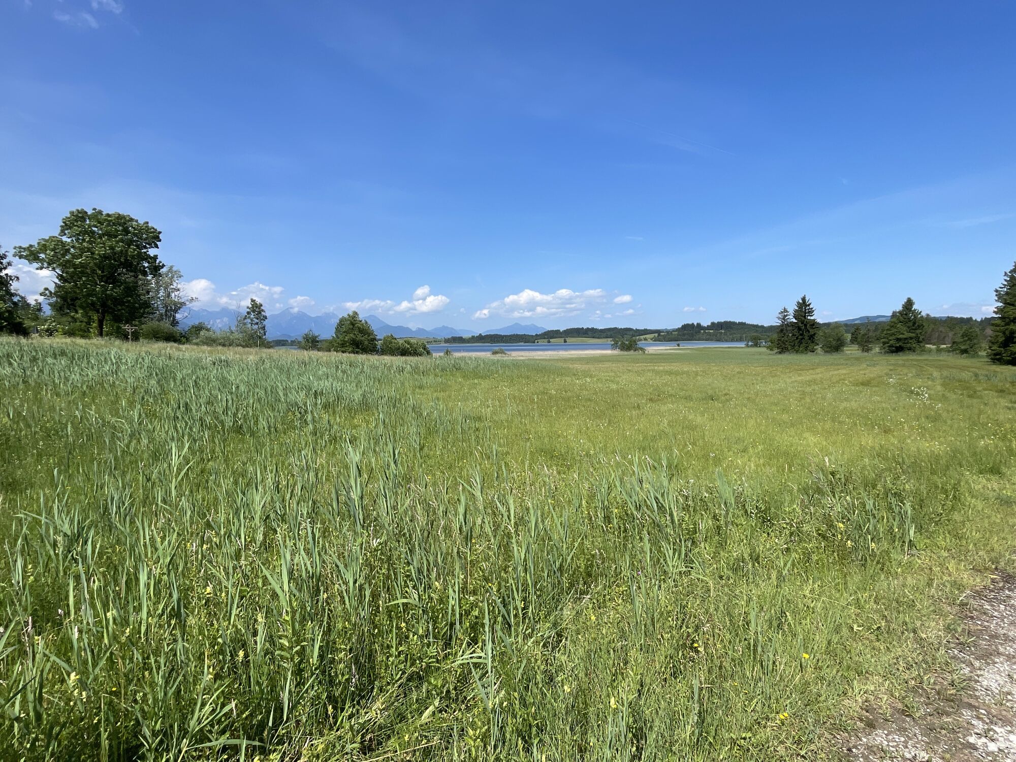
The starting point of this bike route is the Karbrücke in the Brunnen district. Cross the stone bridge and follow the bike path along the Mühlberger Ach towards Mühlberg. From there, continue cycling on the bike path past the campsite. Afterwards, the path winds picturesquely between the B17 and the shore of Bannwaldsee.
Soon you will reach an idyllic natural pedal pool – a welcome refreshment for tired legs. After a short climb, you arrive at Bayerniederhofen. Here you pass the St. Michael church and after about 300 meters turn left towards Berghof. The path now noticeably ascends.
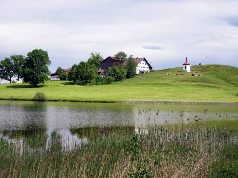
From Berghof, the route leads along the road to the small hamlet of Greith. From here it goes steadily downhill until you reach Hegratsrieder See – one of the warmest bathing lakes in the region. Directly above, the Hegratsrieder Hof with its chapel towers picturesquely.
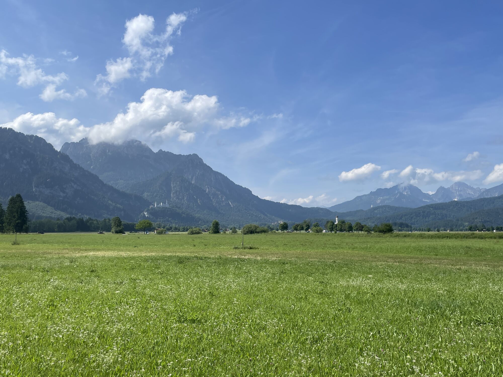
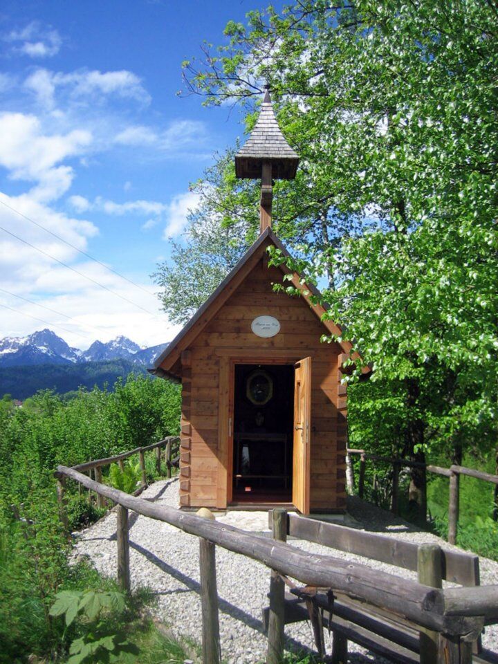
The route now continues with gentle ups and downs, always accompanied by wonderful views of Forggensee. Soon you will reach the small chapel Maria am Weg, ideal for a short break.
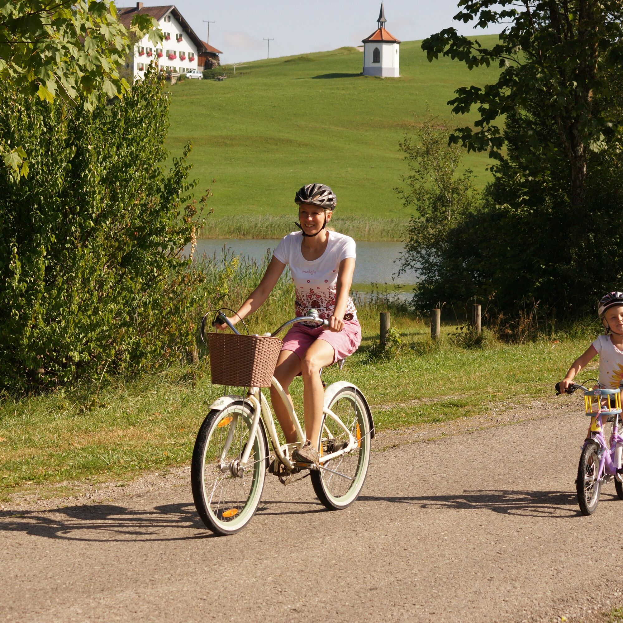
From here you cycle relaxed back to Brunnen. After a few minutes, you cross the Karbrücke again – your starting point.
Ja
We recommend: cycling helmet, weather-appropriate clothing, drinks, first aid kit, and a repair kit.
Coming from the B17, drive into the Schwangau district of Brunnen.
Train: Füssen station
Bus: stop "Schwangau – Brunnen" or other stops in Schwangau
Limited bike transport possible.
Free parking: Karbrücke in 87645 Schwangau-Brunnen Schwangau
2
Bicycle rentals in Schwangau can be found here.
A detour is worthwhile: right after the Karbrücke you will find the lovingly designed chapel Maria am Weg.
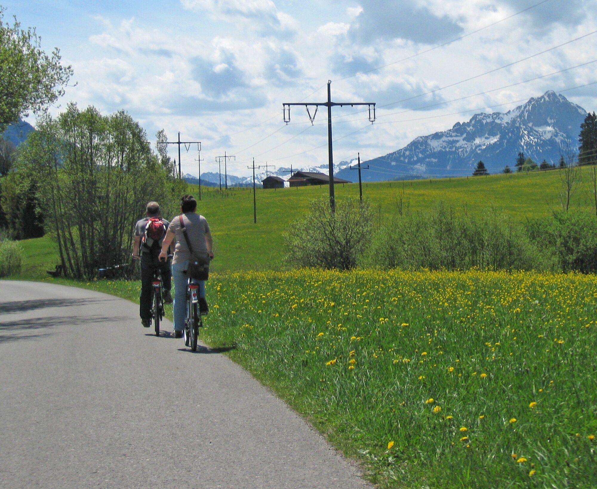
Between Buching and Bannwaldsee, an idyllic natural pedal pool directly on the bike path invites you to a refreshing break – especially on warm days a soothing cooling down.
Places to eat can be found here.
Webkameraer fra turen
-
Talstation
-
Tegelbergbahn Bergstation
-
Halblech
-
Tegelberghaus
-
Füssen - Wellness Hotel Sommer
-
Segelclub Füssen
-
Camping Hopfensee
-
Camping Hopfensee
-
Talstation
-
Talstation
-
Talstation
-
Talstation
-
Tegelbergbahn Bergstation
-
Tegelbergbahn Bergstation
-
Tegelbergbahn Bergstation
-
Tegelbergbahn Bergstation
-
Talstation
-
Talstation
-
Tegelbergbahn Bergstation
-
Schloss Hohenschwangau
-
Schloss Hohenschwangau
-
Schloss Hohenschwangau
-
Schloss Hohenschwangau
-
Schloss Hohenschwangau
-
Schloss Hohenschwangau
-
Schloss Hohenschwangau
-
Schloss Hohenschwangau
-
Ludwigs Festspielhaus Füssen
-
Ludwigs Festspielhaus Füssen
-
Rieden am Forggensee - Salenberghof
-
Forggensee Yachtschule
-
Roßhaupten im Allgäu
-
Forggensee
-
Tegelbergbahn Bergstation
-
Halblech
-
Schwangau - Blick auf den Tegelberg
-
Hotel Hirsch
-
Hotel Hirsch
-
Schwangau - Schlossbrauhaus
-
Schwangau - Tegelbergbahn
Populære turer i nabolaget
-
4,5
Circular hike Dreh- and Rohrkopfhütte
lysVandring 8,76 km -
4,8
Around Weißensee
lysVandring 6,12 km -
4,7
Yellow Wall Trail, Tegelberg (A)
middelsVia ferrata 3,65 km -
4,6
Tegelbergsteig: Via ferrata, Schwangau (B/C)
tungVia ferrata 3,54 km -
4,6
Schönleitenschrofen
tungVandring 15,5 km -
4,7
Hochplatte
middelsVandring 10,4 km -
4,2
Schloß Neuschwanstein und Schwanensee Schwangau, Bayern
middelsVandring 9 km -
4,9
Tegelberg | Branderschrofen | Neuschwanstein
middelsVandring 14,8 km -
4,6
Kulturpfad Schutzengelweg
middelsVandring 4,61 km -
4,4
Reutte Urisee / Dürrenbergalm / Koflerjoch
lysVandring 10,3 km
Vandring og sporing


Ikke gå glipp av tilbud og inspirasjon til din neste ferie
E-postadressen din har blitt lagt til på adresselisten.