


Vanskelighetsgrad: T2


Deggingen, attractively situated in the heart of the Upper Fils Valley, has developed from a small, rural community into a lively, up-and-coming municipality in which the concepts of living, working and...
Deggingen, attractively situated in the heart of the Upper Fils Valley, has developed from a small, rural community into a lively, up-and-coming municipality in which the concepts of living, working and leisure are combined.
Together with Reichenbach im Täle, the municipality now has around 5,300 inhabitants, making it the largest municipality in the Upper Filstal in terms of population. Many clubs in Deggingen and Reichenbach contribute to the social life of the community with their diverse events and other activities.
The nature and landscape around Deggingen and Reichenbach offer ideal conditions for hiking and many other activities. The untouched heathland, juniper heaths, rare orchid species, valleys, forests, mountains and interesting rock formations are particularly worthy of mention.
Another highlight, as well as a famous place of pilgrimage worth seeing, is the baroque pilgrimage church Ave Maria with the adjoining Capuchin monastery.
Deggingen Mayor's Office
Bahnhofstraße 9 | 73326 Deggingen
07334 78-0 | gemeinde@deggingen.de | www.deggingen.de


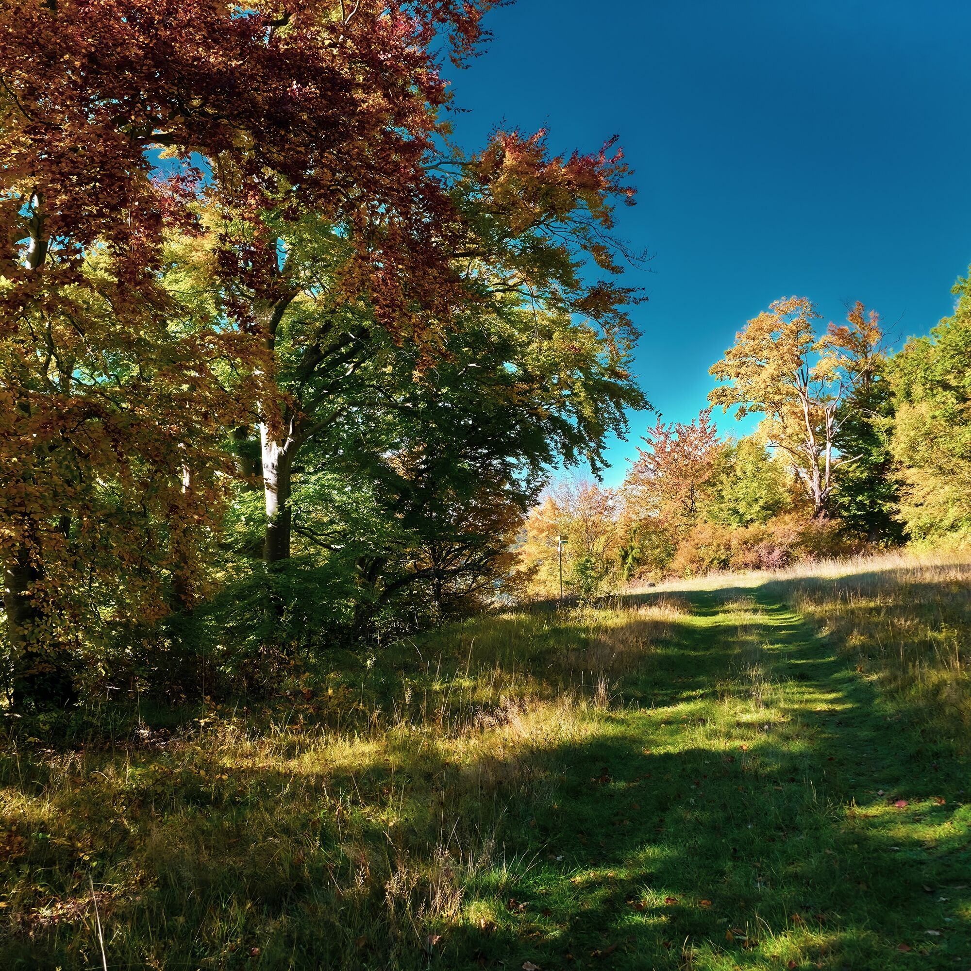
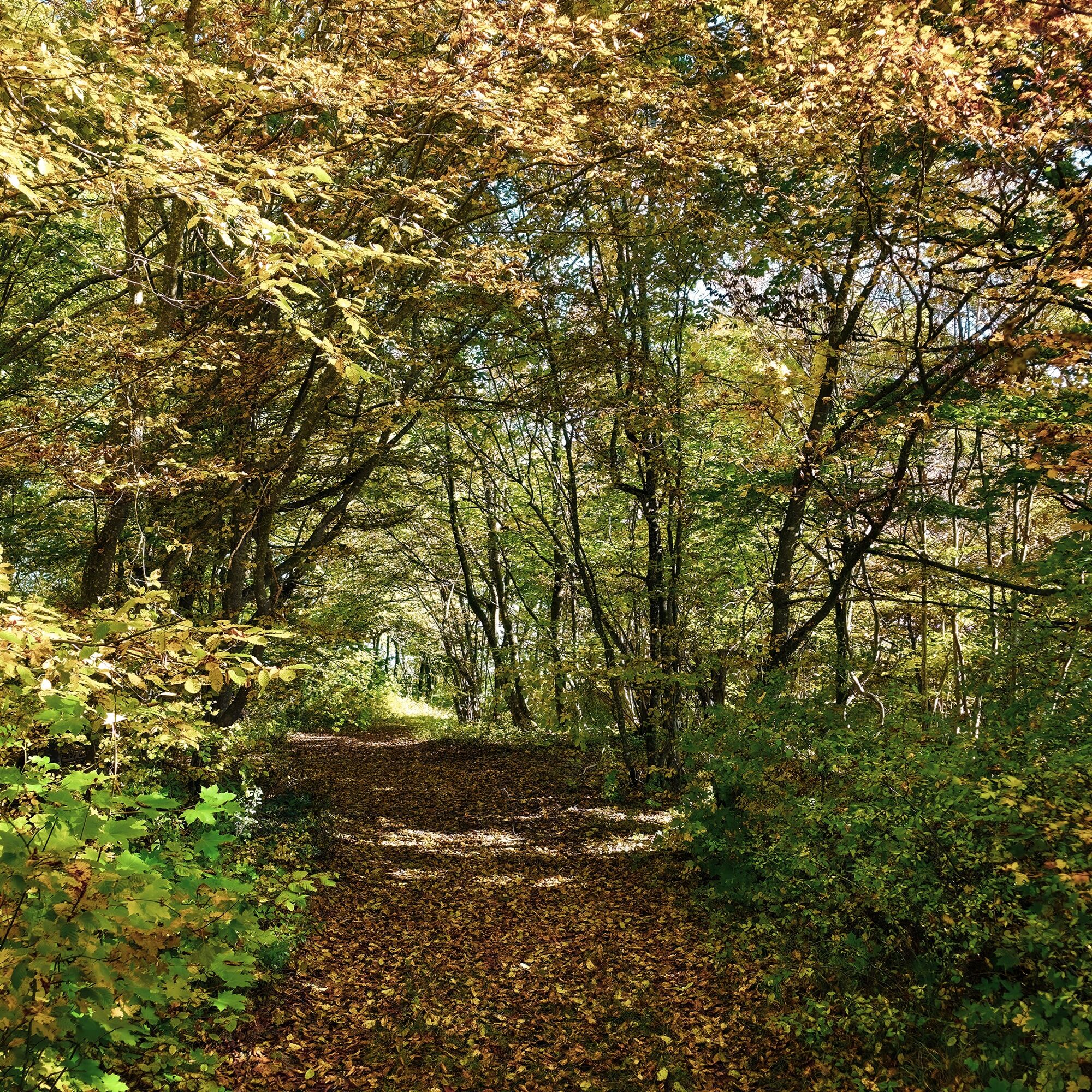
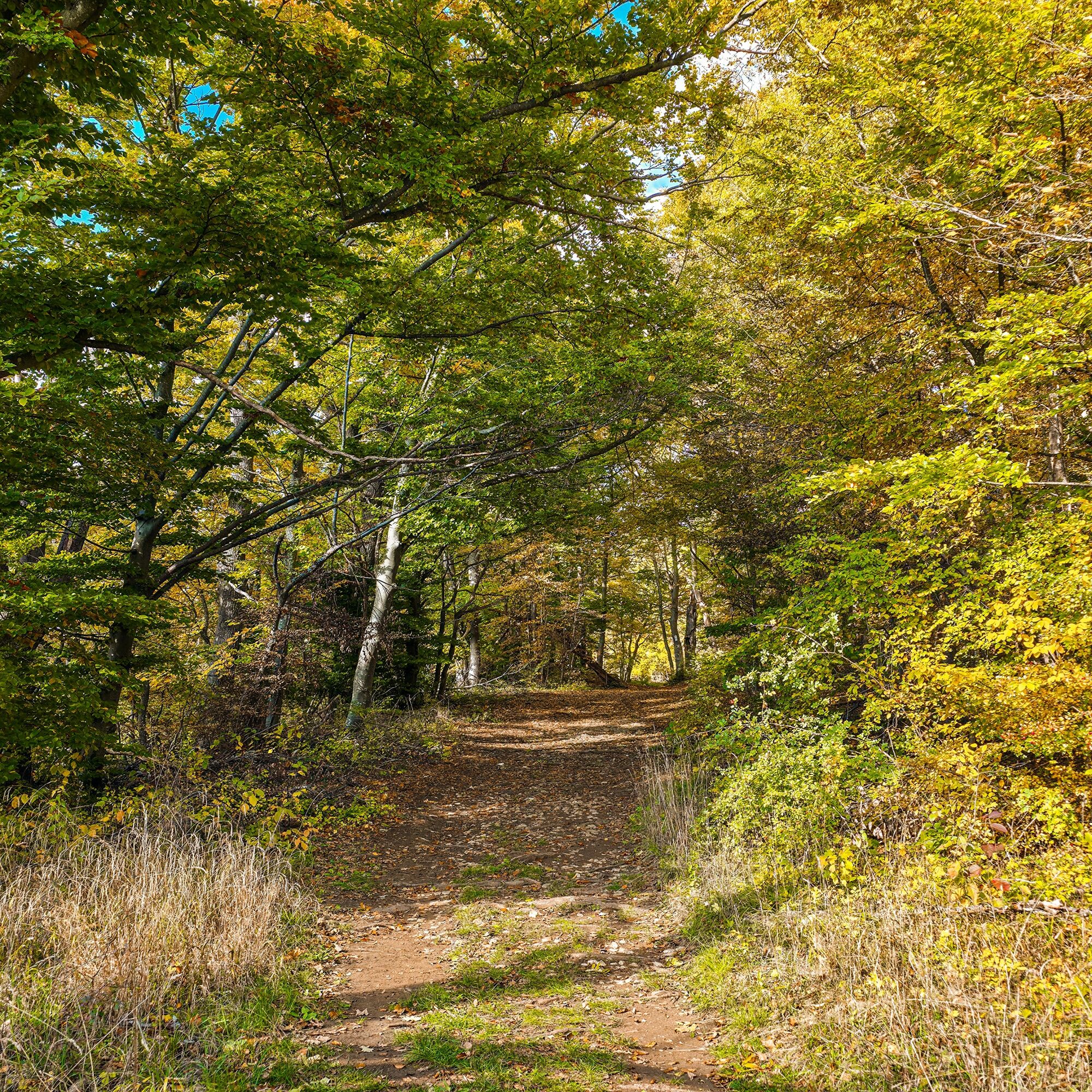

The hike along the Nordalb offers a varied route through gnarled beech forests and narrow paths, most of which run along the eaves. Overall, the tour has only a moderate ascent with a few meters of altitude.
Along the way are untouched heathlands, juniper heaths and areas with rare orchid species. The route leads through dense forests and past interesting rock formations that characterize the landscape. This tour is particularly suitable for those who want to experience nature in its original form without having to make any major effort.
Ja
Wear sturdy, non-slip shoes and clothing suitable for the weather. A rucksack with water, snacks and a first aid kit is recommended.
Some paths can be slippery and dangerous when wet. Watch your steps and use walking poles for stability if necessary.
You can reach Deggingen by car via the A8, Stuttgart - Ulm, exit Mühlhausen in the direction of Geislingen an der Steige (B 466) or via the B10, exit in Geislingen an der Steige in the direction of Deggingen.
Travel from Stuttgart or Ulm to Geislingen/Steige station. From there, take bus no. 966 to the "Ave Maria" stop in Deggingen. After approx. 40 minutes on foot you will reach the starting point of the tour.
You can find the district timetable at: www.vvs.de/fahrplan
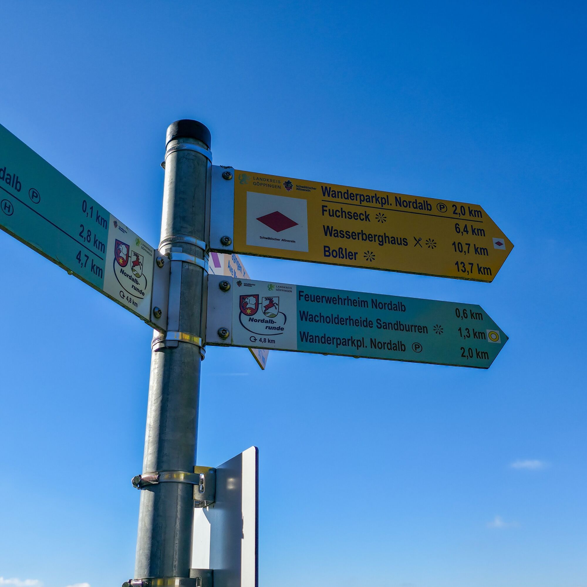
Parking lot at Dürrentalweg
T2
Respectful cooperation in the district of Göppingen.
Code of conduct:
Respect trail closures and the quiet zones developed in the leisure trail concept. Leave no traces such as garbage and animal droppings, treat your path with care. Act with foresight and consideration. Adapt your behavior to the situation at hand. Safety first. Respect other users of the forest and meadows. Be considerate of animals and plants. Plan ahead and make the most of daylight. Try to avoid dusk in the morning and evening. Observe the ban on entering agricultural land during the growing season. Stay on the designated paths and avoid the edges of the forest so that wild animals can get used to people better.
More information at ruecksicht-macht-wege-breiter.de
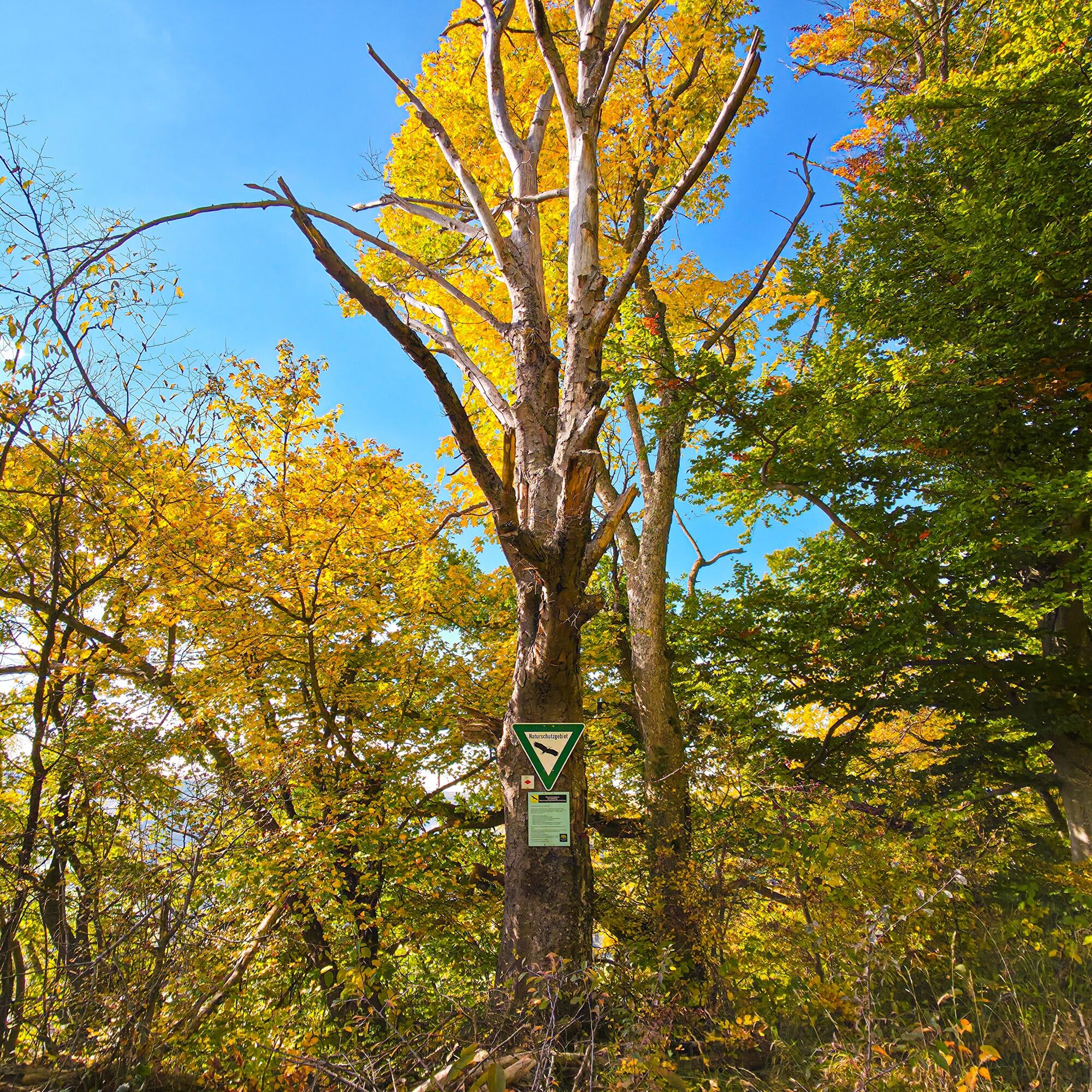
Hutewald Nordalb:
The Hutewald on the Noralb revives a historical form of forest use. Grazing by pigs, sheep and cattle has the effect of creating a dense, dark forest with a lot of undergrowth. There are only very few hut forests left in Germany.
Ave Maria pilgrimage church:
Ave Maria was built between 1716 and 1718. Two hundred meters above today's baroque church lies a chapel called "Alt Ave" in a water-rich spring area. It is a masonry witness to a Marian pilgrimage that has existed since the early Middle Ages. Around 1450, a Gothic church was added to this chapel, which was destroyed during the Reformation. In 1929, the pastoral care of the Marian shrine was entrusted to the Capuchins. The monastery was closed in 1932.
Populære turer i nabolaget
-
4,5
Löwenpfad "Weitblick-Tour" - High up and far-reaching view
tungVandring 12,0 km -
5,0
Löwenpfad "Berta-Hörnle-Tour" - Castle stories in a dreamlike setting
middelsVandring 14,5 km -
4,4
Löwenpfad "Geislinger Felsen-Tour" - Up and down through the Eybacher Valley
middelsVandring 10,9 km -
5,0
Löwenpfad "Filsursprung-Runde" - pure nature around Reußenstein
middelsVandring 14,0 km -
4,6
Löwenpfad "Orchideenpfad" - Herbs, pasqueflower and juniper heather
middelsVandring 9,33 km -
5,0
Löwenpfad "Filstalgucker" – Views from the heart of the Filstal
middelsVandring 13,1 km -
4,3
Löwenpfad "Steigen-Tour" - Along the Swabian century building
tungVandring 17,2 km -
3,8
Löwenpfad "Ave-Weg" - a touch of pilgrimage on the Albtrauf
middelsVandring 8,58 km -
Löwenpfad "Spielburg-Runde" - Around the mountain Hohenstaufen
lysVandring 3,53 km -
5,0
Boßler circuit
middelsVandring 8,59 km

Vandring og sporing


Ikke gå glipp av tilbud og inspirasjon til din neste ferie
E-postadressen din har blitt lagt til på adresselisten.