Tour 31 Points de vues
tung
Navigere
Navigere
Få denne turen på mobiltelefonen din
Tour 31 Points de vues
tung
Vandring
20,55
km
Skann QR-koden og start navigasjonen i bergfex -appen

Vandring og sporing


Avstand
20,55
km
Varighet
06:00
h
Oppstigning
762
hm
Havnivå
444 -
893
m
Nedlasting av spor
Tour 31 Points de vues
tung
Vandring
20,55
km


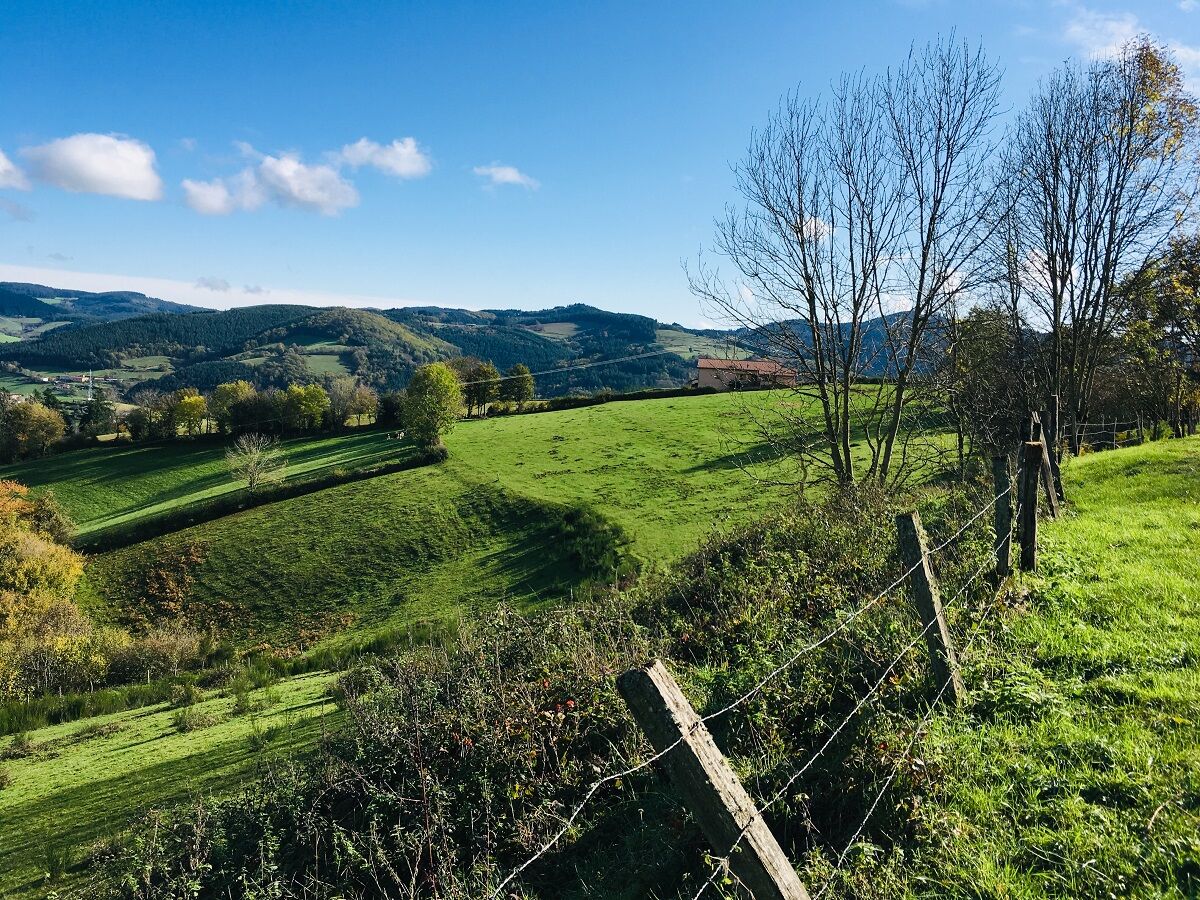
At the end of the circuit, view of the railway loop, which allows trains to gain 43 m in altitude without exceeding the 11 mm per meter gradient. Beware, stony descent between the Bois des Princes and...
Beskrivelse av
At the end of the circuit, view of the railway loop, which allows trains to gain 43 m in altitude without exceeding the 11 mm per meter gradient. Beware, stony descent between the Bois des Princes and the Croix Baleu. At km 8.5, at the post ʺPlat of Mollardsʺ, possibility to return to the village (2.4 km).
Average pace of 3.5km/h.
Rute
Église Saint-Nizier
(520 m)
Sted for tilbedelse
0,0 km
Chevenal
(523 m)
Oppgjør
0,7 km
Chavanne
(491 m)
Oppgjør
3,6 km
Chevelas
(807 m)
Oppgjør
7,0 km
La Collonge
(478 m)
Oppgjør
18,2 km
Les Petits Trèves
(432 m)
Oppgjør
19,7 km
Église Saint-Nizier
(520 m)
Sted for tilbedelse
20,3 km
Rute
Tour 31 Points de vues
tung
Vandring
20,55
km
Église Saint-Nizier
(520 m)
Sted for tilbedelse
0,0 km
Saint-Nizier-d'Azergues
(519 m)
Landsby
0,0 km
Au Coeur du Village
(518 m)
Restaurant
0,0 km
Chevenal
(523 m)
Oppgjør
0,7 km
Chavanne
(491 m)
Oppgjør
3,6 km
Les Forêts
(644 m)
Oppgjør
5,0 km
Chevelas
(807 m)
Oppgjør
7,0 km
Le Cantin
(559 m)
Oppgjør
17,2 km
La Collonge
(478 m)
Oppgjør
18,2 km
Le Montcenis
(471 m)
Oppgjør
18,8 km
Les Petits Trèves
(432 m)
Oppgjør
19,7 km
Au Coeur du Village
(518 m)
Restaurant
20,3 km
Église Saint-Nizier
(520 m)
Sted for tilbedelse
20,3 km
Saint-Nizier-d'Azergues
(519 m)
Landsby
20,5 km
Ingen anmeldelser ennå
Populære turer i nabolaget
-
La forêt de la Cantinière - Beaujolais - Saint-Cyr-le-Châtoux
lysVandring 11,3 km -
De l’Aze à l’Ergues - Beaujolais Vert - Claveisolles
lysVandring 13,0 km -
The forest of Brou - Beaujolais - Dième
lysStavgang 10,5 km -
The golden stones - Between Pierres Dorées and Val d’Azergues - Loop 7.4
tungRennrad 57,6 km -
The Cantinière forest
lysTemaløype 2,96 km -
Around the Lac des Sapins - Beaujolais Vert - Cublize
lysVandring 4,76 km -
B9 Mountain Bike Tour Marchampt
tungTerrengsykkel 19,8 km -
The tour of the Crochet mountain and Tourvéon mount
lysVandring 13,1 km -
Trail around Lac des Sapins - Beaujolais Vert - Cublize
tungTrailrunning 15,0 km -
B8 Mountain Bike Tour from Quincié-en-Beaujolais to Marchampt
lysTerrengsykkel 17,1 km
Vandring og sporing

Over 550.000 turforslag, detaljerte kart og en intuitiv ruteplanlegger gjør appen til et must for alle naturentusiaster.

Ikke gå glipp av tilbud og inspirasjon til din neste ferie
Abonner på nyhetsbrevet
Feil
Det har oppstått en feil. Vennligst prøv på nytt.
Takk for din registrering
E-postadressen din har blitt lagt til på adresselisten.
Turer i hele Europa
Østerrike
Sveits
Tyskland
Italia
Slovenië
Frankreich
Nederland
Belgium
Polen
Liechtenstein
Tsjekkia
Slovakia
Spania
Kroatia
Bosnia-Hercegovina
Luxembourg
Andorra
Portugal
Island
Storbritannia
Irland
Hellas
Albania
Nord-Makedonia
Malta
Norge
Montenegro
Moldova
Kosovo
Ungarn
San Marino
Romania
Estland
Latvia
Hviterussland
Kypros
Litauen
Serbia
Bulgaria
Monaco
Danmark
Sverige
Finland