


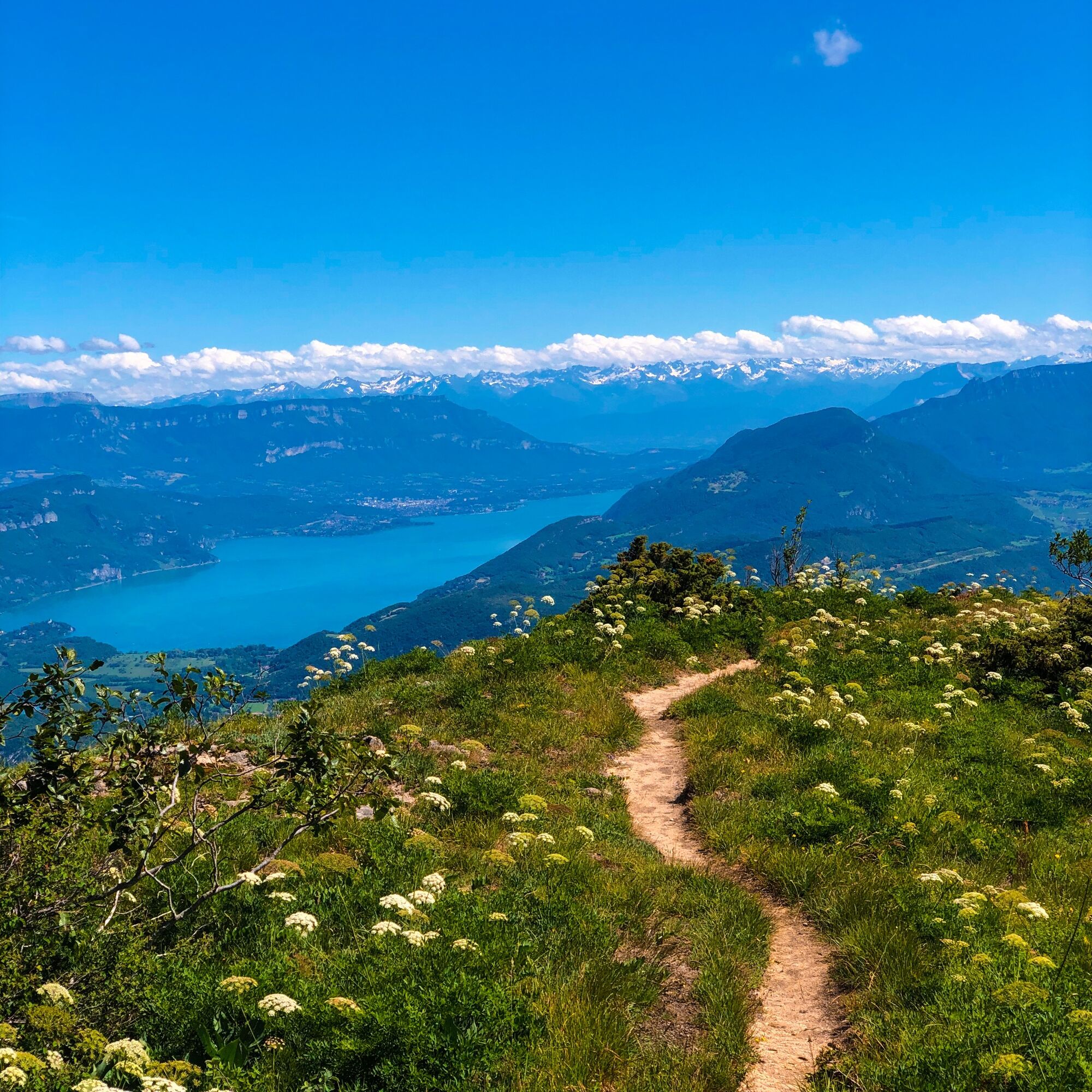
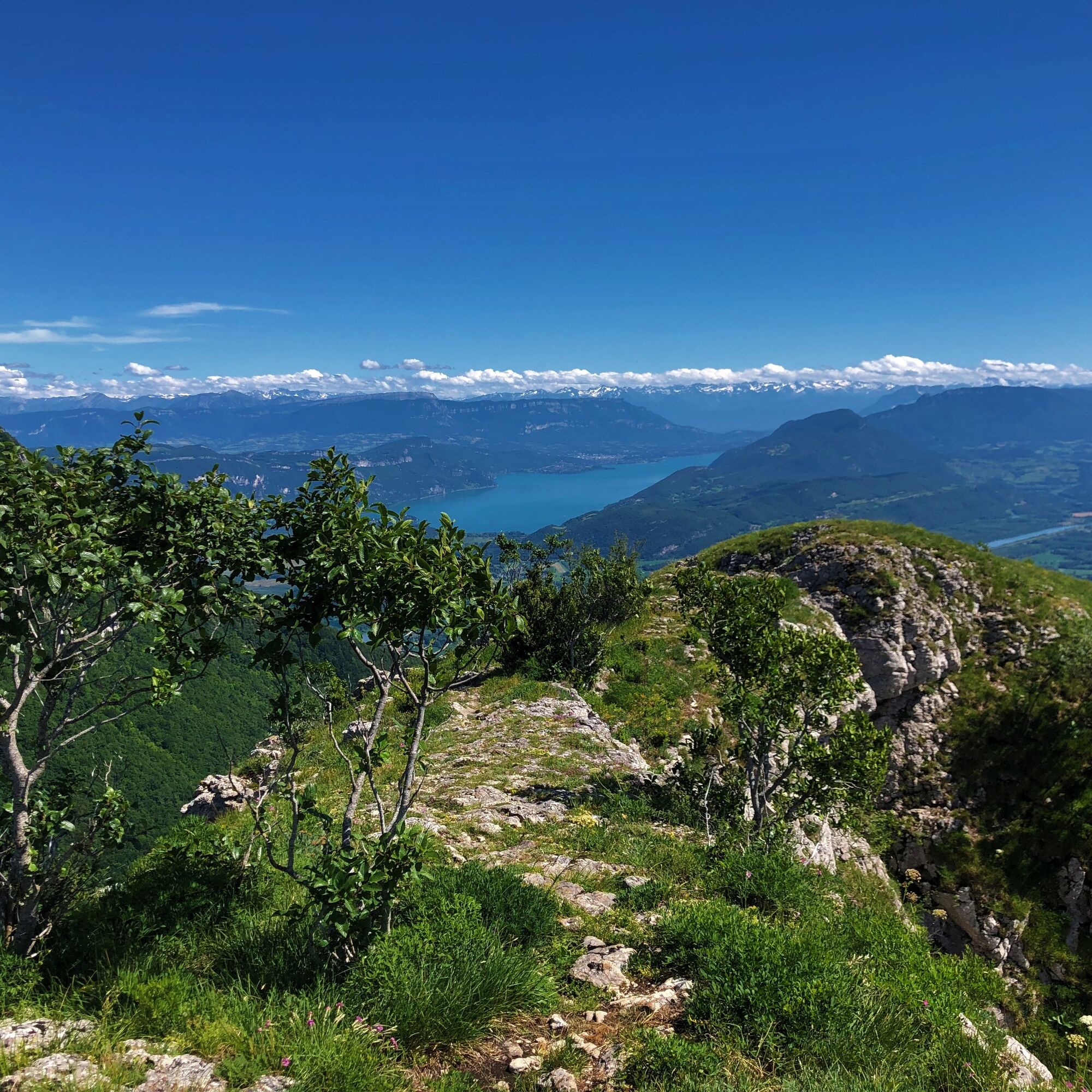
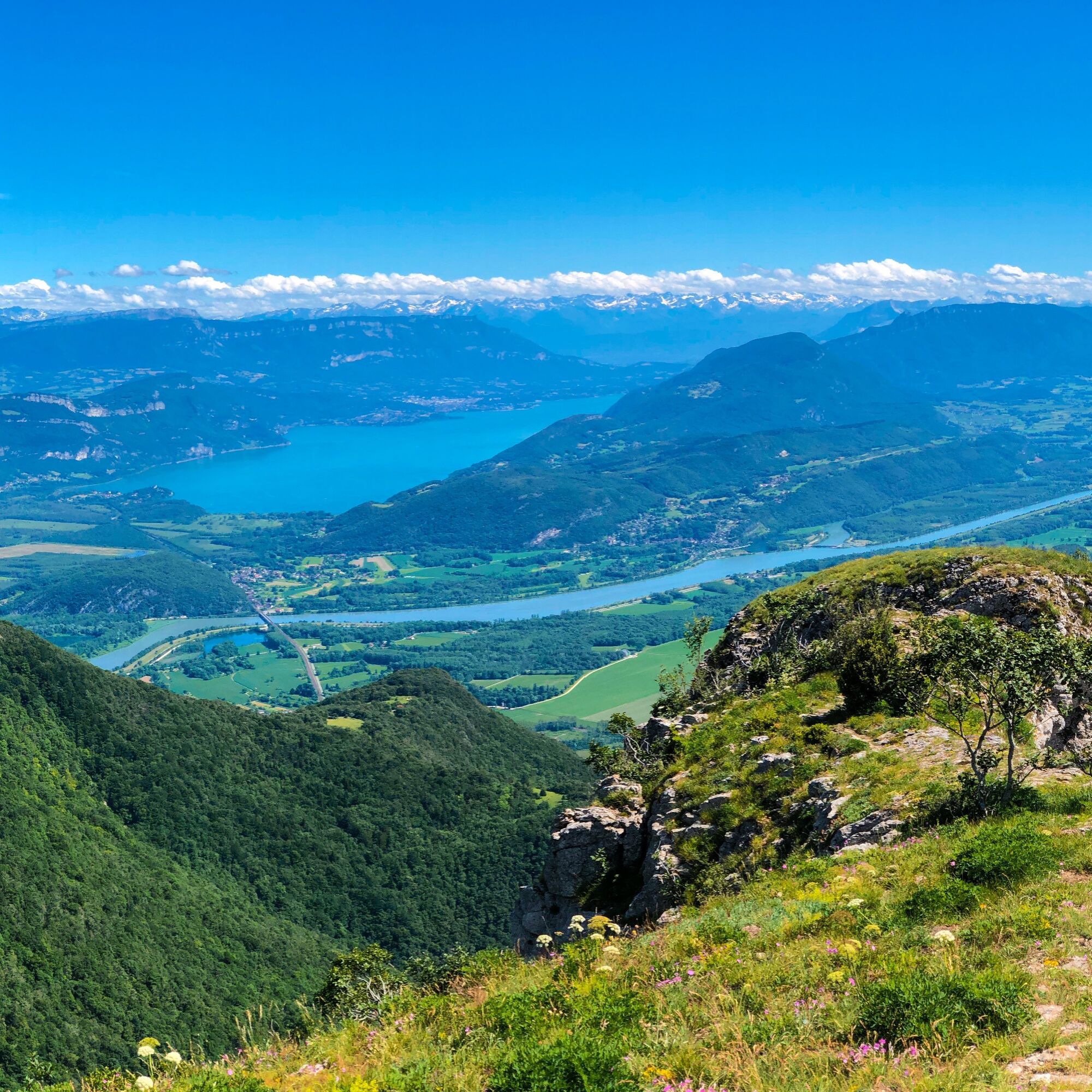
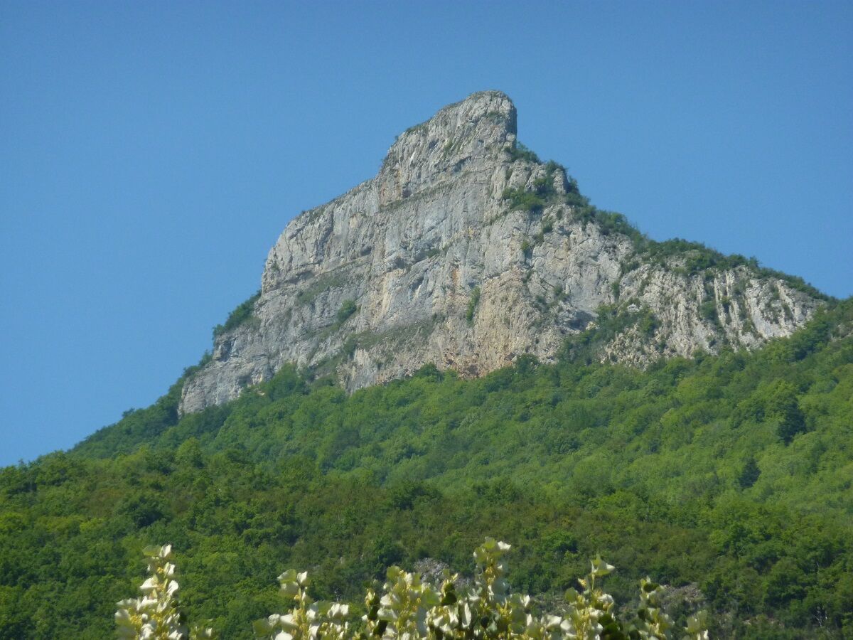
After a long climb, you will go back and forth on the rock of Chanduraz and will be rewarded with a breathtaking view of the Alps, the Rhône river winding in the south of Bugey. (The end of the cliff is inaccessible)


Rejoindre le hameau de Charaillin depuis Chavornay et suivre la direction de Chanduraz.
Aucun équipement spécifique requis.
Attention l'extrémité de la Roche n'est pas accessible.
Le circuit traverse des alpages, la plus grande vigilence est recommandée lorsque vous rencontrez un troupeau.
Nous vous remercions de systématiquement refermer les enclos derrière votre passage.
Balisage défectueux, incidents / sécurité, conflits d'usage, dépôts sauvages ? : localisez et partagez le problème rencontré sur le dispositif d'alerte national depuis l'appli SURICATE ou via le site https://sentinelles.sportsdenature.fr/
Le hameau de Charaillin à Chavornay est situé sur la commune d'Arvière-en-Valromey, accessible depuis Talissieu ou Virieu-le-Petit en prenant la D105.
Le point de départ n'est pas accessible en transports en commun.
Il vous est possible de se garer à Chavornay devant le monument aux morts en face du croisement vers Charaillin.
APIDAE tourism data updated on 25/10/2022 by "Office de Tourisme Bugey Sud Grand Colombier".
Spotted an error? Write to the owner with the following information:
File name: Parcours trail : Chanduraz depuis Chavornay | Record identifier: 5848969 | URL (link) for this Outdooractive page.
Les bons plans de l'Office de Tourisme.
Pour les petits et grands creux après la rando, nous vous conseillons café restaurant de la Barque situé à moins de 5 minutes du départ.
Incontournable pour les amateurs de fromages et de Comté, découvrez la Valromette, la raclette made in Valromey à la Fruitière du Valromey située à Virieu-le-Petit.
Ce circuit trail est composé d'une monté de 820m de dénivelé positif aux pourcentages réguliers sur environ 6 km. Il est possible de rejoindre le sommet du Grand Colombier situé à 5 km de la Roche de Chanduraz.
Cet itinéraire fait partie de la sélection "Ain Outdoor".
Populære turer i nabolaget
-
1,0
Hike of the Clairefontaine waterfall
lysVandring 5,46 km -
Hike: Gorges de Thurignin
middelsVandring 14,2 km -
Hike of the Grand Colombier starting from Munet
tungVandring 16,0 km -
Hike starting from Parves-et-Nattages: le circuit du Sorbier
middelsVandring 11,4 km -
Cycling tour : Marshes and vineyards in Bugey
lysRennrad 33,1 km -
Hike: A wolf life.
middelsVandring 7,22 km -
3,0
Hike: on the ridge of the Grand Colombier (circuit des crêtes)
middelsVandring 11,3 km -
3 day-hike in Jura: hiking trails through Plateau de Retord and Grand Colombier
tungVandring 50,9 km -
Hike : Lake and vineyards
lysVandring 9,76 km -
Hike in Bugey: Chanduraz from Béon
tungVandring 12,6 km

Vandring og sporing


Ikke gå glipp av tilbud og inspirasjon til din neste ferie
E-postadressen din har blitt lagt til på adresselisten.