- Kort beskrivelse
-
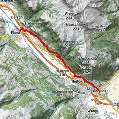
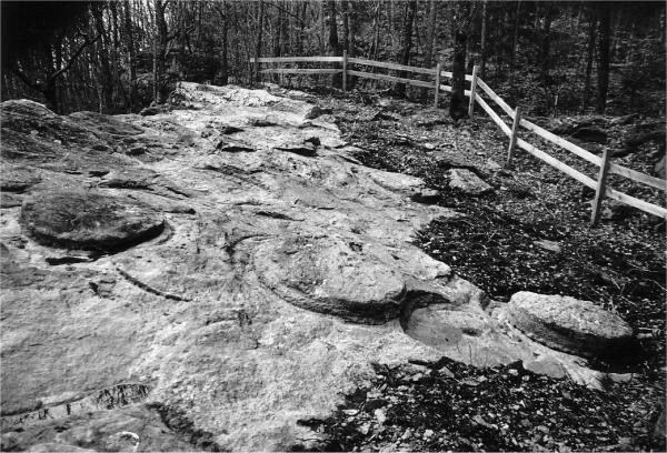
On the way to places of stone extraction, glass and iron smelting and prehistory. The Melser Geoweg leads through the village centre of Mels as well as through relaxing forest areas.
- Vanskelighet
-
middels
- Evaluering
-
- Rute
-
Mels (497 m)Heiligkreuz (485 m)0,1 kmLourdes-Grotte0,3 kmPlons1,4 kmSt.Martin3,1 kmSt.Martin4,5 kmRüfi4,7 kmMels (497 m)5,5 kmHarzloch6,0 km
- Beste sesong
-
jan.feb.marsaprilmaijunijuliaug.sep.okt.nov.des.
- Høyeste punkt
- 634 m
- Reisemål
-
Mels, Säge
- Høydeprofil
-
 © outdooractive.com
- Forfatter
-
Turneen Geo path in Mels brukes av outdooractive.com forutsatt.
GPS Downloads


Generell info
Forfriskningsstopp
Flere turer i regionene
-
Heidiland
2208
-
Heidiland / Graubünden
899
-
Mels
240