© Verein Mühlviertler Granitland


- Kort beskrivelse
-
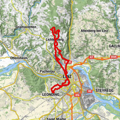
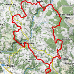
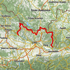
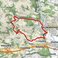
This route leads from the lowest to the highest point of the Granite Land South - from the Danube to the Gis.
- Evaluering
-
- Rute
-
Ottensheim0,3 kmAmberg5,3 kmGramastetten8,2 kmGasthaus zur Gis15,9 kmLichtenberg19,6 kmLandgasthaus Holzpoldl20,7 kmNeulichtenberg20,7 kmKoglerauer Spitz (685 m)24,0 kmKöglerhof24,4 kmDürnberg27,9 kmGuckerstein28,2 kmGasthaus Dürnberg30,8 km
- Beste sesong
-
jan.feb.marsaprilmaijunijuliaug.sep.okt.nov.des.
- Høyeste punkt
- 884 m
- Høydeprofil
-


- Forfatter
-
Turneen MTB - Danube GIS circuit brukes av outdooractive.com forutsatt.
GPS Downloads


Generell info
Forfriskningsstopp
Lovende
Flere turer i regionene
-
Mühlviertel
194
-
Linz & Region Linz
95
-
Eidenberg
39