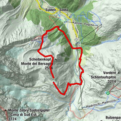
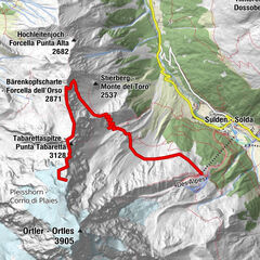
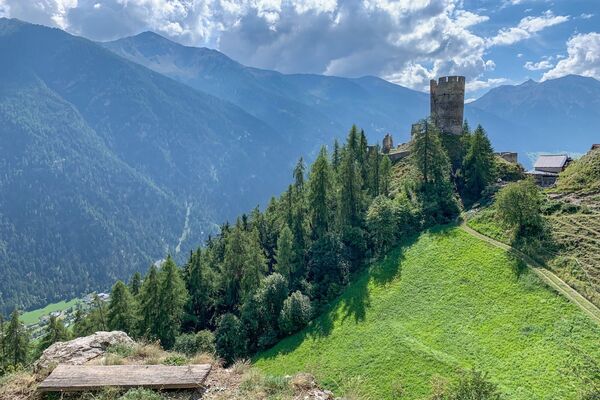
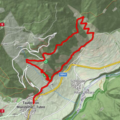
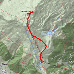
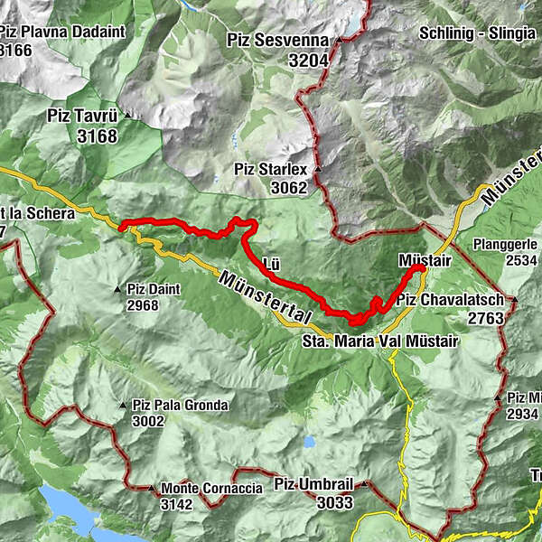
Senda Val Müstair (Süsom Givè - Alp da Munt - Alp Champatsch - Lü - Müstair)


© Engadin Samnaun Val Müstair - Tobias Cueni

© Engadin Samnaun Val Müstair - Tobias Cueni

© Engadin Samnaun Val Müstair - Tourismus Engadin Scuol Samnaun Val Müstair AG

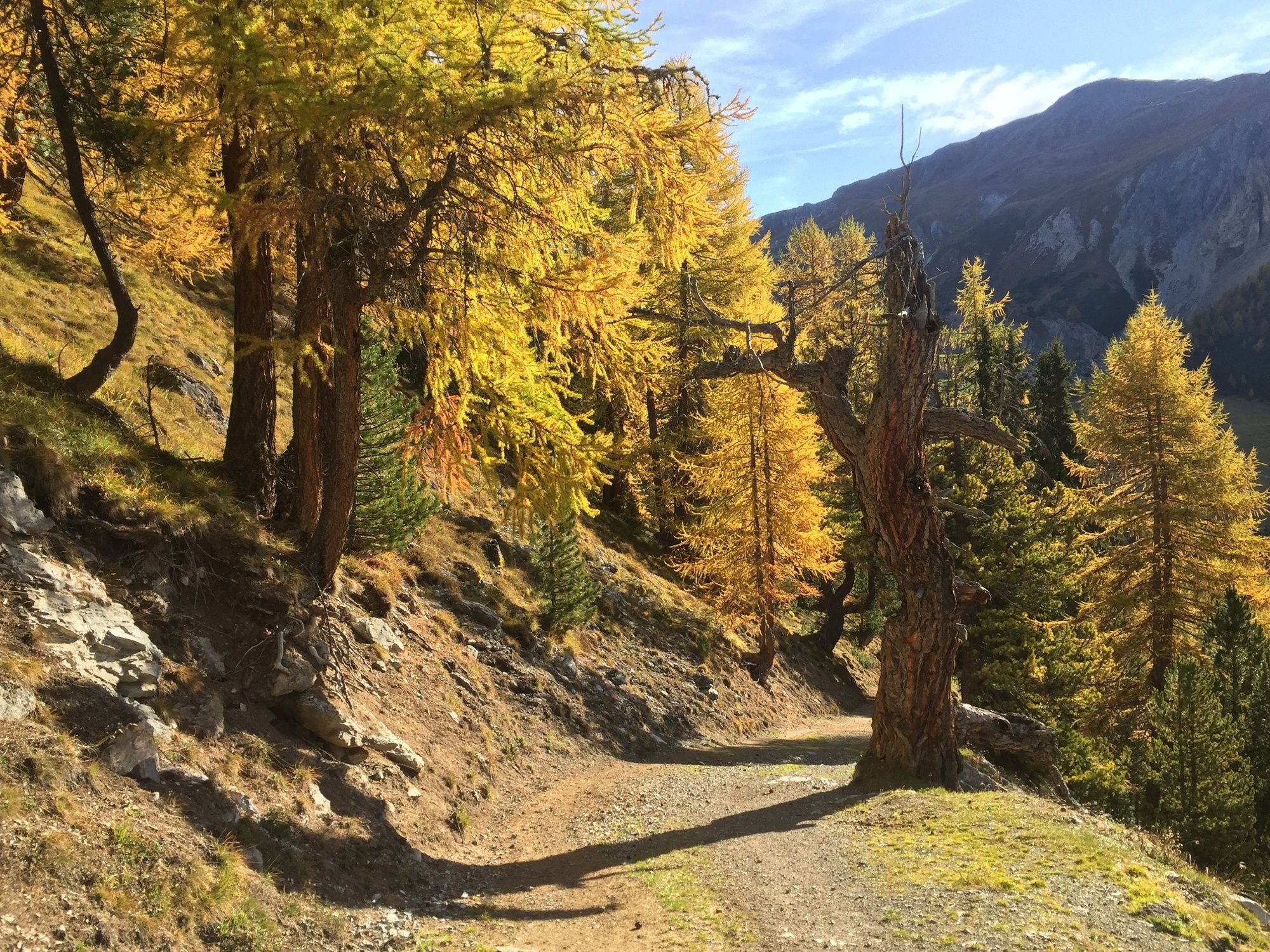
© Engadin Samnaun Val Müstair - Michael Leibacher

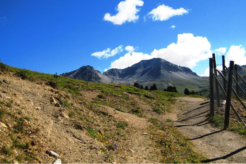
© Engadin Samnaun Val Müstair - Michael Leibacher

- Kort beskrivelse
-
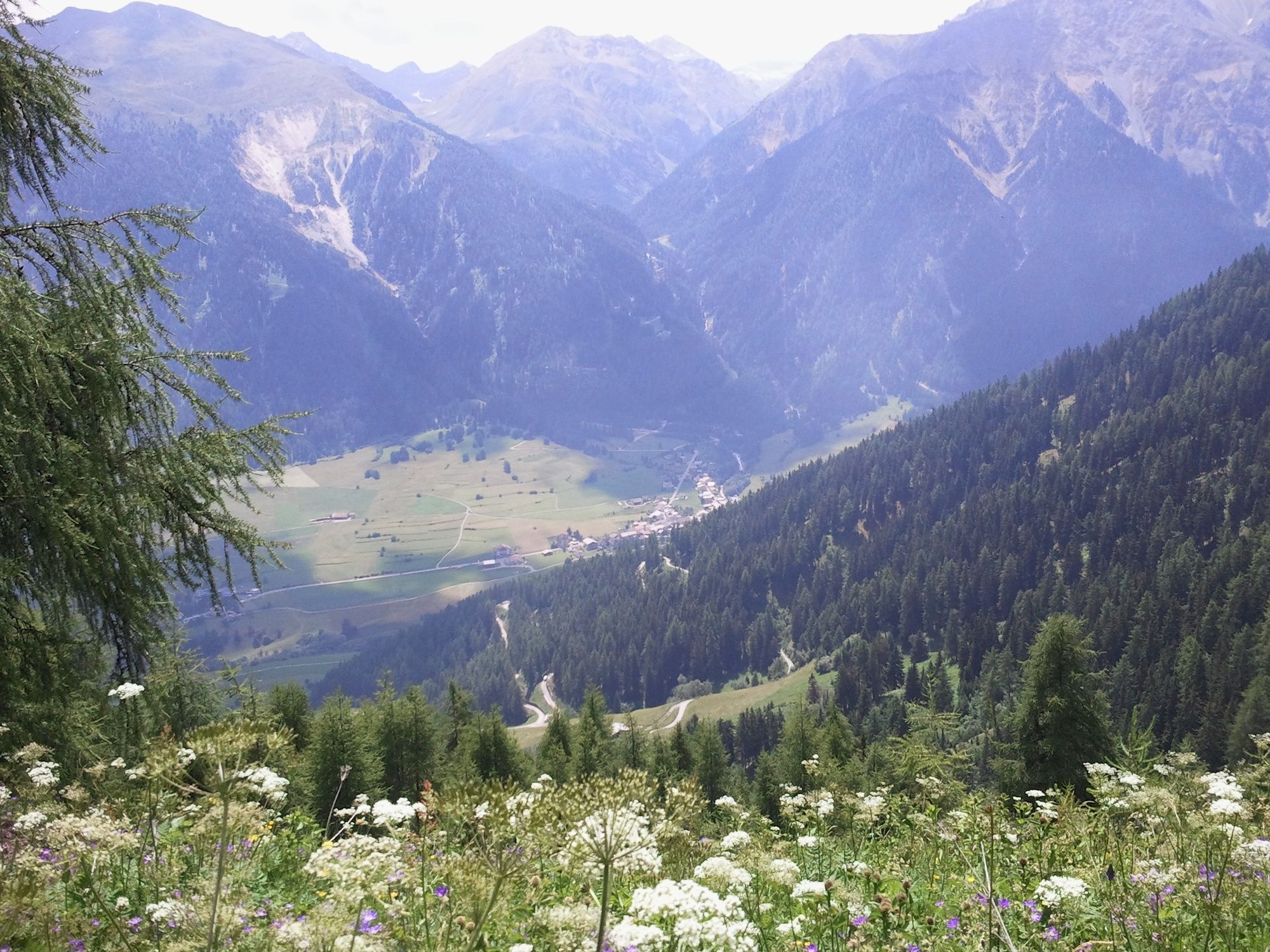
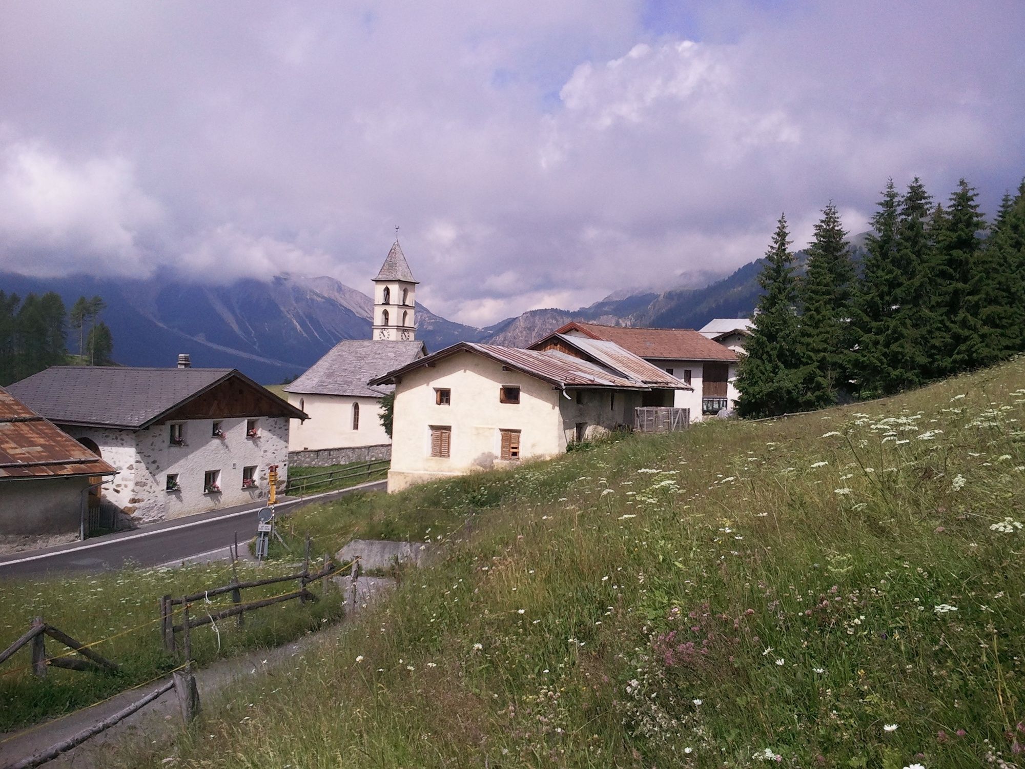
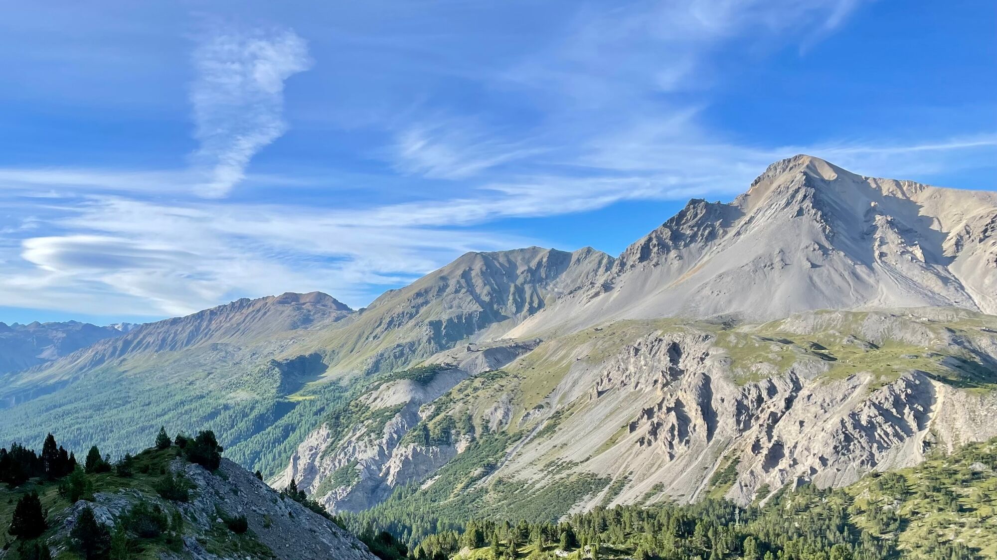
Senda Val Müstair - the easy high-level hike on the sunny side of the valley with a magnificent panoramic view. With the Natura Trail guide this hike becomes a theme trail.
- Vanskelighet
-
middels
- Evaluering
-
- Rute
-
Hotel Süsom Givè0,0 kmAlp da Munt3,3 kmLa Posa6,1 kmVictimas da las Lavinas de l'On 19518,6 kmLü (1.920 m)9,1 kmReformierte Kirche9,3 kmUrschai10,4 kmValpaschun12,3 kmCraistas13,2 kmPütschai15,9 kmMüstair (1.273 m)19,4 km
- Beste sesong
-
jan.feb.marsaprilmaijunijuliaug.sep.okt.nov.des.
- Høyeste punkt
- 2.254 m
- Reisemål
-
PostBus stop Müstair, posta
- Høydeprofil
-
 © outdooractive.com
- Forfatter
-
Turneen Senda Val Müstair (Süsom Givè - Alp da Munt - Alp Champatsch - Lü - Müstair) brukes av outdooractive.com forutsatt.
GPS Downloads


Generell info
Forfriskningsstopp
Lovende
Flere turer i regionene
-
Vinschgau
1290
-
Biosfera Val Müstair
566
-
Lü - Lüsai
148