


- Kort beskrivelse
-
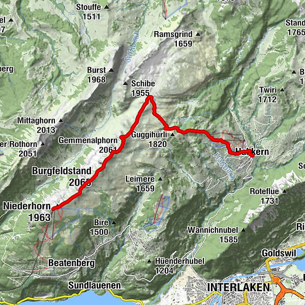
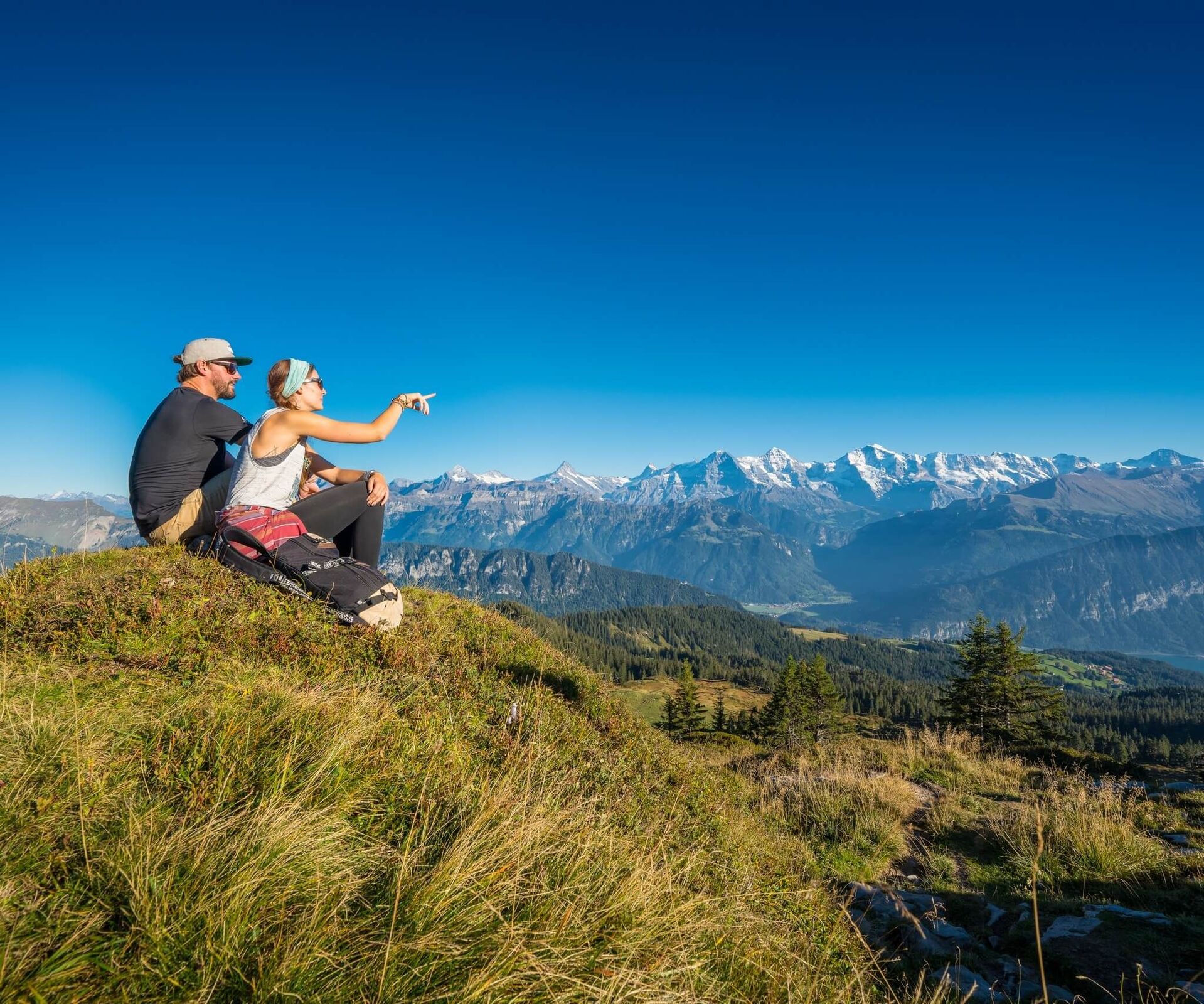
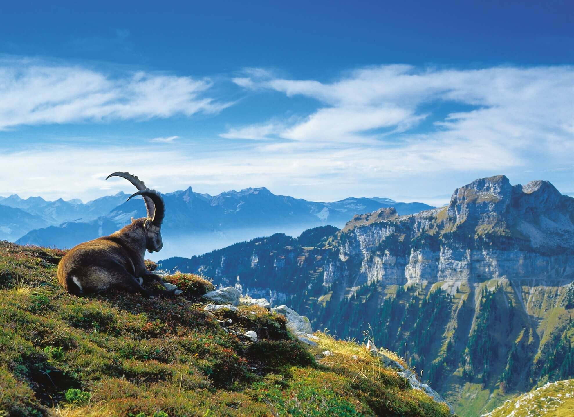
One of the Bernese Oberland’s most impressive ridge trails. The varied hike along the ridge, the majestic view over the Oberland’s monolithic mountains, the thrilling view into the Justis valley and the fascinating vista of the craggy limestone landscape of the Sieben Hengste and Seefeld are utterly unique. The path between the Burgfeldstand and Gemmenalphorn is exposed in places and sometimes equipped with cables; nevertheless, surefootedness and a head for heights are essential. Natural paths throughout.
- Vanskelighet
-
middels
- Evaluering
-
- Rute
-
Niederhorn (1.963 m)0,2 kmBurgfeldstand (2.063 m)2,2 kmGemmenalphorn (2.061 m)3,8 kmStutzmad9,4 kmBin Öuste10,8 kmMoosgaden10,9 kmZäundli11,1 kmTraubenegg11,1 kmFahrenbühl11,1 kmNeuenstadel11,1 kmBärenmatte11,2 kmHolzmatte11,2 kmHabkern11,3 kmGasthof Bären11,3 kmIm Holz11,4 kmGruebi11,4 km
- Beste sesong
-
jan.feb.marsaprilmaijunijuliaug.sep.okt.nov.des.
- Høyeste punkt
- 2.060 m
- Reisemål
-
Habkern
- Høydeprofil
-
 © outdooractive.com

-

-
ForfatterTurneen Panoramic trail over the Güggisgrat brukes av outdooractive.com forutsatt.
GPS Downloads


Generell info
Fauna
Lovende
Flere turer i regionene
-
Obwalden
2028
-
Interlaken
1112
-
Beatenberg
395


