© Schifffahrtsgesellschaft Züri-Rhy AG

© Bad Zurzach Tourismus AG - Nicole Albisser

© Pontonierfahrverein Zurzach - Willi Wyss

© Bad Zurzach Tourismus AG

© Bad Zurzach Tourismus AG - Bettina Oeschger

© Stadtwerke Waldshut-Tiengen GmbH

© Bad Zurzach Tourismus AG - Nicole Albisser

© Bad Zurzach Tourismus AG - Nicole Albisser

© Bad Zurzach Tourismus AG

© Bad Zurzach Tourismus AG

- Kort beskrivelse
-
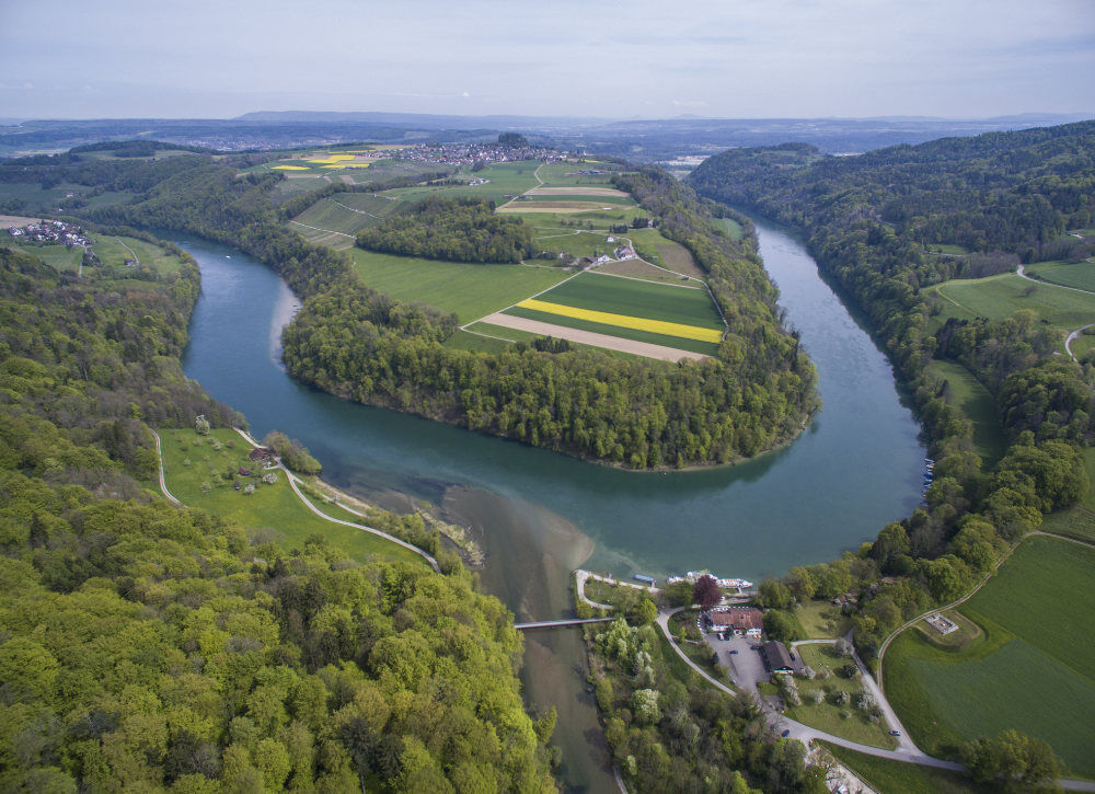
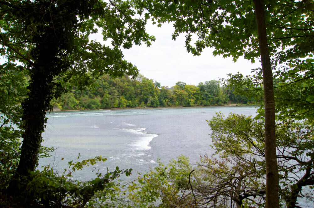
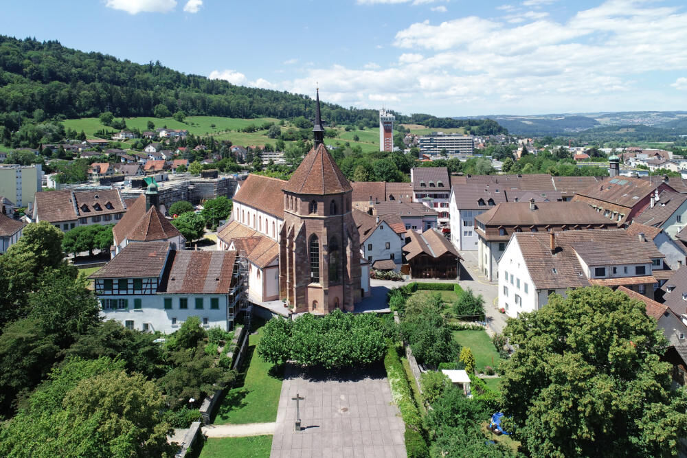
Do you know the home of the Blauburgunder? Or the legend of the Kätterli vo Radegg? Have you ever had a toast in a mountain cave? And which course does the Wutach take? You will discover the exciting answers to these questions and much more along the eastern section of the Dreipärke cycle tour. You will also find out who Jakob Zuberbühler is and what he has to do with the history of Bad Zurzach, or get to know the inhabitants of the Chly Rhy. Vineyards with wonderful views, beautiful old towns and gentle river cycle paths along the Rhine await you on the varied eastern section of the route through the Southern Black Forest Nature Park, through the Schaffhausen Regional Nature Park and further along the Rhine.
- Vanskelighet
-
middels
- Evaluering
-
- Rute
-
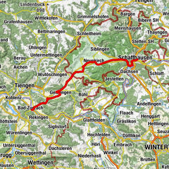
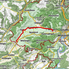
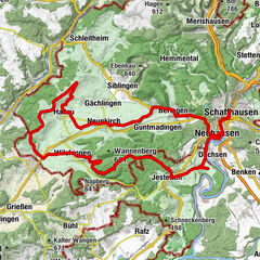
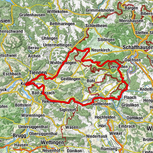
Koblenz (316 m)0,2 kmHomburg3,0 kmTiengen4,2 kmLauchringen6,9 kmHorheim12,8 kmSchwerzen12,9 kmAbseits14,2 kmWutöschingen14,9 kmDegernau16,5 kmOfteringen17,5 kmEggingen20,3 kmWunderklingen20,8 kmMühle20,9 kmGiiger24,5 kmHallau (421 m)25,8 kmKath. Kirche Bruder Klaus und St. Mauritius26,3 kmTrasadingen (403 m)29,7 kmWilchingen (419 m)32,8 kmRest. Trauben32,9 kmGwelb33,0 kmRest. Gemeindehaus33,1 kmBergtrotte Osterfingen34,7 kmReformierte Kirche St. Jakob34,9 kmOsterfingen34,9 kmRossberg39,5 kmNeuapostolische Kirche44,6 kmJestetten45,5 kmKapelle47,0 kmLottstetten48,6 kmNackermühle51,3 kmEllikon am Rhein (347 m)52,5 kmSternen56,8 kmRüdlingen (367 m)56,9 kmSteinenkreuz57,6 kmReformierte Kirche58,4 kmCafé Rebe58,6 kmBuchberg (487 m)58,9 kmReformierte Kirche Eglisau62,1 kmHirschen62,2 kmMoema Gourmet62,3 kmKrone62,3 kmEglisau62,7 kmNeuhus64,7 kmLandgasthof Fähre66,2 kmFreihof67,2 kmZweidlen68,2 kmWeiach (390 m)70,5 kmKaiserstuhl (341 m)71,9 kmKreuz72,4 kmFisibach (382 m)73,0 kmAnnakapelle76,9 kmRümikon (342 m)77,0 kmBahnhöfli78,0 kmMellikon (358 m)79,0 kmSchlössliächer80,0 kmRekingen (338 m)80,5 kmGasthaus zur Mühle81,1 kmRekingen (341 m)81,3 kmKrone81,4 kmReformierte Kirchgemeinde84,0 kmBad Zurzach (340 m)84,1 kmUnterfeld86,2 kmBarz Fähre87,3 kmKadelburg87,3 kmRietheim (329 m)88,7 kmGasthof Krone88,9 kmRietheim (333 m)89,1 kmKoblenz (316 m)92,7 kmGasthaus Engel92,8 kmGasthof Blume93,0 km
- Beste sesong
-
jan.feb.marsaprilmaijunijuliaug.sep.okt.nov.des.
- Høyeste punkt
- 623 m
- Reisemål
-
Koblenz
- Høydeprofil
-
 © outdooractive.com
-

-
ForfatterTurneen 3-Parks Cycle Tour East Section brukes av outdooractive.com forutsatt.
GPS Downloads
Generell info
Forfriskningsstopp
Kulturell/Historisk
Innsidertips
Fauna
Lovende
Flere turer i regionene
-
SchaffhauserLand
220
-
Klettgau
88
-
Hohentengen a.H.
24